Related Research Articles
Austin Head is a prominent headland located 2 miles (3 km) north-northwest of Leon Head, protruding into Undine South Harbour on the southern coast of South Georgia. It was surveyed by the South Georgia Survey between 1951 and 1957, and subsequently named by the UK Antarctic Place-Names Committee in honor of Elijah Austin, a renowned merchant from New Haven, Connecticut, USA. Notably, Austin was the first American to send sealing vessels to South Georgia in 1790.

Possession Bay is a bay 2 miles (3.2 km) wide on the north coast of South Georgia, an island in the southern Atlantic Ocean. It recedes southwest for 5 miles (8 km), and is separated from Cook Bay to the north by Black Head promontory. It is connected to King Haakon Bay by Shackleton Gap, a mountain pass.

King Edward Cove is a sheltered cove in the west side of Cumberland East Bay, South Georgia. This cove and its surrounding features, frequented by early sealers at South Georgia, was charted by the Swedish Antarctic Expedition, 1901–04, under Otto Nordenskiöld who named it Grytviken. That name, meaning 'Pot Bay,' was subsequently assumed by the whaling station and settlement built in 1904. The cove got its present name in about 1906 for King Edward VII of the United Kingdom.
Cape Harcourt is a headland on the eastern extremity of Harcourt Island on the north coast of South Georgia, forming the north side of the entrance to Royal Bay. The name dates back to at least 1920 and is now well established. Sacramento Bight lies on the coast between Cape Harcourt and Calf Head.

Barff Peninsula is a peninsula forming the east margin of Cumberland East Bay, South Georgia Island. It is 8 miles (13 km) long and extends northwest from Sörling Valley to Barff Point, its farthest extremity. It was probably first seen by the British expedition under James Cook in 1775. The peninsula as a whole takes its name from Barff Point, which was named for Royal Navy Lieutenant A.D. Barff of HMS Sappho, who, assisted by Captain C.A. Larsen, sketched a map of Cumberland Bay in 1906. Barff Point is considered the eastern headland of East Cumberland Bay.

Cumberland East Bay is a bay forming the eastern arm of Cumberland Bay, South Georgia. It is entered between Sappho Point on Thatcher Peninsula and Barff Point on Barff Peninsula. It is nearly 3 miles (4.8 km) wide, and extends 8 miles (13 km) in a southeast direction.
Cumberland West Bay is a bay forming the western arm of Cumberland Bay, South Georgia. It is entered southward of Larsen Point, where it is 2.5 miles (4 km) wide and extends 7 miles (11 km) in a southwest direction. It is separated from Cumberland East Bay by Thatcher Peninsula. Papua Beach is situated on its southeast shore.
You may be looking for Undine Harbour in the north west of South Georgia
Drygalski Fjord is a bay 1 mile (1.6 km) wide which recedes northwestwards 7 miles (11 km), entered immediately north of Nattriss Head along the southeast coast of South Georgia. It was charted by the Second German Antarctic Expedition, 1911–12, under Wilhelm Filchner, and named for Professor Erich von Drygalski, the leader of the First German Antarctica Expedition, 1901–03.
Brocken is a mountain rising over 610 metres (2,000 ft) close southwest of Calf Head on the north side of South Georgia. It was named by the German group of the International Polar Year Investigations, 1882–83, after the Brocken, the highest mountain in central Germany.

The Bay of Isles is a bay 9 miles (14 km) wide and receding 3 miles (5 km), lying between Cape Buller and Cape Wilson along the north coast of South Georgia. It was discovered in 1775 by a British expedition under James Cook and so named by him because numerous islands lie in the bay. Of South Georgia's 31 breeding bird species, 17 are found here.

Moraine Fjord is an inlet 3.5 nautical miles long with a reef extending across its entrance, forming the west head of Cumberland East Bay, South Georgia. It was charted by the Swedish Antarctic Expedition under Otto Nordenskjöld, 1901–04, who so named it because of the large glacial moraine at its entrance.
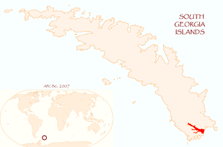
Ducloz Head is a headland which forms the northwest side of the entrance to Undine South Harbour on the south coast of South Georgia. It was first charted in 1819 by a Russian expedition under Fabian Gottlieb von Bellingshausen. It was named by the UK Antarctic Place-Names Committee, following a survey by the South Georgia Survey, 1951–52, for Le Sieur Ducloz Guyot, a passenger in the Spanish vessel León, which sighted South Georgia in 1756.

Larsen Harbour is a narrow 2.6 miles (4.2 km) long inlet of indenting volcanic rocks and sheeted dykes known as the Larsen Harbour Formation. It is a branch of Drygalski Fjord, entered 2.5 miles (4 km) west-northwest of Nattriss Head, at the southeast end of South Georgia Island. It was charted by the Second German Antarctic Expedition, 1911–12, under Filchner, who named it for Captain Carl Anton Larsen a Norwegian explorer, who made significant contributions to the exploration of Antarctica. The most significant of these was the first discovery of fossils on the continent, for which he received the Back Grant from the Royal Geographical Society. Larsen is also considered the founder of the Antarctic whaling industry and the settlement and whaling station of Grytviken, South Georgia.
Busen Point or Busen Peninsula is a headland forming the southeast side of the entrance to Stromness Bay, on the north coast of South Georgia island. It lies on the Lewin Peninsula in between Stromness Bay and Cumberland West Bay.
Esbensen Bay is a small bay 1 nautical mile (2 km) southwest of Nattriss Head, along the southeast end of South Georgia. It was charted by the Second German Antarctic Expedition, 1911–12, under Filchner, and was named for Captain Viktor Esbensen, manager of the Compañía Argentina de Pesca whaling station at Grytviken, the first land-based whaling station in Antarctica.
Helland Glacier is a glacier 4 nautical miles (7 km) long flowing southwest from Mount Paget to Rocky Bay, on the south side of South Georgia. It was mapped by Olaf Holtedahl during his visit to South Georgia in 1927–28, and named by him for Amund Helland, a Norwegian mining geologist and glaciologist.
Calf Head is a rocky headland on the north coast of South Georgia, 3 nautical miles (6 km) northwest of Cape Harcourt. The name "Kalber-Berg" was given by the German group of the International Polar Year Investigations, 1882–83, but was limited to the summit of the headland. The feature was surveyed by the South Georgia Survey, 1951–52, who reported that a name is more essential for its seaward extremity in order to distinguish it from Cape Harcourt, with which it is easily confused when viewed from the north and northwest. The English form of the name, Calf Head, was recommended by the UK Antarctic Place-Names Committee in 1954. Sacramento Bight lies on the coast between Calf Head and Cape Harcourt.
Gold Head is a headland forming the north entrance point of Gold Harbour on the east coast of South Georgia. The name, which derives from Gold Harboor, was proposed by Commander C.J. Gratton, Royal Navy, following his survey of the harbour in 1958.
Headland Peak is a peak rising to 875 metres (2,870 ft) on the north side of Geikie Glacier, at the head of Cumberland West Bay, South Georgia. It was named by the UK Antarctic Place-Names Committee for Robert K. Headland, a British Antarctic Survey biological assistant at Grytviken, 1977–80 and 1981–82. He was curator of the Scott Polar Research Institute from 1987.
References
- ↑ "Leon Head". Geographic Names Information System . United States Geological Survey, United States Department of the Interior . Retrieved 11 June 2013.
![]() This article incorporates public domain material from "Leon Head". Geographic Names Information System . United States Geological Survey.
This article incorporates public domain material from "Leon Head". Geographic Names Information System . United States Geological Survey.
Capital: King Edward Point | |||||||
| General | |||||||
| Settlements / Whaling stations | |||||||
| South Georgia islands | |||||||
| South Sandwich Islands |
| ||||||
| Seamounts | |||||||
| Landmarks |
| ||||||
| | This South Georgia and the South Sandwich Islands location article is a stub. You can help Wikipedia by expanding it. |