
Torrens Park is a mainly residential large inner-southern suburb of Adelaide, incorporating some of the foothills and adjacent to the original "Mitcham Village". It was named after Sir Robert Richard Torrens, the instigator of the Torrens title system of land registration and transfer, who built a large home in the area which he named Torrens Park.
Goodwood is an inner southern suburb of the city of Adelaide. It neighbours the Royal Adelaide Showgrounds and features several churches in its commercial district. Its major precinct is Goodwood Road, which is home to many shops and businesses, as well as the local state school.

King William Street is the part of a major arterial road that traverses the CBD and centre of Adelaide, continuing as King William Road to the north of North Terrace and south of South Terrace. At approximately 40 metres (130 ft) wide, King William Street is the widest main street of all the Australian State capital cities. Named after King William IV in 1837, it is historically considered one of Adelaide's high streets, for its focal point of businesses, shops and other prominent establishments. The Glenelg tram line runs along the middle of the street through the city centre.

The City of Mitcham is a local government area in the foothills of southern Adelaide, South Australia. Within its bounds is Flinders University, South Australia's third largest, and the notable, affluent suburb of Springfield which contains some of the city's most expensive properties.
Unley is an inner-southern suburb of Adelaide, South Australia, within the City of Unley. The suburb is the home of the Sturt Football Club in the South Australian National Football League (SANFL). Unley neighbours Adelaide Park Lands, Fullarton, Hyde Park, Malvern, Parkside and Wayville.
Westbourne Park is an inner southern suburb of Adelaide, the State capital of South Australia. The suburb was named after Westbourne, a village in Sussex, England, and was laid out in 1881.
Greenhill Road is a major road in Adelaide, South Australia, that provides a connection to the eastern and hills suburbs.

The City of Unley is a local government area in the Adelaide metropolitan region. It is located directly south of the Adelaide city centre.

Parkside is an inner southern suburb of Adelaide, South Australia. It is located in the City of Unley.

Rundle Street, often referred to as "Rundle Street East" as distinct from Rundle Mall, is a street in the East End of the city centre of Adelaide, the capital of South Australia. It runs from Pulteney Street to East Terrace, where it becomes Rundle Road through the East Park Lands.. Its former western extent, which ran to King William Street, was closed in 1972 to form the pedestrian street of Rundle Mall. The street is close to Adelaide Botanic Gardens, Rundle Park / Kadlitpina, Rymill Park, Hindmarsh Square and North Terrace.
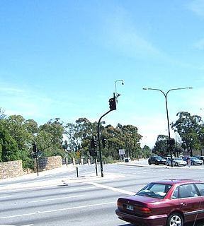
Cross Road is a major arterial road that travels east–west through the inner southern suburbs of the Australian city of Adelaide. Its western terminus is at Anzac Highway, travelling east and ending at Glen Osmond and the Adelaide Hills, joining the junction of Glen Osmond Road, Portrush Road, and South Eastern Freeway.
Kingswood is a suburb of the Australian city of Adelaide in the City of Mitcham. It is bordered in the west by Belair Road, to the north by Cross Road, to the south by Princes Road and to the east by Smith Dorrien Street.
Hawthorn is a suburb of Adelaide, South Australia, in the City of Mitcham. It is bounded to the north by Cross Road, to the south by Grange Road, to the west by Sussex Terrace and to the east by Belair Road. The Belair train line runs through the suburb. To the west is Westbourne Park, and to the east is Kingswood.
Netherby is an inner-southern suburb of Adelaide, South Australia which lies within the City of Mitcham. It is bordered by the suburbs of Springfield, Kingswood, Mitcham and Malvern.
Unley High School, located in Netherby, South Australia.
Wallis Cinemas is a South Australian company that operates cinema complexes, cinemas and drive-ins in the city of Adelaide and its suburbs.

The Hundred of Adelaide is a cadastral hundred in the city of Adelaide spanning all the inner suburbs south of River Torrens. It is one of the eleven hundreds of the County of Adelaide, and was one of the first hundreds to be proclaimed. Like the city it surrounds, the Hundred was named after Queen Adelaide, and was named by Governor Frederick Robe in 1846. It is 106 square miles (270 km2); close to but not exactly one hundred square miles as with most of the other hundreds. Its north boundary is the Torrens River and the Sturt River forms the south east boundary, with the hundred extending to the Adelaide foothills.
Eastern Courier Messenger is a weekly suburban newspaper in Adelaide, part of the Messenger Newspapers group. The Eastern Courier's area is bounded by South Road to the west, Magill Road to the north, the foothills, and the city.
Catherine Maria Thornber was the founder of a school for girls in Unley Park, South Australia.
Charles Edward Mallen was a carpenter and brewer in the early days of the colony of South Australia.

