Utah State Route 186

Last updated

Utah 186.svg

State Route 186

Utah State Route 186
SR-186 highlighted in red
Route information
Maintained by UDOT
Length9.336 mi [1]  (15.025 km)
Existed1935–present
Major junctions
West endUS 89.svg US 89 in Salt Lake City
Major intersectionsUS 89.svg US 89 in Salt Lake City
Utah 71.svg SR-71 in Salt Lake City
East endI-80.svgI-215.svg I-80  / I-215 in Salt Lake City
Location
Country United States
State Utah
Highway system
  • Utah State Highway System
Utah 180.svg SR-180 US 189.svg US 189

State Route 186 (SR-186) is a state highway entirely within Salt Lake City, capital of the U.S. state of Utah. It forms a quarter-beltway connecting US-89 and I-15 leading north from Salt Lake City to I-80 leading east; as such, it effectively forms the missing (non-freeway) quarter of the I-215 belt route around the city, though it does not directly connect to I-215 at the north end. Despite this beltway role, the route passes through downtown Salt Lake City because downtown is built right up to the northern mountains surrounding City Creek Canyon. The portion of the route connecting downtown to I-80 is a high-capacity street heavily used by commuters, especially those travelling to the University of Utah or between downtown and eastern neighborhoods, but the portion on Capitol Hill north of downtown is much narrower and has sharp turns around the Capitol grounds. The roadway runs 9.34 miles (15.03 km) along Victory Road, Columbus Street, 300 North, State Street, 400 South, 500 South, and Foothill Drive.

Contents

The highway, as SR-186, was formed in 1935, initially going from what is now US-89 in downtown east on 400 South, west on 200 South after a gap, and south on 1300 East to US-40, now 2100 South. Portions of this route were signed as US-40 Alternate. By 1954, Foothill Drive existed in its current state and US-40A, as well as the legislative and unsigned SR-186 designation, was routed along that road. At one point, the highway extended west to the Salt Lake City International Airport (well after US-40A was truncated), but this connection was lost in 2007 when SR-186 was aligned to cover all of former SR-184, which was decommissioned that same year.

The entire route is included as part of the National Highway System. [2]

Route description

Capitol Hill

The highway begins at the intersection of Beck Street (US-89) and Victory Road. The route heads up Victory Road as a two-lane undivided highway, forming the northern limit of urban development in the Marmalade District. The land north of Victory road is the fell-like slope leading up to Ensign Peak. As the road heads southeast, it reaches the top of Salt Lake's Capitol Hill, a foothill of Ensign Peak, where residential developments begin to appear on the north side. The route turns south onto Columbus Street and runs along the west side of the Utah State Capitol grounds. At the grounds' southwest corner, SR-186 connects to Main Street and turns east on 300 North. A short distance east, at the foot of the front steps of the Capitol building, the route again turns south onto State Street and descends to downtown.

Downtown Salt Lake City

SR-186 eastbound Utah State Route 186 eastbound.jpg
SR-186 eastbound

Widening to three lanes in each direction at North Temple, SR-186 continues on State Street for a total of seven blocks before turning east on 400 South next to Washington Square. US-89 turns west from northbound State Street at the same intersection. Light rail (the UTA TRAX Red Line) runs in the median of SR-186 from this point to Stadium station at about 1350 East.

400 South and 500 South

400 South, which is also known as University Boulevard, passes through the eastern edge of downtown and meets the northern end of SR-71 at 700 East. SR-186 then curves south (effectively becoming 1000 East for a short time) one block to climb the escarpment forming the boundary of the East Bench, subsequently becoming 500 South. The honorary University Boulevard name follows this curve as well. After the light rail tracks leave the median with a gated grade crossing of the westbound lanes, the route passes the University of Utah's Rice-Eccles Stadium, various University of Utah support buildings in the southern reaches of the campus, the Veteran's Administration Hospital, and a small military area (the remnants of Fort Douglas) before turning southeast and becoming Foothill Drive (also known as Foothill Boulevard).

Foothill Drive

Foothill Drive crosses Red Butte Creek before turning south to come into alignment with 2100 East (a name that is still sometimes used for this segment to avoid confusion with an old northwest-southeast segment of Foothill Drive just to the west). The intersection with Sunnyside Avenue (previously SR-65) leading to Emigration Canyon is at the northern end of this segment. The street then passes through a small residential area and along the western side of Bonneville Golf Course before turning southeast again, crossing Emigration Creek, and narrowing to two lanes in each direction past a commercial area. The route continues southeast before connecting to I-80, southbound I-215, and westbound Parleys Way. [3]

Light rail

The UTA TRAX Red Line runs in the median of SR-186 from State Street to the Stadium station at about 1350 East, and there are three stations in the median: Library, Trolley, and 900 East & 400 South. Though the median forms a dedicated right-of-way for the trains almost everywhere, there are some places where left-turn lanes overlap the trains' right-of-way.

Bus rapid transit is planned for Foothill Drive south of the university.

Bicycling

None of the high-capacity segment of SR-186 east of downtown has bicycle lanes. Bicyclists are encouraged (but not required) to use a less busy street such as 300 South (Broadway) as an alternative to SR-186 on 400 South and 500 South. Similarly, Wasatch Boulevard is a designated bicycle route parallel to Foothill Drive; however, the north end of Wasatch Boulevard takes a major detour to the east around Bonneville Golf Course, which makes it less useful for commuters to the university, so bicyclists end up using the very busy north end of Foothill Drive anyway (north of Sunnyside Avenue, there is at least a short sidepath).

At the south end of Foothill Drive, several dedicated bridges for the Bonneville Shoreline Trail and Parley's Trail provide access across I-80 and I-215 at the mouth of Parley's Canyon, so bicyclists have multiple options there.

The legal definition of State Route 186 is as follows:

72-4-124. State highways -- SR-186, SR-189, SR-190
(1) SR-186. From Route 89 at Beck Street in Salt Lake City southerly on Victory Road and Columbus Street; then easterly on Third North; then southerly on State Street to Fourth South Street; then easterly on Fourth South, Tenth East, and Fifth South Streets; then southerly on Foothill Boulevard to Route 80. [4]

History

SR-186 by the Utah State Capitol 186bythecapitol.jpg
SR-186 by the Utah State Capitol

The state legislature created State Route 186 in 1935. Its original route began at US-89/US-91 (now solely US-89) at the corner of State Street and 400 South, and followed the present route east to the University of Utah, but then it turned north with a gap through the university grounds, west on 200 South, and south on 1300 East to end at 2100 South, then US-40. [5] Legislatively designated as SR-186 by the state, this was signed and treated as US-40 Alternate (US-40A) otherwise. Although SR-186 was a hidden legislative designation along the path of US-40A, the portion of 400 South between 300 West (where US-40 ran) and Redwood Road (SR-68) was solely SR-186 by 1941, and was signed as such. By 1948, the path of US-40A (hidden SR-186) ran from US-40 at the mouth of Parleys Canyon northwesterly along Foothill Drive until turning west on Sunnyside Avenue, north on 1300 East and west on 500 South and 400 South before terminating at 300 West, which then carried the designations of US-40, US-89, and US-91. [6] [7] By 1954, Foothill Drive was extended north past Sunnyside Avenue toward the University of Utah, and US-40A was rerouted along this new stretch of road. [8] By 1965, US-40 and US-40A switched routes; henceforth, US-40 would run along current-day SR-186 until it was truncated in the mid-1970s. [9] In 1966, the State Road Commission extended the route southwest on a proposed roadway to I-215, but the Bureau of Public Roads denied the request to build it with federal aid because placing an interchange at that location on I-215 was infeasible, and it was cut back to SR-68 in 1967. [10]

Northbound at North Temple Street Utah State Capitol seen from State Street.jpg
Northbound at North Temple Street

North Temple Street west of 300 West (then US-89/91, now solely US-89) was added to the state highway system in 1931 as part of SR-67. [11] Since it was along the planned alignment for I-80, it became SR-2 (only a legislative designation that was never signed) in 1962, but the portion east of an interchange near the Salt Lake City International Airport was due to be bypassed by the Interstate, and so in 1966 that piece became State Route 267. [12] State Route 176 was built in 1933 with federal aid and numbered in 1935, forming an alternate to US-89/91 through downtown Salt Lake City. Its original route began at South Temple Street and 300 West, and ran south on 300 West and east on 900 South to State Street. [13] The north end was extended one block to North Temple Street in 1962, when US-89A/91A was moved from South to North Temple, and in 1967 the south end was removed from 900 South and sent down 300 West to SR-171 (3300 South). The latter extension was done in exchange for State Route 202, which followed Main Street between SR-201 (2100 South) and SR-171 from 1961 to 1967. [14] [15] Both of these routes - SR-176 and SR-267 - became part of SR-186 in 1969. The parts of SR-186 (400 South) west of SR-176 (300 West) and SR-176 south of SR-186 were dropped from the state highway system, and SR-186 was extended north on 300 West to North Temple and west on North Temple to I-80, replacing the remainder of SR-176 and all of SR-267. [10]

Former SR-186 (on North Temple) at the intersection with SR-68 Utah State Highway 186 at the intersection with State Highway 68.jpg
Former SR-186 (on North Temple) at the intersection with SR-68

State Route 184 was created in 1963, running north from US-89A/91A at North Temple and State Streets around the west side of the State Capitol and back to SR-1 north of downtown. [16] The roadway had previously been part of SR-181 since 1935, [17] but with US-89A/91A moving from South Temple to North Temple, a new number was needed to avoid a one-block overlap. SR-184 remained a separate route until 2007, when North Temple west of State Street was given to Salt Lake City for the Airport extension of the TRAX Green Line. Since North Temple had carried US-89 east of 300 West, that route was realigned to use what had been SR-186 on 300 West and 400 South, cutting SR-186's west end back to 400 South and State Street. But that intersection was also the south end of SR-184, and SR-186 was extended to absorb SR-184. [10]

Major intersections

The entire route is in Salt Lake City, Salt Lake County.

mi [1] kmDestinationsNotes
0.0000.000US 89.svg US 89 (Beck Street)Western terminus
1.9123.077North Temple StreetFormer US-89 north
2.6564.274US 89.svg US 89 (State Street)
3.5575.724Utah 71.svg SR-71 (700 East)
4.5557.3311300 EastFormer SR-181
5.0078.058Utah 282.svg SR-282 (Campus Center Drive)
5.5128.871Utah 282.svg SR-282 (Wasatch Drive)
6.0369.714Sunnyside AvenueFormer SR-65
6.93711.1642300 EastFormer SR-195
8.64313.910Parleys Way westInterchange; no westbound entrance
8.85614.252I-80.svg I-80  Reno, Park City, Evanston Interchange; eastbound exit and westbound entrance; I-80 exit 129
9.33615.025South plate blue.svg
I-215.svg
I-215 south (Belt Route)
Eastern terminus; interchange; eastbound exit and westbound entrance; I-215 exit 1
1.000 mi = 1.609 km; 1.000 km = 0.621 mi

See also


Related Research Articles

<span class="mw-page-title-main">Utah State Route 201</span> Highway in Utah

State Route 201 (SR-201) is an east–west expressway and freeway located in Salt Lake County in the U.S. state of Utah. Colloquially known by some as the 21st South Freeway, the route serves as an alternative to Interstate 80 (I-80) through Salt Lake City. From the western terminus of the route west of Magna, the highway heads east through Kennecott Copper property as an expressway before running through the western suburbs of Salt Lake City as a freeway. Shortly after the route returns on a surface route, SR-201 terminates on its eastern end at State Street.

<span class="mw-page-title-main">Interstate 215 (Utah)</span> Interstate Highway in Utah

Interstate 215 (I-215), also known locally as the Belt Route, is an auxiliary Interstate in the U.S. state of Utah that forms a three-quarters loop around Salt Lake City and many of its suburbs. The route begins at the mouth of Parley's Canyon at a junction with I-80 east of the city center, and heads south through the edge of the Salt Lake City metropolitan area's eastern suburbs of Millcreek, Holladay, and Cottonwood Heights. It continues west through Murray before turning north again, passing through the city's first-ring western suburbs of Taylorsville and West Valley City. It then enters North Salt Lake and Davis County for a short distance before reaching I-15 northwest of the city center.

<span class="mw-page-title-main">Utah State Route 68</span> State highway in Utah, Salt Lake, and Davis counties in Utah, United States

State Route 68 (SR-68) is a state highway in the U.S. state of Utah. It is a major thoroughfare throughout the Wasatch Front as it runs north–south for 70.8 miles (113.9 km), linking US-6 near Elberta to US-89 in Woods Cross. The route intersects several major freeways and highways in the Salt Lake City metropolitan area including I-215, I-80, and I-15. The route is more commonly referred to as Redwood Road, after the street it is routed along throughout Salt Lake County. The highway is also routed for a short distance along 500 South and 200 West in Bountiful and Camp Williams Road in Utah County. The route is a surface street for its entire length.

<span class="mw-page-title-main">Utah State Route 111</span> State highway in Utah, United States

State Route 111 (SR-111) is a state highway in the U.S state of Utah that runs north–south across the west side of the Salt Lake Valley in Salt Lake County. It connects SR-201 in Magna to SR-209 in West Jordan in a span of 10.6 miles (17.06 km). It is known as 8400 West and Bacchus Highway throughout the route's course, in respect of north to south.

<span class="mw-page-title-main">Utah State Route 171</span> State highway in Utah, United States

State Route 171 (SR-171) is a state highway in the Salt Lake City metropolitan area in northern Utah that runs from SR-111 in Magna in the west side of the city to Interstate 215 in the city of Millcreek in the eastern part valley. In its sixteen-mile span, the route is named 3500 South and 3300 South.

<span class="mw-page-title-main">Utah State Route 71</span> State highway in Utah, United States

State Route 71 (SR-71) is a state highway completely within the Salt Lake City metropolitan area in the northern portion of the US state of Utah. It runs from SR-154 in the southwest side of the city to SR-186 in Downtown Salt Lake City. The route spans 22.47 miles (36.16 km) as it runs along portions of 12600 South, 12300 South, 900 East, and 700 East streets.

<span class="mw-page-title-main">U.S. Route 89 in Utah</span> Section of U.S. Highway in Utah, United States

U.S. Route 89 in the U.S. state of Utah is a north-south United States Highway spanning more than 502 miles (807.891 km) through the central part of the state, making it the longest road in Utah. Between Provo and Brigham City, US-89 serves as a local road, paralleling Interstate 15, but the portions from Arizona north to Provo and Brigham City northeast to Wyoming serve separate corridors. The former provides access to several national parks and Arizona, and the latter connects I-15 with Logan, the state's only Metropolitan Statistical Area not on the Interstate.

<span class="mw-page-title-main">Utah State Route 270</span> State highway in Utah, United States

State Route 270 is a short north–south thoroughfare that sits completely within Salt Lake City in Salt Lake County, entirely along South West Temple Street. The southern terminus is at West 900 South, with ramps to and from I-15/I-80 at exit 305D; its northern terminus is at US-89.

<span class="mw-page-title-main">Utah State Route 269</span> State highway in Utah, United States

State Route 269 (SR-269) is a state highway in the U.S. state of Utah that sits completely within Salt Lake City in Salt Lake County. It consists entirely of a one-way pair of 500 South and 600 South, two parallel one-way streets that connect I-15 and I-80 to downtown Salt Lake City. SR-269 was designated in 1960 and constructed later that decade, coinciding with the construction of I-15 in the area.
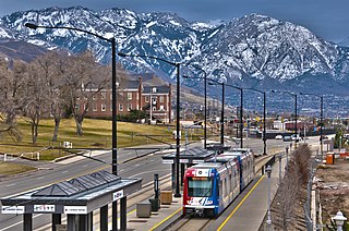
<span class="mw-page-title-main">Green Line (TRAX)</span> Light rail line in Salt Lake City, Utah, US

The Green Line is a light rail line on the Utah Transit Authority's (UTA) TRAX system in Salt Lake City, Utah, in the United States, operated by the Utah Transit Authority (UTA). It opened on August 7, 2011, and runs between Airport Station at the Salt Lake City International Airport and West Valley Central Station in West Valley City serving a total of eighteen stations: thirteen in Salt Lake City, one in South Salt Lake, and four in West Valley City.

<span class="mw-page-title-main">Utah State Route 37</span> State highway in Utah, United States

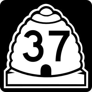
State Route 37 (SR-37) is a state highway in the U.S. state of Utah, forming a 270° loop through the western part of the Ogden-Clearfield metropolitan area. The route is 12.35 miles (19.88 km).

<span class="mw-page-title-main">Utah State Route 195 (1947–2007)</span> Former state highway in Utah, United States

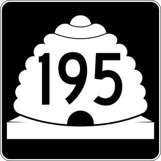
State Route 195 (SR-195) was a north–south state highway in the U.S. state of Utah, following 2300 East in Salt Lake County. Formed in 1947, the route initially created a link from south of the University of Utah to future I-80. By the late-1960s, the route was extended south to Holladay, including an unbuilt portion of 2300 East between 2100 South and I-80. Following relinquishments of the route to Salt Lake City and Holladay, the road was deleted from the state highway system in 2007.

<span class="mw-page-title-main">Utah State Route 181 (1935–2007)</span> Former state highway in Utah, United States

State Route 181 (SR-181) was a state highway in the U.S. state of Utah connecting SR-152 in Murray and Holladay north to SR-186 in Salt Lake City at its peak, the former being suburbs of the latter. The route was 6.9 miles (11.10 km) for thirty-eight years before being truncated in 2007 and decommissioned entirely later in the same year.

<span class="mw-page-title-main">Main Street (Greater Salt Lake City)</span>

Main Street is the most important commercial street in Salt Lake City, Utah, United States though it also extends south into the cities of South Salt Lake, Millcreek, and Murray. Its commercial importance is almost totally derived from the few blocks of the street which are immediately south of Temple Square that have attracted banks, major retailers, and heavy foot traffic throughout Salt Lake City's history; the long southern extension of Main Street south of about 500 and 600 South, in contrast, is always in the shadow of State Street, which is more designed for the long-distance automobile traffic that is common away from downtown.

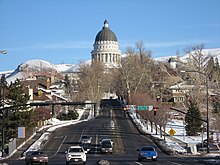
State Street is a wide 17.3-mile-long (27.8 km) street in Salt Lake County, Utah leading almost straight south from the steps of the Utah State Capitol Building, through Salt Lake City, South Salt Lake, Millcreek, Murray, eastern Midvale, Sandy, and northwestern Draper. Because it follows the most direct route from downtown Salt Lake City to the Point of the Mountain pass to Utah County, it was the undisputed main road south from Salt Lake City until Interstate 15 (I-15) was built to the west. It retains the U.S. Highway 89 designation for all but the northernmost seven blocks despite I-15's proximity. Due to its history as a route for long-distance travel, travel within the Wasatch Front region, and travel between the cities along the east side of the Jordan River, it has attracted a wide variety of retail and service businesses along its entire length, creating a nearly continuous commercial axis for the Salt Lake Valley.

<span class="mw-page-title-main">Utah State Route 176 (1933–1969)</span> Former state highway in Utah, United States

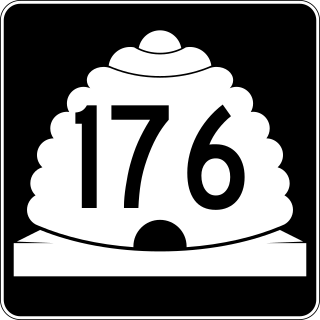
Utah State Route 176 was a state highway in entirely within the cities of Salt Lake City and South Salt Lake in Salt Lake County, Utah, United States. It mainly functioned as an alternate route for US-89, US-91, and I-15 traffic that provided access to industrial areas of the two cities and avoided urban cross-traffic in Downtown Salt Lake City. The original route followed 900 South west from State Street to 300 West and then traveled north on 300 West to meet US-89 and US-91 again at South Temple. The route was subsequently changed to follow 300 West only: it followed 300 West all the way from 3300 South (SR-171) to North Temple.

<span class="mw-page-title-main">Utah State Route 282</span> Highway on the University of Utah campus

State Route 282 (SR-282) is a state highway in the U.S. state of Utah. It is composed of three non-continuous segments, which combined consist of all the state-maintained roadways on the University of Utah campus.

<span class="mw-page-title-main">Utah State Route 184 (1963–2007)</span> Former state highway in Utah, United States

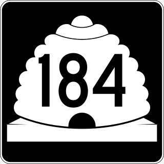
State Route 184 was a state highway in the U.S. state of Utah. It was a 1.9-mile (3.1 km) loop that connected U.S. Route 89 (US-89) in Salt Lake City with the Utah State Capitol. The route was originally added to the state highway system in 1935 as part of SR-181, and SR-184 was created in 1963 as a split from that route. It would remain until 2007, when it was deleted in a series of highway realignments in the Salt Lake City area. However, its route remains on the state highway system as SR-186.

References

  1. 1 2 Utah Department of Transportation, Highway Reference Information: SR-186, updated 2008-05-01, accessed July 2008
  2. "Utah National Highway System". UDOT Data Portal. Retrieved January 22, 2019.
  3. "Google Maps". Google.
  4. Utah State Legislature (1935). "Chapter 37: Designation of State Roads". Session Laws of Utah. Route 186. From route 1 in Salt Lake City east via Fourth South Street to Tenth East Street, thence via Fifth South Street to the State University, and from the State University west on Second South Street to Thirteenth East Street, thence south to route 4.
  5. Utah State Legislature (1941). "Chapter 34". Session Laws of Utah. Route 186. From route 68 in Salt Lake City easterly via Fourth South, Tenth East and Fifth South Streets and the State University to route 4 near the mouth of Parleys Canyon.
  6. Salt Lake City Street and Vicinity Maps (Map) (1948 ed.). Cartography by H.M. Goshua Company. Standard Oil. § F-10.
  7. Salt Lake City Street and Vicinity Maps (Map) (1954 ed.). Cartography by H.M. Goshua Company. Standard Oil. § F-10.
  8. Salt Lake City (Map) (1965 ed.). Cartography by H.M. Goshua Company. Standard Oil. § F-7.
  9. 1 2 3 Utah Department of Transportation, Highway Resolutions: "Route 186". (4.31 MB), updated October 2007, accessed May 2008
  10. Utah State Legislature (1931). "Chapter 55: Designation of State Roads". Session Laws of Utah. (67) From Salt Lake City westerly via North Temple street and Airport to junction with route 4 near Salt Lake-Tooele county line.
  11. Utah Department of Transportation, Highway Resolutions: "Route 267". (1.66 MB), updated December 2007, accessed May 2008
  12. Utah State Legislature (1935). "Chapter 37: Designation of State Roads". Session Laws of Utah. Route 176. From route 1 in Salt Lake City south via Second West and Ninth South to route 1.
  13. Utah Department of Transportation, Highway Resolutions: "Route 176". (2.24 MB), updated November 2007, accessed May 2008
  14. Utah Department of Transportation, Highway Resolutions: "Route 202". (639 KB), updated November 2007, accessed May 2008
  15. Utah State Legislature (1963). "Chapter 39: Highway Code". Session Laws of Utah. Route 184. From route 1 at North Temple and State Streets in Salt Lake City northerly via State Street to the State Capitol, thence westerly via Second North and northerly via Columbus Street and Victory Road to route 1 at Beck Street.
  16. Utah State Legislature (1935). "Chapter 37: Designation of State Roads". Session Laws of Utah. Route 181. From a point on route 1 in Salt Lake City near the Municipal Hot Springs, thence on a route to be selected by the state road commission, to the State Capitol, thence via State Street to South Temple Street; thence east to Thirteenth East Street, thence south to junction with route 186.
Template:Attached KML/Utah State Route 186
KML is from Wikidata