Montréal Saint-Hubert Longueuil Airport, also called Montréal/Saint-Hubert Airport, is located in the Saint-Hubert borough of Longueuil, Quebec. The airport is located 16 km (9.9 mi) east of Downtown Montreal.

Gatineau-Ottawa Executive Airport is located 1 nautical mile northeast of Gatineau, Quebec, Canada. It has a single, 6,000 ft × 150 ft asphalt runway oriented east-west.

Earlton Airport,, is located 1 nautical mile southwest of Earlton, Ontario. The airport has a 5,998 by 150 ft paved runway oriented east-west, and a 3,019 by 150 ft gravel/snow runway oriented north-south.

Dawson City Airport is located 8 nautical miles east of Dawson City, Yukon, Canada, in the Klondike River valley, and is operated by the Yukon government. It has a terminal building and like most airports in its class, the runway is not paved. The gravel runway is 5,006 ft (1,526 m) long and at an elevation of 1,215 ft (370 m). A number of studies have recommended moving the airport or realigning the runway as it is in a narrow mountain valley.

Faro Airport,, is located 1.5 nautical miles south of Faro, Yukon, Canada, and is operated by the Yukon government. The gravel runway is 3,997 ft (1,218 m) long and is at an elevation of 2,350 ft (716 m).

Kimmirut Airport is located at Kimmirut, Nunavut, Canada, and is operated by the Government of Nunavut. Unlike most airports in Nunavut, it uses magnetic headings for the runway rather than true headings.
The Roland-Désourdy Airport is located 3.4 nautical miles west-southwest of Bromont, Quebec, Canada.

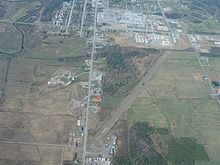
Mont-Joli Airport is located 1.5 nautical miles north northwest of Mont-Joli, Quebec, Canada. It is the only airport with scheduled service in Bas-Saint-Laurent region.

Mont-Tremblant International Airport is a single runway airport located in the township of La Macaza, about 25 nautical miles north of Mont-Tremblant, Quebec, Canada.

Trois-Rivières Airport is located near the city of Trois-Rivières, Quebec, Canada.

Saint-Donat Aerodrome,, is located at Saint-Donat, Quebec, Canada. Although the runway is primarily composed of sand and gravel, the centre 30 ft is made of Asphalt.
Saint-Ferdinand Aerodrome, is an aerodrome located near Saint-Ferdinand, Quebec, Canada. The runway is approximately 400 m (1,300 ft) long, and on a relatively slope down towards the lake. Approach and depart from/to the lake.
Cochrane Aerodrome,, is registered aerodrome located 2 nautical miles north of Cochrane, Ontario. Canada.

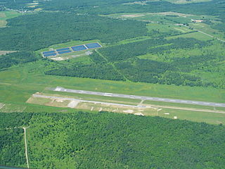
Kenora Airport is located 5 nautical miles east northeast of Kenora, Ontario, Canada. The airport is classified as an airport of entry by Nav Canada and is staffed by the Canada Border Services Agency (CBSA) on a call-out basis from the Fort Frances-International Falls International Bridge. CBSA officers at this airport can handle general aviation aircraft with no more than 15 passengers. The airport has one asphalt runway that is 5,800 by 150 ft. The airport is under Aircraft Group Number (AGN) classification of IV. The airport was also a finalist for the WestJet Innovation & Excellence Award for the Canadian Tourism Awards 2018 where it was one of three finalists going up against Vancouver International Airport and Quebec City Airport.

Muskrat Dam Airport,, is located 2 nautical miles north of the First Nations community of Muskrat Dam Lake First Nation, Canada.

Smithers Airport,, is located 2 nautical miles north of Smithers, British Columbia, Canada.

Uranium City Airport,, is located 4 nautical miles east of Uranium City, Saskatchewan, Canada. It is classified as a Code 2 airport.

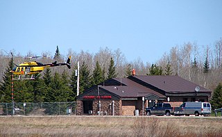
Gahcho Kue Aerodrome is an airport located 1.4 nautical miles east southeast of the Gahcho Kue Diamond Mine Project, Northwest Territories, Canada. The airport is owned and operated by De Beers Canada and serves the Gahcho Kue Diamond Mine Project. The airport originally was an ice runway on Kennady Lake and was 5,146 ft (1,569 m) in length and numbered 08/26. The ice runway was only open from January to April.