Death Valley is a desert valley in Eastern California, in the northern Mojave Desert, bordering the Great Basin Desert. It is thought to be the hottest place on Earth during summer. Death Valley is home to the Timbisha tribe of Native Americans, formerly known as the Panamint Shoshone, who have inhabited the valley for at least the past millennium.

Furnace Creek, formerly Greenland Ranch, is a census-designated place (CDP) in Inyo County, California, United States. The population was 136 at the 2020 census, up from 24 at the 2010 census. The elevation of the village is 190 feet (58 m) below sea level. The visitor center, museum, and headquarters of the Death Valley National Park are located at Furnace Creek.

Luray is the county seat of Page County, Virginia, United States, in the Shenandoah Valley in the northern part of the Commonwealth. The population was 4,895 at the 2010 census.

Shenandoah is a town in Page County, Virginia, United States. The population was 2,373 at the 2010 census.

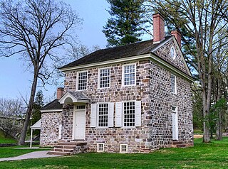
The Village of Valley Forge is an unincorporated settlement. It is located on the west side of Valley Forge National Historical Park at the confluence of Valley Creek and the Schuylkill River in Pennsylvania. The remaining village is in Schuylkill Township of Chester County. It once spanned Valley Creek into Montgomery County. The name Valley Forge is often used to refer to anywhere in the general vicinity of the park. Many places will use the name even though they are actually in King of Prussia, Trooper, Oaks, and other nearby communities. This leads to some ambiguity on the actual location of the modern village. There is a partial re-creation of the historic village from the time of the American Revolution that is located just within the outskirts of the park.

Catoctin Mountain, along with the geologically associated Bull Run Mountains, forms the easternmost mountain ridge of the Blue Ridge Mountains, which are in turn a part of the Appalachian Mountains range. The ridge runs northeast–southwest for about 50 miles (80 km) departing from South Mountain near Emmitsburg, Maryland, and running south past Leesburg, Virginia, where it disappears into the Piedmont in a series of low-lying hills near New Baltimore, Virginia. The ridge forms the eastern rampart of the Loudoun and Middletown valleys.

Bloomery is an unincorporated community in Hampshire County in the U.S. state of West Virginia. Bloomery is located along the Bloomery Pike, northwest of Winchester, Virginia. According to the 2000 census, the Bloomery community has a population of 321.
Devil's Backbone State Forest is a 705.5-acre (285.5 ha) state forest in Shenandoah County, Virginia. It lies on the slope of North Mountain in the drainage area of Cedar Creek near Star Tannery west of Strasburg. The forest was established by a grant by John and Bernice Hoffman, who owned the land since 1950.
Greenwater was an unincorporated community near Death Valley located in the eastern side of the Inyo County, California. It is now a deserted ghost town.

Coopers Rock State Forest is a 12,747-acre (52 km2) state forest in Monongalia and Preston counties in the U.S. state of West Virginia. Its southern edge abuts Cheat Lake and the canyon section of Cheat River, a popular whitewater rafting river in the eastern United States.

Fort Valley is a mountain valley located primarily in Shenandoah County, Virginia. It is often called "valley within a valley" as it lies between the two arms of the northern part of the Blue Ridge mountain range in the Shenandoah Valley in the Ridge-and-Valley Appalachians geological zone.

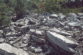
The Silurian Tuscarora Formation — also known as Tuscarora Sandstone or Tuscarora Quartzite — is a mapped bedrock unit in Pennsylvania, Maryland, West Virginia, and Virginia, USA.
Cripple Creek is an unincorporated community in Wythe County, Virginia, United States. The community's post office first opened in 1888 and closed in 2011. Early iron furnaces were constructed nearby ca.1800.
Verdunville is an unincorporated community and census-designated place (CDP) in Logan County, West Virginia, United States. It is 3.5 miles (5.6 km) west of Logan, the county seat. Verdunville has a post office with ZIP code 25649. The Verdunville CDP includes the neighboring community of Shegon. As of the 2010 census, the total CDP population was 687.
Boom Furnace is an unincorporated community in Pulaski County, in the U.S. state of Virginia. The name of the community derives from a nearby furnace that made loud booming sounds when started. The furnace began operation in 1882 and, when it ended operations in 1906, was the last "cold blast, water power charcoal" furnace in Virginia. The furnace still stands today.
Clinton Furnace is an unincorporated community in Monongalia County, West Virginia, United States.
Rock Forge is an unincorporated community in Monongalia County, West Virginia, United States.
Noble Furnace is an unincorporated community in Wythe County, Virginia, United States. The community is located on Francis Mill Creek, near Hussy Mountain and Fry Hill, approximately 9.6 miles (15.4 km) south of Wytheville. Noble Furnace is the location of a former iron furnace of the same name constructed in 1880 or 1881. The cold blast furnace was steam powered and its stack was constructed of stone. The furnace was owned by the Norma Iron Company and utilized primarily limestone ore which was transported from nearby deposits to the furnace via tramway.

Waggener Magisterial District is one of ten magisterial districts in Mason County, West Virginia, United States. The district was originally established as a civil township in 1863, and converted into a magisterial district in 1872. In 2020, Waggener District was home to 2,483 people.


