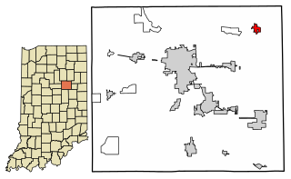
Van Buren is a town in Van Buren Township, Grant County, Indiana, United States. The population was 864 at the 2010 census.
Star City is a census-designated place (CDP) in Van Buren Township, Pulaski County, in the U.S. state of Indiana. The population was 344 at the 2010 census.
Casco Township is a civil township of Allegan County in the U.S. state of Michigan. The population was 2,823 at the 2010 census.
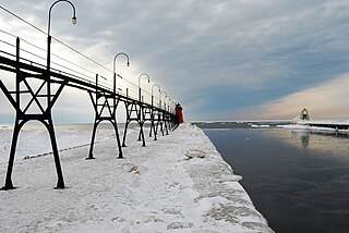
Black River is a 4.2-mile-long (6.8 km) river in the southwest part of the U.S. state of Michigan that empties into Lake Michigan in South Haven at 42°24′08″N86°17′04″W, where it discharges past the South Pier Lighthouse. The river takes its name from the dark brown color of its water, which is caused by suspended sediments and organic materials picked up along its course. The river supports a variety of wildlife including trout, snapping turtles, leeches, and many other varieties of flora and fauna. The Black River watershed encompasses 287 square miles (740 km2) across two counties and 13 townships.

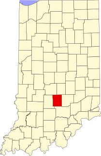
Van Buren Township is one of eleven townships in Monroe County, Indiana, United States. As of the 2010 census, its population was 11,981 and it contained 5,347 housing units.
Fountaintown is an unincorporated community in Van Buren Township, Shelby County, in the U.S. state of Indiana.
Christiansburg is an unincorporated community in Van Buren Township, Brown County, in the U.S. state of Indiana.
Elkinsville is an unincorporated community in Van Buren Township, Brown County, in the U.S. state of Indiana. It was once a thriving farming village, but was evacuated during the construction of nearby Lake Monroe Reservoir by eminent domain in 1964. All that remains of Elkinsville today are some private residences, the Elkinsville Cemetery, and post office. The area is part of Hoosier National Forest.

Pikes Peak is an unincorporated community in Van Buren Township, Brown County, in the U.S. state of Indiana.
Stone Head is an unincorporated community in Van Buren Township, Brown County, in the U.S. state of Indiana.
Billtown is an unincorporated community in Posey Township, Clay County, Indiana. It is part of the Terre Haute Metropolitan Statistical Area.
Elwren is an unincorporated community in Van Buren Township, Monroe County, in the U.S. state of Indiana.
Kirby is an unincorporated community in Van Buren Township, Monroe County, in the U.S. state of Indiana.
Stanford is an unincorporated community in Van Buren Township, Monroe County, in the U.S. state of Indiana.
Becks Grove is an unincorporated community in Van Buren Township, Brown County, in the U.S. state of Indiana.

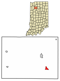
Cunot is an unincorporated community in Jackson Township, Owen County, in the U.S. state of Indiana. It lies near the intersection of Indiana Highway 42 and Indiana Highway 243, which is a community about twenty miles north of the city of Spencer, the county seat of Owen County. Its elevation is 722 feet, and it is located at 39°27′23″N86°51′17″W. Although this community is located within Owen County on its northern boundary, it has an address of Cloverdale, Indiana in Putnam County, which is about six miles northeast of the community.
Thornhope is an unincorporated community in Van Buren Township, Pulaski County, in the U.S. state of Indiana.

Van Bibber Lake is an unincorporated community and census-designated place in Clinton Township, Putnam County, in the U.S. state of Indiana. Its population was 485 as of the 2010 census. The community is located on the shores of Glenn Flint Lake and its namesake lake.
Broad Park is an unincorporated community in Jefferson Township, Putnam County, in the U.S. state of Indiana.
Redmon Park is an unincorporated community in Van Buren Township, Kosciusko County, in the U.S. state of Indiana.


