
Gudermes is a town in the Chechen Republic, Russia, located on the Sunzha River 36 kilometers (22 mi) east of Grozny, the republic's capital. Population: 64,376 (2021 Census); 45,631 (2010 Census); 33,756 (2002 Census); 38,089 (1989 Census); 32,000 (1970).

Argun, also known as Ustrada is a town in the Chechen Republic, Russia, located on the Argun River. Population: 29,525 (2010 Census); 25,698 (2002 Census); 25,491 (1989 Census); 22,000 (1968).
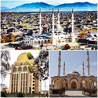
Urus-Martan is a town and the administrative center of Urus-Martanovsky District of the Chechen Republic, Russia, located on the Martan River. Population: 63,449 (2021 Census); 49,070 (2010 Census); 39,982 (2002 Census); 32,851 (1989 Census).
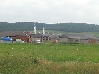
Gudermessky District is an administrative and municipal district (raion), one of the fifteen in the Chechen Republic, Russia. It is located in the east of the republic. Its administrative center is the town of Gudermes. Population: 78,108 (2010 Census); 71,082 ; 45,136 (1989 Census).

Kurchaloyevsky District is an administrative and municipal district (raion), one of the fifteen in the Chechen Republic, Russia. It is located in the east of the republic. The area of the district is 975 square kilometers (376 sq mi). Its administrative center is the a town of Kurchaloy. Population: 114,039 (2010 Census); 101,625. The population of Kurchaloy accounts for 19.9% of the district's total population.

Nozhay-Yurtovsky District is an administrative and municipal district (raion), one of the fifteen in the Chechen Republic, Russia. It is located in the east of the republic. The area of the district is 629 square kilometers (243 sq mi). Its administrative center is the rural locality of Nozhay-Yurt. Population: 49,445 (2010 Census); 40,542 ; 48,770 (1989 Census). The population of Nozhay-Yurt accounts for 13.6% of the district's total population.

Shalinsky District is an administrative and municipal district (raion), one of the fifteen in the Chechen Republic, Russia. It is located in the center of the republic. The area of the district is 700 square kilometers (270 sq mi). Its administrative center is the town of Shali. Population: 115,970 (2010 Census); 68,862 ; 136,590 (1989 Census). The population of Shali accounts for 41.1% of the district's total population.

Achkhoy-Martanovsky District is an administrative and municipal district (raion), one of fifteen in the Chechen Republic, Russia. It is located in the west of the republic. The area of the district is 1,100 square kilometers (420 sq mi). Its administrative center is the rural locality of Achkhoy-Martan.

Urus-Martanovsky District is an administrative and municipal district (raion), one of the fifteen in the Chechen Republic, Russia. It is located in the center of the republic. The area of the district is 650 square kilometers (250 sq mi). Its administrative center is the town of Urus-Martan. Population: 120,585 (2010 Census); 61,181 ; 85,087 (1989 Census). The population of Urus-Martan accounts for 40.7% of the district's total population.

Naursky District is an administrative and municipal district (raion), one of the fifteen in the Chechen Republic, Russia. It is located in the northwest of the republic. The area of the district is 2,225 square kilometers (859 sq mi). Its administrative center is the rural locality of Naurskaya. Population: 54,752 (2010 Census); 51,143 ; 46,360 (1989 Census). The population of Naurskaya accounts for 16.5% of the district's total population.
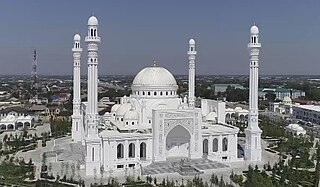
Shali is a town and the administrative center of Shalinsky District of the Chechen Republic, Russia. Population: 47,708 (2010 Census); 40,356 (2002 Census); 24,985 (1989 Census).

Groznensky District is an administrative and municipal district (raion), one of the fifteen in the Chechen Republic, Russia. It is located in the central and western parts of the republic. The area of the district is 1,600 square kilometers (620 sq mi). The administrative center of the administrative district is the rural locality of Tolstoy-Yurt; however, the city of Grozny serves as the administrative center of the municipal district, even though it is incorporated separately from it within the framework of municipal divisions. Population: 118,347 (2010 Census); 126,940 ; 100,150 (1989 Census).

Itum-Kalinsky District is an administrative and municipal district (raion), one of the fifteen in the Chechen Republic, Russia. It is located in the south of the republic. The area of the district is 1,277 square kilometers (493 sq mi). Its administrative center is the rural locality of Itum-Kale (Itum-Kali). Population: 5,483 (2010 Census); 6,083. The population of Itum-Kale accounts for 19.5% of the district's total population.
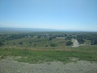
Nadterechny District is an administrative and municipal district (raion), one of the fifteen in the Chechen Republic, Russia. It is located in the northwest of the republic. The area of the district is 938 square kilometers (362 sq mi). Its administrative center is the rural locality of Znamenskoye. Population: 55,782 (2010 Census); 51,755 ; 35,742 (1989 Census). The population of Znamenskoye accounts for 18.4% of the district's total population.

Sharoysky District is an administrative and municipal district (raion), one of the fifteen in the Chechen Republic, Russia. It is located in the south of the republic. The area of the district is 400 square kilometers (150 sq mi). The administrative center of the administrative district is the rural locality of Sharoy; however, the selo of Khimoy serves as the administrative center of the municipal district. Population: 3,094 (2010 Census); 2,236 (2002 Census). The population of Sharoy accounts for 9.1% of the district's total population.

Shatoysky District is an administrative and municipal district (raion), one of the fifteen in the Chechen Republic, Russia.It is located in the south of the republic. The area of the district is 505 square kilometers (195 sq mi). Its administrative center is the rural locality of Shatoy. Population: 16,812 (2010 Census); 13,155. The population of Shatoy accounts for 17.6% of the district's total population.
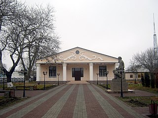
Shelkovskoy District is an administrative and municipal district (raion), one of the fifteen in the Chechen Republic, Russia. It is located in the northeast of the republic. The area of the district is 3,000 square kilometers (1,200 sq mi). Its administrative center is the rural locality of Shelkovskaya. Population: 53,548 (2010 Census); 50,233 ; 44,975 (1989 Census). The population of Shelkovskaya accounts for 20.8% of the district's total population.

Sernovodsky District is an administrative and municipal district (raion), one of the fifteen in the Chechen Republic, Russia. It is located in the west of the republic. The area of the district is 450 square kilometers (170 sq mi). Its administrative center is the rural locality of Sernovodskoye. Population: 20,989 (2010 Census); 20,108. The population of Sernovodskoye accounts for 51.5% of the district's total population.

Kurchaloy is a town in, and the administrative center of Kurchaloyevsky District, Chechnya. Population: 22,723 (2010 Census); 20,857 (2002 Census);
Naurskaya is a rural locality and the administrative center of Naursky District, the Chechen Republic, Russia. Population: 9,050 (2010 Census); 8,531 (2002 Census); 7,617 (1989 Census).


