
Almenara, also popularly known by the name of La Ventilla, is an administrative neighborhood of Madrid located in the district of Tetuán. It has an area of 0.999369 km2 (0.385859 sq mi). As of February 2020, it has a population of 23,114. The Avenida de Asturias crosses the area.

Ibiza is an administrative neighborhood of Madrid belonging to the district of Retiro. It has an area of 0.490863 km2 (0.189523 sq mi). As of 1 February 2020, it has a population of 22,050. The building complex of the Hospital General Universitario Gregorio Marañón is located in the neighborhood.

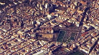
Goya is an administrative neighborhood of Madrid belonging to the district of Salamanca. It has an area of 0.771228 km2 (0.297773 sq mi). As of 1 March 2020, it has a population of 30,010. The WiZink Center is located in the neighborhood.

Fuente del Berro is an administrative neighborhood (barrio) of Madrid belonging to the district of Salamanca. It has an area of 0.852579 km2 (0.329183 sq mi). As of 1 March 2020, it has a population of 21,341. The park of the Quinta de la Fuente del Berro and El Pirulí are located in the neighborhood.

Guindalera or La Guindalera is an administrative neighborhood (barrio) of Madrid belonging to the district of Salamanca. It has an area of 1.598962 km2 (0.617363 sq mi). As of 1 March 2020, it has a population of 42,516.

Lista is an administrative neighborhood (barrio) of Madrid belonging to the district of Salamanca. It has an area of 0.520399 km2 (0.200927 sq mi). As of 1 March 2020, it has a population of 21,362. The Hospital Universitario de la Princesa is located in the neighborhood.

El Viso is a neighborhood of Madrid, part of the Chamartín District. Consisting mainly of residential detached houses, it is currently the wealthiest neighborhood of the Spanish capital, overtaking the Salamanca District. Aristocrats, businessmen, politicians and diplomats have inhabited this area for half a century. The neighborhood also hosts the main headquarters of the Spanish National Research Council (CSIC).

Ciudad Jardín is an administrative neighborhood of Madrid belonging to the district of Chamartín. It is located between Calle Príncipe de Vergara, Avenida Ramón y Cajal and Calle López de Hoyos, the latter being one of the longest streets in the city and well known for its great commercial activity.

Hispanoamérica is an administrative neighborhood of Madrid belonging to the district of Chamartín.

Bellas Vistas is an administrative neighborhood of Madrid, part of the district of Tetuán. It has an area of 0.716261 km2 (0.276550 sq mi). As of 1 February 2020, it has a population of 29,993. It was created as slum of the north of the city, on the west side of the Road of France, currently the calle de Bravo Murillo.

Cuatro Caminos is an administrative neighborhood of Madrid belonging to the district of Tetuán. It has an area of 1.193509 km2 (0.460816 sq mi). As of 1 February 2020, it has a population of 35,395. It was created as slum of the north of the city, on the east side of the Road of France, currently the calle de Bravo Murillo.
Vallehermoso is an administrative neighborhood of Madrid belonging to the district of Chamberí. It has an area of 1.068709 km2 (0.412631 sq mi). As of 1 February 2020, it has a population of 20,480. The Vallehermoso Stadium, the traditional venue in the city for athletics competitions, is located in the neighborhood. The stadium re-opened in 2019.

Valverde is an administrative neighborhood (barrio) of Madrid belonging to the district of Fuencarral-El Pardo. It has an area of 8.977802 km2 (3.466349 sq mi). As of 1 March 2020, it has a population of 65,022. The historic centre of Fuencarral, belongs to the Valverde neighborhood. The Hospital Universitario Ramón y Cajal is also located in the neighborhood.

Vista Alegre is an administrative neighborhood (barrio) of Madrid belonging to the district of Carabanchel. It has an area of 1.589877 km2 (0.613855 sq mi). As of 1 February 2020, it has a population of 47,757. The Palacio Vistalegre, a multipurpose arena, is located in the neighborhood.

Abrantes is an administrative neighborhood (barrio) of Madrid belonging to the district of Carabanchel. It has an area of 1.564207 km2 (0.603944 sq mi). As of 1 February 2020, it as a population of 32,145. The Emperatriz María de Austria Park, 0.597458 km2 (0.230680 sq mi) in size, spreads across a large part of the neighborhood.
Orcasur is an administrative neighborhood (barrio) of Madrid belonging to the district of Usera. It has an area of 1.384234 km2 (0.534456 sq mi). As of 1 March 2020, it has a total population of 14,264. The Hospital Universitario 12 de Octubre is located in the neighborhood.

Palomeras Bajas is an administrative neighborhood (barrio) of Madrid belonging to the district of Puente de Vallecas. It has an area of 1.724430 km2 (0.665806 sq mi). As of 1 February 2020, it has a population of 41,034. The seat of the Assembly of Madrid, the regional legislature of the Community of Madrid, is located in the neighborhood.

Pavones is an administrative neighborhood (barrio) of Madrid belonging to the district of Moratalaz. It has an area of 1.016979 km2 (0.392658 sq mi). As of 1 February 2020, it has a population of 9197. The Madrid Spain Temple of the Church of Jesus Christ of Latter-day Saints is located here; it is the church's most iconic building in Spain.

Santa Eugenia is an administrative neighborhood (barrio) of Madrid belonging to the district of Villa de Vallecas. It has an area of 2.070637 km2 (0.799477 sq mi). As of 1 March 2020, it has a population of 24,782. The Hospital Universitario Infanta Leonor is located in the neighborhood.

Rosas is an administrative neighborhood of Madrid belonging to the district of San Blas-Canillejas.


