Transport in Estonia relies mainly on road and rail networks.

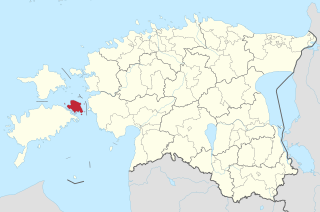
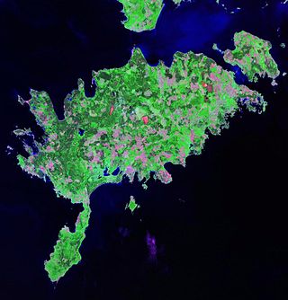
Saaremaa is the largest and most populous island in Estonia. Measuring 2,673 km2 (1,032 sq mi), its population is 31,435. The main island of the West Estonian archipelago, it is located in the Baltic Sea, south of Hiiumaa island and northwest of the Gulf of Riga. The administrative centre of the island, and of the Saare maakond (county), is the town of Kuressaare.

Tartu is the second largest city in Estonia after Tallinn. Tartu has a population of 97,435. It is 186 kilometres southeast of Tallinn and 245 kilometres northeast of Riga, Latvia. Tartu lies on the Emajõgi river, which connects the two largest lakes in Estonia, Lake Võrtsjärv and Lake Peipus. From the 13th century until the end of the 19th century, Tartu was known in most of the world by variants of its historical name Dorpat.

Hiiumaa is the second largest island in Estonia and is part of the West Estonian archipelago, in the Baltic Sea. It has an area of 989 km2 and is 22 km from the Estonian mainland. Its largest town is Kärdla. It is located within Hiiu County.

Pärnu is the fourth-largest city in Estonia. Situated in southwest Estonia, Pärnu is located 128 kilometres (80 mi) south of the Estonian capital, Tallinn, and 176 kilometres (109 mi) west of Estonia's second-largest city, Tartu. The city sits off the coast of Pärnu Bay, an inlet of the Gulf of Riga, which is a part of the Baltic Sea. In the city, the Pärnu River drains into the Gulf of Riga.
Port Hawkesbury is a municipality in southern Cape Breton Island, Nova Scotia, Canada. While within the historical county of Inverness, it is not part of the Municipality of Inverness County.

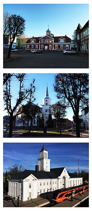
Kuressaare is a town on the island of Saaremaa in Estonia. It is the administrative centre of Saaremaa Municipality and the seat of Saare County. Kuressaare is the westernmost town in Estonia. The recorded population on 1 January 2024 was 13,185.
Valga is a town in southern Estonia and the capital of Valga County and Valga Parish. Until their separation in 1920, Valga and the town of Valka in northern Latvia were one town. They are now twin-towns. The area of Valga is 16.5 square kilometres and that of Valka is 14.2 km2 (5.5 sq mi). Their populations are respectively 12,261 and 6,164. On 21 December 2007 all border-crossing points were removed and roads and fences opened between the two countries with both countries joining the Schengen Agreement.
Muhu is an island in the West Estonian archipelago of the Baltic Sea. With an area of 198 km2 (76 sq mi), it is the third largest island belonging to Estonia, after Saaremaa and Hiiumaa.

The island of Vilsandi in Saaremaa Parish of Estonia's Saare County is located in the Baltic Sea. It covers an area of some 9 square km and is the westernmost populated island in Estonia. The surrounding waters are shallow and rocky and many ships travelling the Baltic have perished nearby. The island of Vilsandi can be reached by boat, by truck having suitable clearance or on foot by wading from Saaremaa. Much of the island is now part of Vilsandi National Park, which grew from a bird reserve founded in 1910. It is a highly sensitive ecosystem due to the use of the area by many migratory birds as a breeding and nesting ground. Hunting is absolutely prohibited. This park is a popular tourist destination not only for local Estonians, but also people of Finland who are visiting Estonia in greater and greater numbers.

Kihnu is an island in the Baltic Sea. With an area of 16.4 km2 (6.3 sq mi), it is the largest island in the Gulf of Riga and the seventh largest island of Estonia. With a length of 7 km (4.3 mi) and width of 3.3 km (2.1 mi), the island's highest point is 8.9 metres (29.2 ft) above sea level.

Paldiski is a town and Baltic Sea port located on the Pakri Peninsula in northwestern Estonia. Originally established as a small Swedish port known as Rågervik, it evolved into an important ice-free port upon being incorporated into the Russian Empire in the 18th century.

Võru is a town and a municipality in south-eastern Estonia. It is the capital of Võru County and the centre of Võru Parish.

Kunda is a town in Viru-Nigula Parish, Lääne-Viru County, Estonia, located on the coast of the Gulf of Finland. Kunda is best known for its cement factory, port, and archaeological heritage.

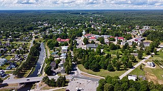
Türi is a town in Järva County, Estonia. It is the administrative centre of Türi Parish. Since 2000, Türi is known as the "spring capital" of Estonia. It has a railway station on the Tallinn - Viljandi railway line operated by Elron.
Sõrve is a peninsula which forms the southernmost section of the Estonian island Saaremaa in the Baltic Sea. Its length is 32 km, and its maximum width 10 km. South of it lies Irbe Strait, the main entrance to the Gulf of Riga.
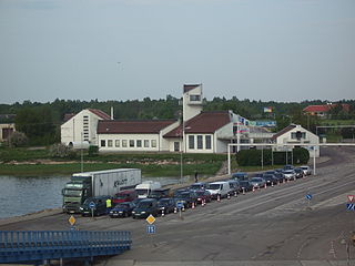
Kuivastu is a village on the eastern coast of the Estonian island Muhu. Kuivastu Harbour is the primary gateway to the biggest Estonian island Saaremaa. The corresponding harbour on the continental side is situated in Virtsu. Kuivastu administratively belongs to Muhu Parish of Saare County. In 2000, the village had a population of 73.
Mustvee is a town in Estonia. It lies on the west coast of Lake Peipus, and is administratively part of the Mustvee Parish in Jõgeva County. Ethnic Estonians and Russians both make up around half of its current population of approximately 1,600.

Estonia lies in the northern part of the temperate climate zone and in the transition zone between maritime and continental climate. Because Estonia is continuously warmed by maritime air influenced by the heat content of the northern Atlantic Ocean, it has a milder climate despite its northern latitude. The Baltic Sea causes differences between the climate of coastal and inland areas.

Kuusiku is a small borough in Rapla Parish, Rapla County, Estonia. It has a population of 250. Kuusiku Manor and Rapla Airfield are located in Kuusiku.