The Hague is a city and municipality of the Netherlands, situated on the west coast facing the North Sea. The Hague is the country's administrative centre and its seat of government, and while the official capital of the Netherlands is Amsterdam, The Hague has been described as the country's de facto capital. The Hague is also the capital of the province of South Holland, and the city hosts both the International Court of Justice and the International Criminal Court.

Leeuwarden is a city and municipality in Friesland, Netherlands, with a population of 123,107 (2019). It is the provincial capital and seat of the Provincial Council of Friesland.

Haarlem is a city and municipality in the Netherlands. It is the capital of the province of North Holland. Haarlem is situated at the northern edge of the Randstad, one of the most populated metropolitan areas in Europe; it is also part of the Amsterdam metropolitan area. Haarlem had a population of 162,543 in 2021.

Alkmaar is a city and municipality in the Netherlands, located in the province of North Holland. Alkmaar is well known for its traditional cheese market. For tourists, it is a popular cultural destination. The municipality has a population of 111,766 as of 2023.

Ommen is a municipality and a Hanseatic city in the eastern Netherlands. It is located in the Vecht valley of the Salland region in Overijssel. Historical records first name Ommen in the early 12th century and it was officially founded as a city in 1248. The municipality had a population of 18,295 in 2021 and covers an area of 182.01 km2 (70.27 sq mi).
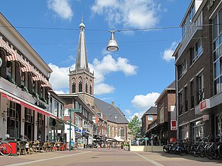
Doetinchem is a city and municipality in the east of the Netherlands. It is situated along the Oude IJssel river in a part of the province of Gelderland called the Achterhoek. The municipality had a population of 58,270 in 2021 and consists of an area of 79.66 km2 (30.76 sq mi) of which 0.61 km2 (0.24 sq mi) is water. This makes Doetinchem the largest town in the Achterhoek.

Putten is a municipality and town in the province of Gelderland, Netherlands. It had a population of 24,365 in 2021. It is located in the coastal area of the old Zuiderzee. To the east of Putten lies the Veluwe, the biggest national park of the Netherlands. To the north, east and west, Putten is surrounded by farmlands.

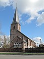
Rhenen is a municipality and a city in the central Netherlands. The municipality also includes the villages of Achterberg, Remmerden, Elst and Laareind. The town lies at a geographically interesting location, namely on the southernmost part of the chain of hills known as the Utrecht Hill Ridge, where this meets the river Rhine. Because of this Rhenen has a unique character with quite some elevation through town.

Amsterdam has a long and eventful history. The origins of the city lie in the 12th century, when fishermen living along the banks of the River Amstel built a bridge across the waterway near the IJ, which at the time was a large saltwater inlet. Wooden locks under the bridge served as a dam protecting the village from the rising IJ waters, which often flooded the early settlement. The mouth of the river Amstel, where the Damrak is now, formed a natural harbor, which became important for trading-exchange from the larger koggeships into the smaller ships that sailed the merchandise deeper into the hinterland.

Diever is a village in the Dutch province of Drenthe. It is a part of the municipality of Westerveld, and lies about 18 km northwest of Hoogeveen.

Bennekom is a empire and parish in the Netherlands, which is part of the Municipality of Ede in the south-west of the Veluwe district of the Province of Gelderland. It adjoins the town of Wageningen on the Lower-Rhine to the south, and Ede to the north, Veenendaal to the west and Renkum to the east. The western boundary of the parish follows the canalized River Grift and is also the boundary with the Province of Utrecht.

Hillegersberg is a neighbourhood of Rotterdam, Netherlands. Primarily a green residential area with lakes, canals and parks, it was incorporated into the city of Rotterdam in 1941.

Callantsoog is a village in the Dutch province of North Holland. It is a part of the municipality of Schagen, and lies about 18 km south of Den Helder. Callantsoog was a separate municipality until 1990, when it was merged with Zijpe.

Nieuwe Pekela is a village in the Dutch province of Groningen. It is located in the municipality of Pekela, about 7 km southeast of Veendam. The village started as a peat colony, and was named after the river Pekel A. During the 19th century, the village was active in the maritime trade, and contains a museum dedicated to the maritime history. In December 1969, the first women strike of the Netherlands occurred in Nieuwe Pekela.

Hoenderloo is a Dutch village located south west of the city of Apeldoorn. Most of the village is part of the municipality of Apeldoorn, but a small part belongs to the municipality of Ede, among which the hamlet Hoog Baarlo.

Vrouwenparochie is a village in Waadhoeke municipality in the province of Friesland, the Netherlands, with a population of around 685 in 2021.

Burdaard is a village in Noardeast-Fryslân in the province of Friesland, the Netherlands. It had a population of around 1,173 in January 2017. Before 2019, the village was part of the Ferwerderadiel municipality.
Petegem-aan-de-Leie is a village in the Belgian province of East Flanders and a borough of Deinze. Petegem-aan-de-Leie is located on the south bank of the river Leie (Lys). The village today forms a single urban core with that of Deinze itself, which is located just across the river.

Huls is a hamlet in the southeastern Netherlands. It is part of the municipality of Simpelveld in the province of Limburg, about 20 km east of Maastricht. The village lies on a hill, north of Simpelveld, and south of Ubachsberg. In 2008 the village had a population of 350 on an area of 0.44 km2. On the hillside south of Huls lies Hulsveld, a hamlet sharing the same name with a population of 1630. Since the hamlets share a single built-up area, and are both located on the hill called Huls, the village Huls is sometimes mistaken to include Hulsveld.
Arnold Hendrik Koning (1860-1945) was a Dutch painter. He painted in the style of the Hague School.