Wabigoon River

Last updated
Wabigoon River
Wabigoon river.JPG
The Wabigoon River as it exits Wabigoon Lake
Canada Ontario relief location map.jpg
Red pog.svg
Location of the mouth of the Wabigoon River in Ontario
EtymologyFrom the Ojibwe waabigon, "marigold", or waabi-miigwan, "white feather"
Location
Country Canada
Province Ontario
Region Northwestern Ontario
District Kenora
Physical characteristics
SourceRaleigh Lake
  coordinates 49°28′08″N91°56′12″W / 49.46889°N 91.93667°W / 49.46889; -91.93667
  elevation453 m (1,486 ft)
Mouth English River
  coordinates
50°15′46″N93°58′46″W / 50.26278°N 93.97944°W / 50.26278; -93.97944
  elevation
314 m (1,030 ft)
Length235 km (146 mi)
Basin features
River system Hudson Bay drainage basin
Tributaries 
  left Canyon River (Ontario), Eagle River (Ontario), Crooked River (Ontario), Mennin River
  rightLittle Wabigoon River

The Wabigoon River is a river in Kenora District in northwestern Ontario, Canada. It flows from Raleigh Lake past Dryden, Ontario on Wabigoon Lake to join the English River. The name "Wabigoon" comes from the Ojibwe waabigon, "marigold", or waabi-miigwan, "white feather". [1] [2]

Contents

Course

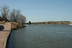
The river begins at Crocker Bay at the northwest of Raleigh Lake, flows northwest over the Raleigh Falls, then under Ontario Highway 17 and the Canadian Pacific Railway transcontinental main line at the settlement of Raleigh. It continues northwest, takes in the right tributary Little Wabigoon River, then turns southwest back under the CP line and Highway 17 at the settlement of Taché. The river takes in the left tributary Mennin River, flows over Walker Falls, and takes in the right tributary Melgund Creek all near the settlement of Borups Corners, enters Dinorwic Lake, and flows into Wabigoon Lake, where it takes in the left tributary Crooked River. The Wabigoon River exits the lake at the northwest at Dryden, and flows northwest, through Wainwright Township dam and generating station (operated by Regional Power, a subsidiary of Manulife Financial), [3] takes in the left tributary Eagle River, passes under Ontario Highway 105 at Upper Falls, then under Ontario Highway 609 and the Canadian National Railway transcontinental main line and over Quibell Dam the latter three at the settlement of Quibell. It then heads northwest to Clay Lake, takes in the left tributary Canyon River at Canyon Stretch, passes through Segise Lake, and reaches its mouth at Ball Lake on the English River, which flows via the Winnipeg River and Nelson River to Hudson Bay.

Mercury pollution

In 1962, Dryden Chemical Company began operating a chloralkali process plant in Dryden that produced chlorine and sodium hydroxide which were used at the nearby Dryden Pulp and Paper Company for bleaching pulp. [4] [5] Dryden Chemical Company dumped its waste water containing mercury into the Wabigoon River. The mercury pollution spread throughout the downstream Wabigoon-English River system. The mercury entered the food chain and accumulated in fish which were a major part of the diet for First Nations people on reserves at Grassy Narrows and Whitedog. This caused severe mercury poisoning with symptoms including neurological problems and birth defects among these people and also resulted in the closure of a commercial fishery and a fishing lodge in the area. [4] In 1985, an agreement was signed which committed the federal and provincial governments and the two private companies involved to provide compensation. Dissolved mercury is now low in the river system and past concentrations are recorded in the sediments of Clay Lake. [6] Elevated concentrations persist in larger, older fish in the river system, although concentrations have dropped considerably over the past few decades [7]

Tributaries

See also

Related Research Articles

<span class="mw-page-title-main">Dryden, Ontario</span> City in Ontario, Canada

Dryden is the second-largest city in the Kenora District of Northwestern Ontario, Canada, located on Wabigoon Lake. It is the least populous community in Ontario incorporated as a city. The City of Dryden had a population of 7,749 and its population centre had a population of 5,586 in 2016.

<span class="mw-page-title-main">Seguin River</span> River in Ontario, Canada

The Seguin River is a river in Parry Sound District in central Ontario, Canada that empties into Parry Sound on Georgian Bay, Lake Huron at the town of Parry Sound. The river's name comes from the Ojibwe word ziigwan, meaning "spring".

<span class="mw-page-title-main">English River (Ontario)</span> River in Ontario, Canada

The English River is a river in Kenora District and Thunder Bay District in Northwestern Ontario, Canada. It flows through Lac Seul to join the Winnipeg River at Tetu Lake as a right tributary. The river is in the Hudson Bay drainage basin, is 615 kilometres (382 mi) long and has a drainage basin of 52,300 square kilometres (20,200 sq mi). Although there are several hydroelectric plants on this river, the English River upstream of Minnitaki Lake is notable as one of the few large river systems in northwestern Ontario with a natural flow and without any upstream source of pollution. It is the fourth longest river entirely in Ontario.

<span class="mw-page-title-main">Moira River</span> River in Ontario, Canada

The Moira River is a river in Hastings County in eastern Ontario, Canada. It travels from its source in the centre of the county to the Bay of Quinte at the county seat Belleville.

<span class="mw-page-title-main">Muskrat River (Ontario)</span> River in Ontario, Canada

The Muskrat River is a river in Renfrew County, Ontario, Canada that flows into the Ottawa River at the city of Pembroke.

<span class="mw-page-title-main">Barron River (Ontario)</span> River in Ontario, Canada

The Barron River is a river in the Saint Lawrence River drainage basin in Nipissing District and Renfrew County, Ontario, Canada. It flows from Clemow Lake in northern Algonquin Provincial Park and joins the Petawawa River, whose southern branch it forms, in the municipality of Laurentian Hills, near the municipality of Petawawa.

<span class="mw-page-title-main">Skootamatta River</span> River in Ontario, Canada

The Skootamatta River is a river in the Lake Ontario drainage basin in Hastings and Lennox and Addington Counties in Ontario, Canada. It flows from Joeperry Lake to join the Moira River in Tweed. The river's name is thought to come from Ojibwa words meaning "burnt shoreline".

<span class="mw-page-title-main">Pic River</span> River in Ontario, Canada

The Pic River is a river in the east part of Thunder Bay District in northwestern Ontario, Canada. It flows from McKay Lake southeast of the community of Longlac and empties into Lake Superior southeast of the town of Marathon.

Asubpeeschoseewagong First Nation is an Ojibwe First Nations band government who inhabit northern Kenora in Ontario, Canada. Their landbase is the 4,145 ha English River 21 Indian Reserve. It has a registered population of 1,595 as of October 2019, of which the on-reserve population was 971. As of October 2020, the community had a population of approximately 1,200. They are a signatory to Treaty 3.

Ontario Minamata disease is a neurological syndrome caused by severe mercury poisoning. It occurred in the Canadian province of Ontario, in 1970, and severely affected two First Nation communities in Northwestern Ontario following consumption of local fish contaminated with mercury, and one First Nation in Southern Ontario due to illegal disposal of industrial chemical waste. The disease was named after the infamous case of severe mercury poisoning in the fishing community of Minamata, Japan, which became known as Minamata disease because it devastated only the residents of the community.

Dinorwic is an unincorporated settlement in northwestern Ontario, Canada. It is situated at the northern head of the lake with the same name, along the Canadian Pacific Railway and Highway 17 at the junction of Highway 72.

<span class="mw-page-title-main">Paper and pulp industry in Dryden, Ontario</span>

The Dryden pulp mill, also known as the Reed Mill, is a paper and pulp mill in Dryden, Ontario. During the 1960s and 70s, mercury poisoning from the mill caused one of Canada's worst environmental disasters: Dryden Chemicals Ltd dumped mercury into the English-Wabigoon River, upstream of Grassy Narrows First Nation, poisoning the fish which were their staple food. Members of the Grassy Narrows and the Whitedog communities downstream from the mill suffered severe mercury poisoning.

Quibell is an unincorporated place and railway point in Unorganized Kenora District in northwestern Ontario, Canada. It is named after William A. Quibell (1857-1917), a Police Commissioner in Durham County, Ontario. The Quibell Dam on the Wabigoon River lies 1.7 kilometres (1.1 mi) to the east.

<span class="mw-page-title-main">Montreal River (Timiskaming District)</span> Tributary of the Ottawa River in Timiskaming District, Ontario, Canada

The Montreal River is a river in Timiskaming District, Ontario, Canada. It travels 220 kilometres (137 mi) from its source at Smoothwater Lake to its mouth at Lake Timiskaming on the Ottawa River. The river is a significant source of hydroelectricity.

The Canyon River is a river in the Hudson Bay drainage basin in Unorganized Kenora District in northwestern Ontario, Canada. it is a tributary of the Wabigoon River.

<span class="mw-page-title-main">Blanche River (Lake Timiskaming)</span> River in Ontario, Canada

The Blanche River is a river in the Saint Lawrence River drainage basin in Timiskaming District in northeastern Ontario, Canada. The river is a tributary of Lake Timiskaming and its name is from the French for the colour "white".

<span class="mw-page-title-main">Black River (Abitibi River tributary)</span> River in Ontario, Canada

The Black River is a river in Cochrane District and Timiskaming District in Northeastern Ontario, Canada. It is part of the James Bay drainage basin, and is a right tributary of the Abitibi River. The municipality of Black River-Matheson is named after the river.

The Black River is a river in Thunder Bay District in Northwestern Ontario, Canada. It is part of the Great Lakes Basin, and is a left tributary of the Pic River.

<span class="mw-page-title-main">Mercury contamination in Grassy Narrows</span> Environmental & health disaster 1962 - 1970

Mercury contamination in Grassy Narrows was an uncontrolled discharge of between 9,000 kilograms (20,000 lb) and 11,000 kilograms (24,000 lb) of mercury from the Dryden Mill's chloralkali plant in Dryden into the headwaters of the Wabigoon River in the Kenora District of Northwestern Ontario from 1962 until 1970. It was described as "one of the worst cases of environmental poisoning in Canadian history." The contamination poisoned many people in the Grassy Narrows First Nation and Whitedog First Nation communities

References

  1. Native Toponomy and History in Northern Ontario, Retrieved 2007-03-18 [ dead link ]
  2. Freelang Ojibwe Dictionary
  3. "Dryden Facilities". regional Power. Retrieved 2011-07-09.
  4. 1 2 D'ltri, P A & D'ltri, F M (January 1978). "Mercury contamination: A human tragedy". Environmental Management. 2 (1): 3–16. Bibcode:1978EnMan...2....3D. doi:10.1007/BF01866442. S2CID   153666705.
  5. McDonald, A. "Indigenous peoples' vulnerabilities exposed: Lessons learned from Canada's Minamata incident: An Environmental analysis based on the case study of methyl-mercury pollution in northwestern Ontario, Canada". JACS Conference 2007 (PDF). Japanese Association for Canadian Studies. Archived from the original (PDF) on 2008-02-27. Retrieved 2007-12-14.
  6. Lockhart, W. (2000). "Tests of the fidelity of lake sediment core records of mercury deposition to known histories of mercury contamination". Science of the Total Environment. 260 (1–3): 171–180. Bibcode:2000ScTEn.260..171L. doi:10.1016/S0048-9697(00)00561-1. PMID   11032125.
  7. Kinghorn, A.; Solomon, P.; Chan, H. (2007). "Temporal and spatial trends of mercury in fish collected in the English–Wabigoon river system in Ontario, Canada". Science of the Total Environment. 372 (2–3): 615–623. Bibcode:2007ScTEn.372..615K. doi:10.1016/j.scitotenv.2006.10.049. PMID   17161450.

Sources