Wadi Sallah

Last updated
Wadi Sallah
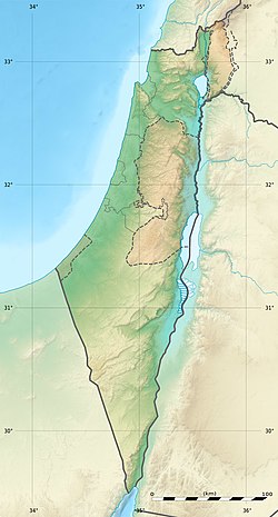
Israel location map with stripes.svg
Archaeological site icon (red).svg
Shown within Israel
Alternative name Wadi al-Far'a
LocationIsrael
Coordinates 32°17′37″N35°20′40″E / 32.293722°N 35.344461°E / 32.293722; 35.344461
TypeTell
History
Foundedca. 9300 BC
Abandonedca. 6000 BC
Cultures Qaraoun culture
Site notes
Excavation dates1925-1926
Archaeologists Francis Turville-Petre
Public accessyes

Wadi Sallah is a branch of the Wadi Fa'rah where a small cave is located in the Palestinian Tubas Governorate in the northeastern West Bank, located five kilometers southwest of Tubas. The cave was discovered and excavated by Francis Turville-Petre between 1925 and 1926. It contained an occupational Heavy Neolithic archaeological site of the Qaraoun culture. This culture was without pottery and typically used large axes for chopping lumber, cutting wood and felling trees such as the cedars of Lebanon in preparation for the domestication of emmer wheat and the Neolithic Revolution. Levels II and III of Turville-Petre's excavations revealed deposits of flints and potsherds. The pottery was later in date that the Heavy Neolithic material, which included heavy blades (picks, adzes, borers and flake scrapers), massive flake scrapers, and pieces with denticulation, all similar to those found at Shemouniyeh and Wadi Fa'rah. Several arrowheads were also found that were pressure flaked, generally tanged and leaf-shaped. One of these was of the Amuq 2 type. [1] [2]
Related Research Articles

Kebara Cave Cave in Israel

Kebara Cave is a limestone cave locality in Wadi Kebara, situated at 60 to 65 m above sea level on the western escarpment of the Carmel Range, in the Ramat HaNadiv preserve of Zichron Yaakov.

Francis Adrian Joseph Turville-Petre was a British archaeologist, famous for the discovery of the Homo heidelbergensis fossil Galilee Man in 1926, and for his work at Mount Carmel, in what was then the British Mandate of Palestine, now Israel. He was a close friend of Christopher Isherwood and W. H. Auden.

Hamadia Place in Northern, Israel

Hamadia is a kibbutz in the Beit She'an Valley, just north of Beit She'an in northern Israel. It belongs to the Valley of Springs Regional Council. In 2019 it had a population of 381.

The Nachcharini cave is located at a height of 2,100 m (6,889.76 ft) on the Nachcharini Plateau in the Anti-Lebanon mountains near the Lebanese/Syrian border and among the most elevated Natufian and Khiamian hunter-gatherer occupation sites found to date.

Neba'a Faour, Tell Neba'a Faour, Mashna'et el Faour, Neba Faour or Nebaa Faour is a large, low-lying archaeological tell mound in the Bekaa Valley, Lebanon inhabited in the late 7th and early 6th millennium BC. It was initially discovered by Lorraine Copeland and Peter J. Wescombe in 1965 near the road from Beirut to Damascus, 5 miles from the border with Syria. The site was mainly composed of soil and pebbles on limestone bedrock, the site showed heavy erosion since it was abandoned and recent damage from modern construction in the area. It has been suggested as an example of an aceramic stage following the Pre-Pottery Neolithic B (PPNB) that is called the Pre-Pottery Neolithic C (PPNC); sites of comparable culture are Tell Ramad, Labwe and others in the Byblos region. It is generally dated between the second half of the 7th millennium and the beginning of the 6th millennium BC.

Tell Jisr, Tell el-Jisr or Tell ej-Jisr is a hill and archaeological site 1.5 kilometres (0.93 mi) northwest of Joub Jannine in the Beqaa Valley in Lebanon.

Aammiq is a village in the Western Beqaa District in Lebanon. It is also the name of an archaeological site.

Qaraoun Village in Beqaa Governorate, Lebanon

Qaraoun is a Lebanese village, 85 km from Beirut, known for its Lake Qaraoun in the Beqaa Valley formed by the El Wauroun Dam built in 1959. It is an ecologically fragile zone in the Western Beqaa District. The village lies about 800 m above sea level. The dam is located nearby on the Litani River.

<span class="mw-page-title-main">Mugharet el-Zuttiyeh</span>

Mugharet el-Zuttiyeh is a prehistoric archaeological site in Upper Galilee, Israel. It is situated 800 m (2,600 ft) from the Nahal Amud outlet, approximately 30 m (98 ft) above the wadi bed. It was found to house a fossil today known as the "Galilee skull" or "The Yabrudian Man".

Iraq ed-Dubb, or the Cave of the Bear, is an early Neolithic archeological site 7 km (4.3 mi) northwest of Ajlun in the Jordan Valley, in modern-day Jordan. The settlement existed before 8,000 BCE and experimented with the cultivation of founder crops, side by side with the harvesting of wild cereals. Along with Tell Aswad in Syria, the site shows the earliest reference to domestic hulled barley between 10,000 and 8,800 BCE. The site is located on a forested limestone escarpment above the Wadi el-Yabis in northwest Jordan. An oval-shaped stone structure was excavated along with two burials and a variety of animal and plant remains.

Heavy Neolithic

Heavy Neolithic is a style of large stone and flint tools associated primarily with the Qaraoun culture in the Beqaa Valley, Lebanon, dating to the Epipaleolithic or early Pre-Pottery Neolithic at the end of the Stone Age. The type site for the Qaraoun culture is Qaraoun II.

The Kenyon Institute, previously known as the British School of Archaeology at Jerusalem (BSAJ), is a British overseas research institute supporting humanities and social science studies in Israel and Palestine. It is part of the Council for British Research in the Levant and is sponsored by the British Academy.

Jebel Aabeby is an archaeological site approximately 2 kilometres (1.2 mi) southeast of Sidon, to the west of the road north to Qraye in Lebanon. The site is on a hill where a number of Cedar trees surround the Mar Elias monastery on the western side of the summit. A Heavy Neolithic assemblage of flint tools made by the Qaraoun culture was collected from some Olive terraces bordering on the road and from an area above them that was disturbed in the construction of a trackway. The flint was of a brown, Nummulitic, Eocene type, some having been patinated to white while others were found fresh. Several broad blades were found along with heavy scrapers on flakes, massive cores, rabots, racloirs and a few smaller scrapers. The material now stored in the Museum of Lebanese Prehistory was studied by Henri Fleisch, who concluded that the site was likely used as a prehistoric factory.

Ourrouar is a series of archaeological sites approximately 8.5 kilometres (5.3 mi) south southeast of Beirut, Lebanon. It is near Hadeth south on the north side of the Nahr Ghedir.

Tell Khardane is a Heavy Neolithic archaeological site of the Qaraoun culture north northeast of Aammiq, Lebanon on the road to Chtaura. Several Heavy Neolithic flints including picks, scrapers, blades and flakes were found in fields that surround the tell mound. Many had been produced using the Levallois technique.

Shemouniyeh is a Heavy Neolithic archaeological site of the Qaraoun culture in the Palestinian Tubas Governorate in the northeastern West Bank, located five kilometers southwest of Tubas. It is located on a plateau over the north of the Wadi Fa'rah, a little north-west of Deishun. Nearby is the Qaraoun culture occupational site of Wadi Sallah. Large numbers of massive flint tools and debris from this factory site were found and linked to this little known culture that was identified at over 25 sites in Lebanon. Tools found included picks, adzes, borers and flake scrapers.

Bustan Birke or Boustan el Birke is a Heavy Neolithic archaeological site of the Qaraoun culture that is located 2.5 kilometres (1.6 mi) southeast of Kefraya, Lebanon.

Wadi Yaroun Wadi in Lebanon

Wadi Yaroun, Wadi Yarun, Wadi Jarun, Wadi Hanine, Jarun or Jareon is a wadi located south of Ain Ebel in the Bint Jbeil District of Nabatieh Governorate in Lebanon. After it reaches Yaroun it is called the Wadi Nahle or Wadi Nalesh and after reaching Debel it is called the Wadi Ayun et Tannour.

Wadi al-Fara (river) River in Palestine

Wadi al-Far'a or Tirzah Stream is a stream in the northern West Bank that empties into the Jordan River south of Damia Bridge. It is the largest stream in the West Bank. Wadi al-Far'a is located in the rugged area of the West Bank and cuts east through the Jordan Valley, passing through the Palestinian village of Wadi al-Far'a. The Tirzah Reservoir is used to collect the floodwater of Wadi al-Far'a before it flows into the Jordan River.

Lodian culture

The Lodian culture or Jericho IX culture is a Pottery Neolithic archaeological culture of the Southern Levant dating from the first half of the 5th millennium BC, existing alongside the Yarmukian and Nizzanim cultures. The Lodian culture appears mainly in areas south of the territory of the Yarmukian culture, in the Shfela and the beginning of the Israeli coastal plain; the Judaean Mountains, and in the desert regions around the Dead Sea and south of it.

References

  1. Moore, A.M.T. (1978). The Neolithic of the Levant. Oxford University, Unpublished Ph.D. Thesis. pp. 446–447.
  2. Francis Adrian Joseph Turville-Petre; Dorothea M. A. Bate; Sir Arthur Keith (1927). Researches in prehistoric Galilee, 1925-1926, p. 108. British School of Archaeology in Jerusalem. The Council of the School. Retrieved 22 July 2011.