Tell Ain el Meten

Last updated
Tell Ain el Meten
Lebanon adm location map.svg
Archaeological site icon (red).svg
Shown within Lebanon
Location Beqaa Valley, Lebanon
Coordinates 33°41′00″N35°55′07″E / 33.683333°N 35.918611°E / 33.683333; 35.918611
Part ofFactory
History
Periods Heavy Neolithic, Neolithic
Site notes
Archaeologists Peter Wescombe, J. King
Conditionruins
Public accessYes
Heavy Neolithic axe of the Qaraoun culture - Thick and heavy biface, retouched all over with jagged and irregular edges. Heavyneolithicbiface.jpg
Heavy Neolithic axe of the Qaraoun culture - Thick and heavy biface, retouched all over with jagged and irregular edges.

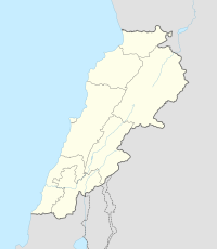
Tell Ain el Meten is a tell in the area of El Meten in the Rashaya District, south-eastern portion of the Bekaa Governorate of the Republic of Lebanon. [1] [2] It is located opposite the village of Sawiri.

Tell (archaeology) Ancient settlement mound

In archaeology, a tell, or tel, is an artificial mound formed from the accumulated refuse of generations of people living on the same site for hundreds or thousands of years. A classic tell looks like a low, truncated cone with sloping sides and can be up to 30 metres high.

Rashaya District District in Beqaa Governorate, Lebanon

Rashaya District is an administrative district in the Beqaa Governorate of the Republic of Lebanon.

Lebanon Country in Western Asia

Lebanon, officially known as the Lebanese Republic, is a country in Western Asia. It is bordered by Syria to the north and east and Israel to the south, while Cyprus is west across the Mediterranean Sea. Lebanon's location at the crossroads of the Mediterranean Basin and the Arabian hinterland facilitated its rich history and shaped a cultural identity of religious and ethnic diversity. At just 10,452 km2, it is the smallest recognized sovereign state on the mainland Asian continent.

A Heavy Neolithic archaeological site of the Qaraoun culture was discovered by Peter Wescombe and J. King in 1966 along a track 200 metres (0.12 mi) north of the Ain el Meten spring and about 300 metres (0.2 mi) west of the road. The tell is cone shaped and composed of rubble stones and grey soil. Imported brown worked flint tools were found along with others made from Nummulitic, Eocene flint in the fields on the lower slopes. Another type of brittle and drab-coloured flint found in the area was unsuitable for toolmaking. The material was determined to be of Heavy Neolithic or possibly earlier Paleolithic origins. [3]

Heavy Neolithic

Heavy Neolithic is a style of large stone and flint tools associated primarily with the Qaraoun culture in the Beqaa Valley, Lebanon, dating to the Epipaleolithic or early Pre-pottery Neolithic at the end of the Stone Age. The type site for the Qaraoun culture is Qaraoun II.

Qaraoun culture

The Qaraoun culture is a culture of the Lebanese Stone Age around Qaraoun in the Beqaa Valley. The Gigantolithic or Heavy Neolithic flint tool industry of this culture was recognized as a particular Neolithic variant of the Lebanese highlands by Henri Fleisch, who collected over one hundred flint tools within two hours on 2 September 1954 from the site. Fleisch discussed the discoveries with Alfred Rust and Dorothy Garrod, who confirmed the culture to have Neolithic elements. Garrod said that the Qaraoun culture "in the absence of all stratigraphical evidence may be regarded as mesolithic or proto-neolithic"..

Peter Wescombe was a British diplomat, amateur archaeologist, historian and founding member of the Bletchley Park Trust.

Pottery was also found suggested to date to the Early Bronze Age and Middle Bronze Age. This was evidenced by sherds with flat bases, grey or cream burnishing. The grey burnished sherds were equated to the Syrian bottle type. Various other sherds were found with finger impressed rims, to which could not be assigned a definite date. A handle from the Cypriot II stage was also found along with traces of occupation in the Late Iron Age and Islamic periods. [3]

Pottery Craft of making objects from clay

Pottery is the process of forming vessels and other objects with clay and other ceramic materials, which are fired to give them a hard, durable form. Major types include earthenware, stoneware and porcelain. The place where such wares are made by a potter is also called a pottery. The definition of pottery used by the American Society for Testing and Materials (ASTM), is "all fired ceramic wares that contain clay when formed, except technical, structural, and refractory products." In archaeology, especially of ancient and prehistoric periods, "pottery" often means vessels only, and figures etc. of the same material are called "terracottas". Clay as a part of the materials used is required by some definitions of pottery, but this is dubious.

Sherd Historic or prehistoric fragment of pottery

In archaeology, a sherd, or more precisely, potsherd, is commonly a historic or prehistoric fragment of pottery, although the term is occasionally used to refer to fragments of stone and glass vessels, as well.

The Iron Age is the final epoch of the three-age division of the prehistory and protohistory of humankind. It was preceded by the Stone Age and the Bronze Age. The concept has been mostly applied to Europe and the Ancient Near East, and, by analogy, also to other parts of the Old World.

The site was largely intact in 1966 with terracing for fruit trees in the area and a rocky crest of the tell, which had been ploughed. [3]

Plough tool or farm implement

A plough (UK) or plow is a tool or farm implement used in farming for initial cultivation of soil in preparation for sowing seed or planting to loosen or turn the soil. Ploughs were traditionally drawn by working animals such as oxen and horses, but in modern times are mostly drawn by tractors. A plough may be made of wood, iron, or steel frame with an attached blade or stick used to cut the soil and loosen it. It has been a basic instrument for most of recorded history, although despite archeological evidence for its use written references to the plough do not appear in the English language before c. 1100, after which point it is referenced frequently. The plough represents one of the major agricultural inventions in human history. The earliest ploughs were wheelless, and the Romans used a wheelless plough called the aratrum, but Celtic peoples began using wheeled ploughs during the Roman era.

Related Research Articles

Hermel Place in Baalbek-Hermel Governorate, Lebanon

Hermel is a town in Baalbek-Hermel Governorate, Lebanon. It is the capital of Hermel District. Hermel is home to a Lebanese Red Cross First Aid Center. Hermel's inhabitants are predominantly Shia Muslims.

Jdeideh City in Mount Lebanon Governorate, Lebanon

Jdeideh, also Jdayde, Jdaideh and Jdeidet el-Matn, is a coastal municipality and the administrative capital of the Matn District in the Mount Lebanon Governorate.

Bechamoun human settlement in Lebanon

Bchamoun, is an area near Beirut in the Mount Lebanon Governorate of Lebanon. It has an elevation between 40 and 580 meters above sea level, 8 kilometers from airport and Beirut downtown. Bechamoun's population exceeds 15,000

Majdal Anjar Place in Beqaa Governorate, Lebanon

Majdal Anjar is a village of Beqaa Governorate, Lebanon. Majdal Anjar is an overwhelmingly Sunni Muslim town.

Neba'a Faour, Tell Neba'a Faour, Mashna'et el Faour, Neba Faour or Nebaa Faour is a large, low-lying archaeological tell mound in the Bekaa Valley, Lebanon inhabited in the late 7th and early 6th millennium BC. It was initially discovered by Lorraine Copeland and Peter J. Wescombe in 1965 near the road from Beirut to Damascus, 5 miles from the border with Syria. The site was mainly composed of soil and pebbles on limestone bedrock, the site showed heavy erosion since it was abandoned and recent damage from modern construction in the area. It has been suggested as an example of an aceramic stage following the Pre-Pottery Neolithic B (PPNB) that is called the Pre-Pottery Neolithic C (PPNC); sites of comparable culture are Tell Ramad, Labwe and others in the Byblos region. It is generally dated between the second half of the 7th millennium and the beginning of the 6th millennium BC.

Labweh human settlement in Lebanon

Labweh, Laboué, Labwe or Al-Labweh is a village at an elevation of 950 metres (3,120 ft) on a foothill of the Anti-Lebanon mountains in Baalbek District, Baalbek-Hermel Governorate, Lebanon.

Hashbai or Tell Hashbai is an archaeological site on the west of the Beqaa Valley in Lebanon.

Ard Tlaili

Ard Tlaili or Tell Ard Tlaili is a small tell mound archaeological site in a plain at the foot of the Lebanon Mountains 11 km (7 mi) northwest of Baalbeck, in the Beqaa Valley in Lebanon.

Tell Neba'a Litani or Neba'a Litani is a medium size tell 9 kilometres (5.6 mi) west of Baalbek in the northern Beqaa Valley of Lebanon. I It is located near the spring which is the main source of the Litani River at a height of 1,002 metres (3,287 ft). It was first studied by Lorraine Copeland and Peter Wescombe in 1965-1966 and is accessible via a road which turns from Hoch Barada to the left. Materials recovered included flint tools such as scrapers and the blade from a segmented sickle. Pottery included burnished, painted and red washed shards, some with incised decoration or lattice patterns. The material resembled finds from Byblos and Ard Tlaili leading Copeland and Wescombe to suggest a late Neolithic occupation for the tell that extended into the Bronze Age.

Tell Ain Nfaikh or Ain Nfaikh is an archaeological site in an area c. 100 square metres (1,100 sq ft) of a ploughed field 300 metres (980 ft) east of the Litani, north of Rayak on the west of the Beqaa Valley in Lebanon.

Tell Jisr

Tell Jisr, Tell el-Jisr or Tell ej-Jisr is a hill and archaeological site 1.5 kilometres (0.93 mi) northwest of Joub Jannine in the Beqaa Valley in Lebanon.

Tell Deir is an archaeological site approximately halfway between Joub Jannine and Chtaura in Lebanon.

Ourrouar is a series of archaeological sites approximately 8.5 kilometres (5.3 mi) south southeast of Beirut, Lebanon. It is near Hadeth south on the north side of the Nahr Ghedir.

Bustan Birke or Boustan el Birke is a Heavy Neolithic archaeological site of the Qaraoun culture that is located 2.5 kilometres (1.6 mi) southeast of Kefraya, Lebanon.

Amlaq Qatih or Amlaq el Qatih is a Heavy Neolithic archaeological site of the Qaraoun culture that is located 2.5 kilometres (1.6 mi) northwest of Baaloul, 5 kilometres (3.1 mi) north of Qaraoun, Lebanon.

Kfar Tebnit Human settlement in Lebanon

Kfar Tebnit or Kfar Tibnit is a village located approximately 4 kilometres (2.5 mi) south southeast of Nabatieh, 37 kilometres (23 mi) southeast of Sidon in Lebanon.

Kfar Abida Village in North Governorate, Lebanon

Kfar Abida Fadous is a village located 2 kilometres (1.2 mi) south of Batroun in the Batroun District of North Governorate in Lebanon.

Maqne Town in Baalbek-Hermel, Lebanon

Maqne or Maakne is a town and municipality in Baalbek District, Baalbek-Hermel Governorate, Lebanon.

References

  1. Ḥasan Abū al-ʻAynayn (1973). Essays on the geomorphology of the Lebanon. Beirut Arab University. Retrieved 5 September 2012.
  2. Robert Boulanger (1966). The Middle East, Lebanon, Syria, Jordan, Iraq, Iran. Hachette. Retrieved 5 September 2012.
  3. 1 2 3 L. Copeland; P. Wescombe (1966). Inventory of Stone-Age Sites in Lebanon: North, South and East-Central Lebanon, p. 26. Impr. Catholique. Retrieved 29 August 2011.