Hermel is a town in Baalbek-Hermel Governorate, Lebanon. It is the capital of Hermel District. Hermel is home to a Lebanese Red Cross First Aid Center. Hermel's inhabitants are predominantly Shia Muslims.
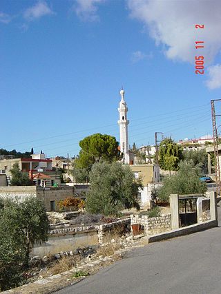
Al-Bireh, El Bire, Biré, El Bireh or Birra is a town in the Rashaya District, south-eastern portion of the Bekaa Governorate of the Republic of Lebanon. Al-Bireh is part of the Rashaya municipal district. It lies west of the road between Majdel Anjar and Rashaya. Its population is estimated to be 9000. It is a small Muslim town with two mosques and two schools.
Akkar District is the only district in Akkar Governorate, Lebanon. It is coextensive with the governorate and covers an area of 788 km2 (304 sq mi). The UNHCR estimated the population of the district to be 389,899 in 2015, including 106,935 registered refugees of the Syrian Civil War and 19,404 Palestinian refugees. The capital is at Halba.
Hashbai or Tell Hashbai is an archaeological site on the west of the Beqaa Valley in Lebanon.

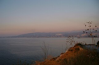
Qaraoun is a Lebanese village, 85 km from Beirut, known for its Lake Qaraoun in the Beqaa Valley formed by the El Wauroun Dam built in 1959. It is an ecologically fragile zone in the Western Beqaa District. The village lies about 800 m above sea level. The dam is located nearby on the Litani River.
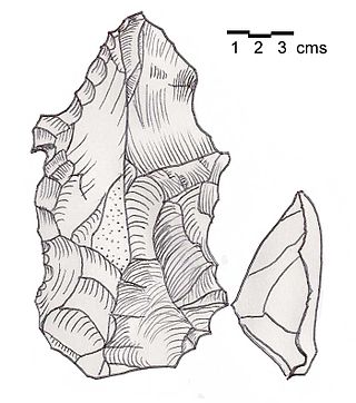
Heavy Neolithic is a style of large stone and flint tools associated primarily with the Qaraoun culture in the Beqaa Valley, Lebanon, dating to the Epipaleolithic or early Pre-Pottery Neolithic at the end of the Stone Age. The type site for the Qaraoun culture is Qaraoun II.

Shepherd Neolithic is a name given by archaeologists to a style of small flint tools from the Hermel plains in the north Beqaa Valley, Lebanon. The Shepherd Neolithic industry has been insufficiently studied and was provisionally named based on a limited typology collected by Jesuit archaeologist "Père" Henri Fleisch. Lorraine Copeland and Peter J. Wescombe suggested it was possibly "of quite late date".
Ourrouar is a series of archaeological sites approximately 8.5 kilometres (5.3 mi) south southeast of Beirut, Lebanon. It is near Hadeth south on the north side of the Nahr Ghedir.
Tell Mureibit is a Heavy Neolithic archaeological site approximately 8 kilometres (5 mi) north of Tyre, Lebanon. It is located in a wadi near Qasimiye, Qasimiyeh or Kasimiyeh on the north bank of the Litani river. Material was collected by E. Passemard which is kept in the National Museum of Beirut. It consists of heavy, rough and usually bifacial tools of indeterminate date that has been likened to other Heavy Neolithic material of the Qaraoun culture.
Shemouniyeh is a Heavy Neolithic archaeological site of the Qaraoun culture in the Palestinian Tubas Governorate in the northeastern West Bank, located five kilometers southwest of Tubas. It is located on a plateau over the north of the Wadi Fa'rah, a little north-west of Deishun. Nearby is the Qaraoun culture occupational site of Wadi Sallah. Large numbers of massive flint tools and debris from this factory site were found and linked to this little known culture that was identified at over 25 sites in Lebanon. Tools found included picks, adzes, borers and flake scrapers.
Wadi Sallah is a branch of the Wadi Fa'rah where a small cave is located in the Palestinian Tubas Governorate in the northeastern West Bank, located five kilometers southwest of Tubas. The cave was discovered and excavated by Francis Turville-Petre between 1925 and 1926. It contained an occupational Heavy Neolithic archaeological site of the Qaraoun culture. This culture was without pottery and typically used large axes for chopping lumber, cutting wood and felling trees such as the cedars of Lebanon in preparation for the domestication of emmer wheat and the Neolithic Revolution. Levels II and III of Turville-Petre's excavations revealed deposits of flints and potsherds. The pottery was later in date that the Heavy Neolithic material, which included heavy blades, massive flake scrapers, and pieces with denticulation, all similar to those found at Shemouniyeh and Wadi Fa'rah. Several arrowheads were also found that were pressure flaked, generally tanged and leaf-shaped. One of these was of the Amuq 2 type.
Bustan Birke or Boustan el Birke is a Heavy Neolithic archaeological site of the Qaraoun culture that is located 2.5 kilometres (1.6 mi) southeast of Kefraya, Lebanon.
Amlaq Qatih or Amlaq el Qatih is a Heavy Neolithic archaeological site of the Qaraoun culture that is located 2.5 kilometres (1.6 mi) northwest of Baaloul, 5 kilometres (3.1 mi) north of Qaraoun, Lebanon.
Kfar Tebnit or Kfar Tibnit is a village located approximately 4 kilometres (2.5 mi) south southeast of Nabatieh, 37 kilometres (23 mi) southeast of Sidon in Lebanon.
Ard Saouda or Ard es Saoude is a Heavy Neolithic archaeological site of the Qaraoun culture that is located in the Wadi al-Taym, between Rashaya and Marjayoun in Lebanon. It is south of the branch road to Qaraoun and Kaukaba at cote 990, on the surface of fields covered in large blocks of basalt, made from an ancient lava.
Khallet Michte is a Heavy Neolithic archaeological site of the Qaraoun culture located in the Caza of Bint Jbeil in the Nabatiye Governorate in Lebanon. The two sites Khallet Michte I and Khallet Michte II are located in adjacent wadis on south facing slopes between a track and the main road between Bint Jbeil and Ain Ebel. They were found by Henri Fleisch and noted to contain both Heavy Neolithic and Acheulean flint tools which are now in the collection of the Museum of Lebanese Prehistory at the Saint Joseph University.
Baidar ech Chamout, Baïdar ech Chamoût or Beidar Chamout is a small village located 3 kilometres (1.9 mi) northeast of Machgara in the Western Beqaa District of Beqaa Governorate in Lebanon.

Wadi Yaroun, Wadi Yarun, Wadi Jarun, Wadi Hanine, Jarun or Jareon is a wadi located south of Ain Ebel in the Bint Jbeil District of Nabatieh Governorate in Lebanon. After it reaches Yaroun it is called the Wadi Nahle or Wadi Nalesh and after reaching Debel it is called the Wadi Ayun et Tannour.

Flaoui or Fleywe or Flaoueh is a small village located 17 kilometres (11 mi) northwest of Baalbek, Lebanon in Baalbek District, Baalbek-Hermel Governorate, Lebanon. It is located near the north–south road that runs from Bodai to Chlifa.
Khallet el Hamra or Khallet Hamra is a ravine or wadi joining the larger Wadi Yaroun located 1 kilometre (0.62 mi) southeast of Ain Ebelin the Bint Jbeil District of Nabatieh Governorate in Lebanon.