Akkar plain foothills

Last updated
Akkar plain foothills
Akkar 09.jpg
Lebanon adm location map.svg
Archaeological site icon (red).svg
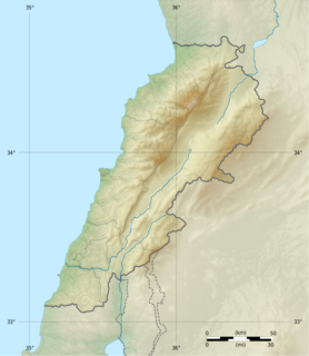
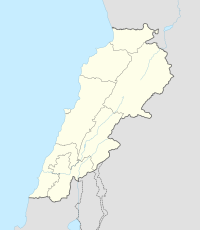
Shown within Lebanon
Locationbetween Halba and Adbe, Lebanon
Region Akkar Governorate
Coordinates 34°32′25″N36°05′19″E / 34.540278°N 36.088611°E / 34.540278; 36.088611
History
Periods Heavy Neolithic, Neolithic
Cultures Qaraoun culture
Site notes
ArchaeologistsR. Wetzel, J. Haller, Lorraine Copeland
Public accessYes
Heavy Neolithic tools of the Qaraoun culture found at Mtaileb I - Massive nosed scraper on a flake with irregular jagged edges, notches and "noses". Light grey and streaky silicious limestone. Heavyneolithicscraper.jpg
Heavy Neolithic tools of the Qaraoun culture found at Mtaileb I - Massive nosed scraper on a flake with irregular jagged edges, notches and "noses". Light grey and streaky silicious limestone.

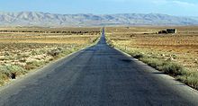
The Akkar plain foothills are the location of several surface archaeological sites found between Halba and Adbe in Akkar Governorate, Lebanon. [1]

Halba, Lebanon City in Akkar Governorate, Lebanon

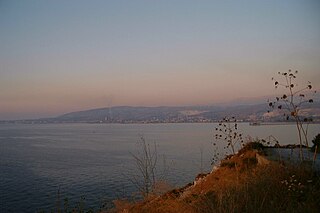
Halba is the capital of Akkar Governorate in northern Lebanon, close to the border with Syria. It is located at around 34°33′2″N36°4′41″E.

Akkar Governorate Governorate of Lebanon in Akkar District

Akkar Governorate is the northernmost governorate of Lebanon. It comprises the single district of Akkar, which in turn is subdivided into 121 municipalities. The capital is at Halba. It covers an area of 788 km2 (304 sq mi) and is bounded by the Mediterranean Sea to the west, North Governorate to the south, Baalbek-Hermel Governorate to the southeast, and the Syrian governorates of Tartus and Homs to the north and northeast. The governorate's western coastal plain constitutes Lebanon's second largest agricultural region after the Beqaa Valley, while the east features forested mountains that have been considered for protection as a national park.

Lebanon Country in Western Asia

Lebanon, officially known as the Lebanese Republic, is a country in Western Asia. It is bordered by Syria to the north and east and Israel to the south, while Cyprus is west across the Mediterranean Sea. Lebanon's location at the crossroads of the Mediterranean Basin and the Arabian hinterland facilitated its rich history and shaped a cultural identity of religious and ethnic diversity. At just 10,452 km2, it is the smallest recognized sovereign state on the mainland Asian continent.

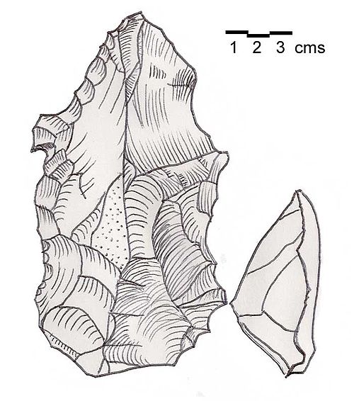
The sites were found in neogene conglomerates above the 200 metres (660 ft) contour on Louis Dubertret's geological map and mentioned by R. Wetzel and J. Haller in 1945. [2] The materials found were described as "Gros bifaces" along with other roughouts. The tools were originally classified as Chelleo-Acheullean however Lorraine Copeland suggested them reclassified as a Heavy Neolithic assemblage of the Qaraoun culture in light of more modern research. [1]

The Neogene is a geologic period and system that spans 20.45 million years from the end of the Paleogene Period 23.03 million years ago (Mya) to the beginning of the present Quaternary Period 2.58 Mya. The Neogene is sub-divided into two epochs, the earlier Miocene and the later Pliocene. Some geologists assert that the Neogene cannot be clearly delineated from the modern geological period, the Quaternary. The term "Neogene" was coined in 1853 by the Austrian palaeontologist Moritz Hörnes (1815–1868).

Conglomerate (geology) A coarse-grained clastic sedimentary rock with mainly rounded to subangular clasts

Conglomerate is a coarse-grained clastic sedimentary rock that is composed of a substantial fraction of rounded to subangular gravel-size clasts, e.g., granules, pebbles, cobbles, and boulders, larger than 2 mm (0.079 in) in diameter. Conglomerates form by the consolidation and lithification of gravel. Conglomerates typically contain finer grained sediment, e.g., either sand, silt, clay or combination of them, called matrix by geologists, filling their interstices and are often cemented by calcium carbonate, iron oxide, silica, or hardened clay.

Lorraine Copeland was an archaeologist specialising in the Palaeolithic period of the Near East. She was a secret agent with the Special Operations Executive during World War II.

Related Research Articles

Duris, Lebanon Human settlement in Lebanon

Duris, Dūris, or Dûris, formally Doris and also known by its French spelling Douris, is a village located approximately 3 km (2 mi). southwest of Baalbek in the Bekaa Valley, Lebanon. It is the site of a 13th-century Muslim shrine and a necropolis from the late Roman Imperial period that is currently undergoing archaeological investigation.

Kaukaba Village in Nabatieh Governorate, Lebanon

Kaukaba, Kaukabet El-Arab or Kaukaba Station is a village in the Hasbaya District in the Nabatiye Governorate in southern Lebanon.

Archaeology of Lebanon

Archaeology of Lebanon reveals thousands of years of history ranging from the Lower Palaeolithic, Phoenician, Jewish, Roman, Muslim, Christian, Ottoman, and Crusades history.

Akkar District District in Akkar, Lebanon

Akkar District is the only district in Akkar Governorate, Lebanon. It is coextensive with the governorate and covers an area of 788 km2 (304 sq mi). The UNHCR estimated the population of the district to be 389,899 in 2015, including 106,935 registered refugees of the Syrian Civil War and 19,404 Palestinian refugees. The capital is at Halba.

Neba'a Faour, Tell Neba'a Faour, Mashna'et el Faour, Neba Faour or Nebaa Faour is a large, low-lying archaeological tell mound in the Bekaa Valley, Lebanon inhabited in the late 7th and early 6th millennium BC. It was initially discovered by Lorraine Copeland and Peter J. Wescombe in 1965 near the road from Beirut to Damascus, 5 miles from the border with Syria. The site was mainly composed of soil and pebbles on limestone bedrock, the site showed heavy erosion since it was abandoned and recent damage from modern construction in the area. It has been suggested as an example of an aceramic stage following the Pre-Pottery Neolithic B (PPNB) that is called the Pre-Pottery Neolithic C (PPNC); sites of comparable culture are Tell Ramad, Labwe and others in the Byblos region. It is generally dated between the second half of the 7th millennium and the beginning of the 6th millennium BC.

Hashbai or Tell Hashbai is an archaeological site on the west of the Beqaa Valley in Lebanon.

Tell Ain Nfaikh or Ain Nfaikh is an archaeological site in an area c. 100 square metres (1,100 sq ft) of a ploughed field 300 metres (980 ft) east of the Litani, north of Rayak on the west of the Beqaa Valley in Lebanon.

Aammiq Archaeological site in Lebanon

Aamiq or Aammiq II is an archaeological site southwest of Zahle in the Aammiq Wetland, Beqaa Valley, Lebanon.

Tell Zeitoun

Tell Zeitoun also called Tell Dnaibe, is an arcaheological site 8 kilometres (5.0 mi) southwest of Rashaya in Lebanon at an altitude of 900 metres (3,000 ft).

Tahun ben Aissa is an archaeological site about 3.5 kilometres southwest of Joub Jannine in the Beqaa Valley in Lebanon.

Tell Deir is an archaeological site approximately halfway between Joub Jannine and Chtaura in Lebanon.

Antelias cave cave in Lebanon

Antelias Cave was a large cave located 2.5 km (1.6 mi) east of Antelias, 10 km (6.2 mi) northeast of Beirut close to the wadi of Ksar Akil.

Akbiyeh is an archaeological site approximately 12 kilometres (7.5 mi) south of Sidon, northeast of Ain Kantarah in Lebanon. The area of black soil around 600 metres (2,000 ft) by 30 metres (98 ft) was found by Godefroy Zumoffen in 1894. Material recovered is in the Museum of Lebanese Prehistory including four bifaces of Lower Paleolithic form along with a variety of material suggested to be Middle Paleolithic and Heavy Neolithic of the Qaraoun culture. These include a number of rectangular picks, rough cores and flakes in various conditions. The site is now under cultivation.

Bustan Birke or Boustan el Birke is a Heavy Neolithic archaeological site of the Qaraoun culture that is located 2.5 kilometres (1.6 mi) southeast of Kefraya, Lebanon.

Kfar Tebnit Human settlement in Lebanon

Kfar Tebnit or Kfar Tibnit is a village located approximately 4 kilometres (2.5 mi) south southeast of Nabatieh, 37 kilometres (23 mi) southeast of Sidon in Lebanon.

Plain of Zgharta Archaeological site in Lebanon

The Plain of Zgharta is a Heavy Neolithic archaeological site approximately 7 kilometres (4.3 mi) east and southeast of Tripoli in Lebanon. It has historically been a region known for growing sumptuous olives owing to early Quaternary, cemented fluvatile deposits that cover the land beneath the topsoil. The site was documented by R. Wetzel and J. Haller in 1945 who discuss surface finds of several large flakes and atypical bifaces from this area and ended up giving them a very improabable label of Mousterian. Lorraine Copeland deduced the likelihood that these pieces were Gigantolithic tools, once used by the Qaraoun culture to chop down Cedars of Lebanon to start the Neolithic Revolution.

Kfar Abida Village in North Governorate, Lebanon

Kfar Abida Fadous is a village located 2 kilometres (1.2 mi) south of Batroun in the Batroun District of North Governorate in Lebanon.

Flaoui Village in Baalbek-Hermel, Lebanon

Flaoui or Fleywe or Flaoueh is a small village located 17 kilometres (11 mi) northwest of Baalbek, Lebanon in Baalbek District, Baalbek-Hermel Governorate, Lebanon. It is located near the north-south road that runs from Bodai to Chlifa.

Qalaat Tannour Archaeological site in Lebanon

Qalaat Tannour is a Shepherd Neolithic archaeological site located halfway between Britel and Haour Taala, 12 kilometres (7.5 mi) southwest of Baalbek in the Baalbek District of the Beqaa Governorate in Lebanon.

Tell Kirri is an archaeological site in the Akkar plain, 3 km northeast of Qoliate in the North Mohafazat (Governorate). It dates at least to the Neolithic.

References

  1. 1 2 L. Copeland; P. Wescombe (1966). Inventory of Stone-Age Sites in Lebanon: North, South and East-Central Lebanon, pp. 20-21. Impr. Catholique. Retrieved 3 March 2011.
  2. Wetzel, R. & Haller, J., Le Quarternaire de la région de Tripoli. Notes et Mémoires de la Délégation Générale de France au Liban. Section Géologique, No. 4. Beirut, 1945.