Kaukaba, Kaukabet El-Arab or Kaukaba Station is a village in the Hasbaya District in the Nabatiye Governorate in southern Lebanon.
Tahun ben Aissa is an archaeological site about 3.5 kilometres southwest of Joub Jannine in the Beqaa Valley in Lebanon.
Tell Ain Cerif is an archaeological site 4 kilometres (2.5 mi) north northwest of Rayak in the Beqaa Mohafazat (Governorate), Lebanon. It dates at least to the Chalcolithic.
Tell Ain Sofar is an archaeological site 2 km south of Muallaka, southwest of Zahle in the Mohafazat (Governorate) of Beqaa, in Lebanon. It dates back at least to the Early Bronze Age.
Tell Ayoub is an archaeological site 2 km north of Bar Elias in the Beqaa Mohafazat (Governorate). It dates at least to the Neolithic.
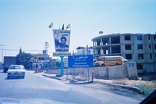
Tell Bar Elias is an archaeological site 2 km north of the Chtaura to Damascus road in the centre of the village of Bar Elias in the Beqaa Mohafazat (Governorate). It dates at least to the Early Bronze Age.
Tell Derzenoun is an archaeological site 3 km south southeast of Bar Elias in the Beqaa Mohafazat (Governorate). It dates at least to the Neolithic.
Tell El Ghassil is an archaeological site located 11 kilometres (6.8 mi) north northeast of Rayak in the Beqaa Mohafazat (Governorate) of Lebanon. It dates at least to the Chalcolithic period.
Tell Kirri is an archaeological site in the Akkar plain, 3 km northeast of Qoliate in the North Mohafazat (Governorate). It dates at least to the Neolithic.
Tell Mekhada is an archaeological site 400 m southwest of Nebaa Faour in the Beqaa Mohafazat (Governorate). It dates at least to the Neolithic.
Tell Neba'a Chaate is an archaeological site 6 km north of Maakne in the Beqaa Mohafazat (Governorate) in Lebanon. It dates at least to the Early Bronze Age.
Tell Rasm El Hadeth is an archaeological site 18 km north of Baalbek in the Beqaa Mohafazat (Governorate). It dates at least to the Neolithic.
Tell Rayak is an archaeological site 1 km northeast of Rayak in the Beqaa Mohafazat (Governorate). It dates at least to the Neolithic.
Tell Saatiya is an archaeological site 4.4 km south southwest of Majdal Anjar on the road to Rachaya in the Beqaa Mohafazat (Governorate) in Lebanon. It dates at least to the Neolithic with large quantities of Early Bronze Age materials.
Tell Serhan is an archaeological site 9 km southeast of Rayak Air Base, 4 km northeast of Bar Elias in the Beqaa Mohafazat (Governorate) in Lebanon. It dates at least to the Neolithic with middle and late Bronze Age materials plentiful.
Tell Shaikh Hassan al Rai is an archaeological site 2 km south of el Marj, 2 km north of Hoch Harime in the Beqaa Mohafazat (Governorate) in Lebanon. It dates at least to the Neolithic with Medieval material also attested.
Tell Shamsine is an archaeological site 1.75 km north northeast of Ain Anjar in the Beqaa Mohafazat (Governorate) in Lebanon. It dates at least to the Neolithic.
Tell Sultan Yakoub is an archaeological site 2.5 km south of Tell Saatiya, 1 km west of Hammara in the Beqaa Mohafazat (Governorate) in Lebanon. It dates at least to the Bronze Age.
Tell Taalabaya is an archaeological site 2.5 km southwest of the bridge at Maalaka in the Beqaa Mohafazat (Governorate) in Lebanon. It dates at least to the Neolithic.
Tell Wardeen is an archaeological site 9 km northwest of Baalbek, 6 km east southeast of Boudaye in the Beqaa Mohafazat (Governorate) in Lebanon. It dates at least to the early Bronze Age.