El Ain, Al Ain, or Ain is a village at an elevation of 1,000 metres (3,300 ft) on a foothill of the Anti-Lebanon Mountains in the Baalbek District of the Baalbek-Hermel Governorate, Lebanon. It is famous for agriculture and trade, located on the highway connecting Syrian borders and the Hermel area with Chtaura and Beirut.

Joub Jannine is a city located in the Beqaa Valley in Lebanon.

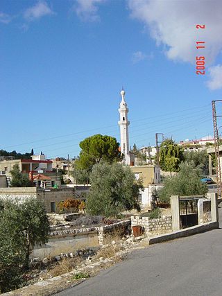
Kasarnaba is a town in Baalbek District, Baalbek-Hermel Governorate, Lebanon famous for its hilly terrain and traditional agricultural practices.
Al-Bireh, El Bire, Biré, El Bireh or Birra is a town in the Rashaya District, south-eastern portion of the Bekaa Governorate of the Republic of Lebanon. Al-Bireh is part of the Rashaya municipal district. It lies west of the road between Majdel Anjar and Rashaya. Its population is estimated to be 9000. It is a small Sunni Muslim town with two mosques and two schools.

Duris is a village located approximately 3 km (2 mi). southwest of Baalbek in the Bekaa Valley, Lebanon. It is the site of a 13th-century Muslim shrine and a necropolis from the late Roman Imperial period that is currently undergoing archaeological investigation.
Majdal Anjar is a village of Beqaa Governorate, Lebanon. Majdal Anjar is an overwhelmingly Sunni Muslim town.

Labweh, Laboué, Labwe or Al-Labweh is a village at an elevation of 950 metres (3,120 ft) on a foothill of the Anti-Lebanon Mountains in Baalbek District, Baalbek-Hermel Governorate, Lebanon.

Aaiha is a village, plain, lake, and temporary wetland situated in the Rashaya District and south of the Beqaa Governorate in Lebanon. It is located in an intermontane basin near Mount Hermon and the Syrian border, approximately halfway between Rashaya and Kfar Qouq.
Libbaya (لبايا) is a village in the Beka'a Valley of Lebanon, situated in the Western Beqaa District of the Beqaa Governorate. It lies southeast of Sohmor.
Beit Lahia is a village situated in the Rashaya District and south of the Beqaa Governorate in Lebanon. It is located near Mount Hermon and the Syrian border, not far from Rashaya, Aaiha and Kfar Qouq.

Manin or Ain Manin is a small town in southern Syria about 18 kilometers north of Damascus. Manin is a popular tourist site, surrounded by seven small mountains with the Manin valley between them. The Manin river flows from a mountain dubbed "Al-Ain" and continues until it reaches the suburbs of Damascus. The town has an elevation of roughly 1,200 meters above sea level. According to the Syria Central Bureau of Statistics, Manin had a population of 17,521 in the 2004 census. In the 1960s it was reported to be a relatively large village with 3,200 inhabitants. Its inhabitants are predominantly Sunni Muslims.

Al-Hebbariyah, Hebbariyeh, Hebbariya or Hebariya is a municipality situated in the Hasbaya District of the Nabatieh Governorate in Lebanon. It is located on the southwestern slopes of Mount Hermon near the Lebanon–Syria border, northeast of Rachaya Al Foukhar and is positioned amongst orchards of apricot trees. There it is a roman temple.

The Temples of Mount Hermon are around thirty Roman shrines and Roman temples that are dispersed around the slopes of Mount Hermon in Lebanon, Israel and Syria. A few temples are built on former buildings of the Phoenician & Hellenistic era, but nearly all are considered to be of Roman construction and were largely abandoned during the persecution of pagans in the late Roman Empire.
Bakka, Bekka or Beka is a village and municipality situated 85 kilometres (53 mi) east of Beirut in the Rashaya District of the Beqaa Governorate in Lebanon. The population of the village is Sunni.

Ain Aata, Ain Ata, 'Ain 'Ata or Ayn Aata is a village and municipality situated southwest of Rashaya, 99 kilometres (62 mi) south-east of Beirut, in the Rashaya District of the Beqaa Governorate in Lebanon.

Kafr Hawr is a Syrian village situated 35 kilometres (22 mi) southwest of Damascus. According to the Syria Central Bureau of Statistics, the village had a population of 2,957 at the 2004 census.
Arsal, is a town and municipality situated east of Labweh, 124 kilometres (77 mi) northeast of Beirut, in Baalbek District of Baalbek-Hermel Governorate, Lebanon. The population is predominantly Sunni Muslim.
Nahlé, is a village situated 6 kilometres (3.7 mi) northeast of Baalbek in Baalbek District, Baalbek-Hermel Governorate, Lebanon. It has the ruins of a Roman temple.

Temnin el-Foka is a village located approximately 28 kilometers southwest of Baalbek in the Baalbek District, in the Beqaa valley of Lebanon, at an altitude of 1100 meters above sea level. The village is famous for its Roman nymphaeum which is close to the spring of Ain el-Jobb.
Kafr Zabad is a village in Lebanon. It is also the site of two ancient Roman antae temples.