| Waldalgesheim | ||
|---|---|---|
| ||
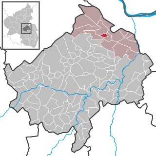
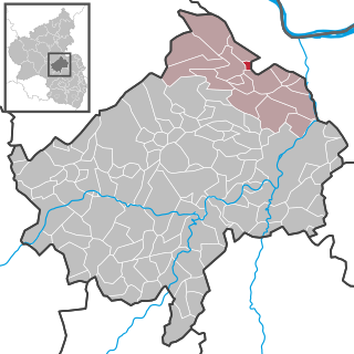
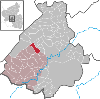
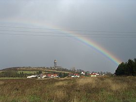
 Waldalgesheim Location of Waldalgesheim within Mainz-Bingen district  | ||
| Coordinates: 49°57′04″N7°50′11″E / 49.95111°N 7.83639°E Coordinates: 49°57′04″N7°50′11″E / 49.95111°N 7.83639°E | ||
| Country | Germany | |
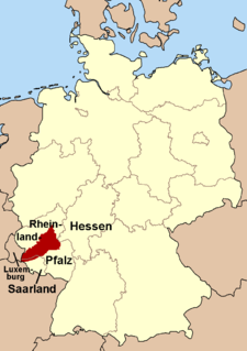
| State | Rhineland-Palatinate | |
| District | Mainz-Bingen | |
| Municipal assoc. | Rhein-Nahe | |
| Government | ||
| • Mayor | Stefan Reichert (CDU) | |
| Area | ||
| • Total | 16.01 km2 (6.18 sq mi) | |
| Elevation | 293 m (961 ft) | |
| Population (2015-12-31) [1] | ||
| • Total | 4,015 | |
| • Density | 250/km2 (650/sq mi) | |
| Time zone | CET/CEST (UTC+1/+2) | |
| Postal codes | 55425 | |
| Dialling codes | 06721 | |
| Vehicle registration | MZ | |
| Website | www.waldalgesheim.de | |

Waldalgesheim is an Ortsgemeinde – a municipality belonging to a Verbandsgemeinde , a kind of collective municipality – in the Mainz-Bingen district in Rhineland-Palatinate, Germany. It is best known as the site of the Iron Age Waldalgesheim chariot burial.

Municipalities are the lowest level of official territorial division in Germany. This is most commonly the third level of territorial division, ranking after the Land (state) and Kreis (district). The Gemeinde which is one level lower in those states also includes Regierungsbezirke as an intermediate territorial division. The Gemeinde is one level higher if it is not part of a Samtgemeinde. Only 10 municipalities in Germany have fifth level administrative subdivisions and all of them are in Bavaria. The highest degree of autonomy may be found in the Gemeinden which are not part of a Kreis. These Gemeinden are referred to as Kreisfreie Städte or Stadtkreise, sometimes translated as having "city status". This can be the case even for small municipalities. However, many smaller municipalities have lost this city status in various administrative reforms in the last 40 years when they were incorporated into a Kreis. In some states they retained a higher measure of autonomy than the other municipalities of the Kreis. Municipalities titled Stadt are urban municipalities while those titled Gemeinde are classified as rural municipalities.
A Verbandsgemeinde is a low-level administrative unit in the German federal states of Rhineland-Palatinate and Saxony-Anhalt. A Verbandsgemeinde is typically composed of a small group of villages or towns.
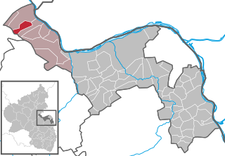
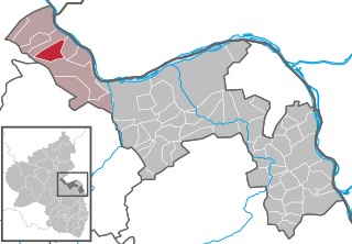
Mainz-Bingen is a district (Kreis) in the east of Rhineland-Palatinate, Germany. Neighboring districts are Rheingau-Taunus, the district-free cities Wiesbaden and Mainz, the districts Groß-Gerau, Alzey-Worms, Bad Kreuznach, and Rhein-Hunsrück.
Contents
- Geography
- Location
- Neighbouring municipalities
- Constituent communities
- History
- Politics
- Municipal council
- Town partnerships
- Culture and sightseeing
- Buildings
- Sport
- Economy and infrastructure
- Transport
- Famous people
- Other
- References
- External links
The winegrowing centre belongs to the Verbandsgemeinde of Rhein-Nahe, whose seat is in Bingen am Rhein, although that town is not within its bounds. Since 2003, Waldalgesheim has been part of the Rhine Gorge UNESCO World Heritage Site.
Rhein-Nahe is a Verbandsgemeinde in the district Mainz-Bingen, in Rhineland-Palatinate, Germany. It is situated along the left bank of the Rhine, north of Bingen. Bingen is the seat of the municipality, but not part of it.

Bingen am Rhein is a town in the Mainz-Bingen district in Rhineland-Palatinate, Germany.

The Rhine Gorge is a popular name for the Upper Middle Rhine Valley, a 65 km section of the Rhine between Koblenz and Bingen in Germany. It was added to the UNESCO list of World Heritage Sites in June 2002 for a unique combination of geological, historical, cultural and industrial reasons.