Wase, Nigeria

Last updated • 3 min readFrom Wikipedia, The Free Encyclopedia

Wase
Gari Mai Dutse
Dutse [1]
LGA and town
Wase Rock.JPG
City view of Wase Rock
Nickname: 
Kafin Madaki Hasan
Motto: 
The land of Agriculture
Nigeria location map.svg
Red pog.svg
Wase
Coordinates: 9°05′N9°57′E / 9.083°N 9.950°E / 9.083; 9.950
Country Nigeria
State Plateau State
Creation1976
HeadquarterWase
Government
  TypeDemocracy
  Chairman Hamisu Haruna Anani
  Emir Muhammadu (Sambo) Haruna
Area
  Total
1,663 sq mi (4,306 km2)
Elevation
794 ft (242 m)
Population
 (2006)
  Total
161,714
  Density100/sq mi (38/km2)
Time zone UTC+1 (WAT)
ZIP code
942105
Area code 942001
Website https://www.plateaustate.gov.ng/wase
Wase, Nigeria

Wase (pronounced: Wersay) is a town and Local Government Area (LGA) of Plateau State, Nigeria, situated some 216 km south east of Jos, the Plateau State capital. It shares its name with the nearby Wase River. The population of the LGA was 159,861 people as of 2006, with an urban area of 1750 km². [2]

Contents

Climate

The climate of Wase is Tropical Continental Climate it is also called Sudan Climate this climate is also known as Aw Köppen Climate [3] In Wase, the dry season is oppressively hot and partially cloudy, and the wet season is oppressively hot and cloudy. The average annual temperature fluctuates between 65°F and 101°F, rarely falling below 60°F or rising over 105°F. [4]

Average Temperature

The 2.5-month hot season, which runs from January 29 to April 14 (average daily high temperature above 97°F), is marked by high temperatures. March is the warmest month of the year in Wase, with typical high temperatures of 100°F and low temperatures of 75°F. The 3.9-month chilly season, which runs from June 23 to October 18, has daily highs that are typically lower than 87°F. In Wase, August is the coldest month of the year, with typical lows of 72°F and highs of 84°F. [4]

History

The region of Wase was first inhabited by the Jukuns, centered around the traditional walled town of the same name. At first, Bashar was at it present location. [5] She contained a chiefdom ruled by the Jukun in Mavo and lastly by Tarok in Kadarko this comes after the second crises between Tarok and Fulani. The Local Government Area was predominantly inhabited by Tarok people,Hausa Fulani, Burmawa and Jukun tribes and other minor tribes [6] [7] and Basherawa. Later on Wase became part of the British Royal Niger Company protectorate (later Northern Nigeria) following the arrival of British troops in 1898. Wase was a part of Plateau Province when it was established in 1926, and then Plateau State upon Nigerian Independence in 1960.

Environment

Around 321 hectares (790 acres) of land around Wase is conserved for wildlife development and serves as a bird sanctuary - local species include the Rossy White Pelican. The protected land includes Wase Rock, a massive dome-shaped inselberg of volcanic origin standing at 350m in height, [8] making it visible from a distance of some 40 km (25 miles).

The region is renowned for its mining activities due to a high concentration of lead, zinc, tin and other minerals. This has attracted considerable interest from Chinese investors who have constructed few local bridges and other infrastructure close to Wase's mining sites, although these services have not always reached the local community. [9]

Wase river Wase River.jpg
Wase river

Population

The 2006 census population of Wase LGA was 159,861. There is a near-equal gender distribution (50.3% male) and a predominantly youthful population - 47.3% are younger than 15, whereas only 2.7% are aged 65 and over. The ethnic groups in Wase are the Hausa/Fulani, Yankam (Hausa: Basharawa), Boghom (Hausa: Burmawa), Jukun and Tarok (Hausa:Yargamawa). The major religions are Islam, Christianity, and the traditional African religion.

Traditional council

The main tribal groups in the local council are Boghom, (Yankam) Basharawa people ruled by the Rekna, who use the Yankham language, and Jukun ruled by Nkir. Emirs are selected by a council of seven kingmakers. The 13th Emir of Wase was Alhaji (Dr.) Haruna Abdullahi Maikano. He was nominated three months after the death of his father in September 2001, although this was not confirmed until the following year. [10] He was assisted by the Rekna of Bashar, Alh. Adamu Idris, in conducting the affairs of the traditional council, who rule in the absence of the emir. Haruna Abdullah died in September 2010 at the age of 64. [11] Alh Dr Muhammadu Sambo Haruna replaced late Dr Haruna Abdullah as the 14th Emir of Wase with effect from 28 October 2010. [12]

Political Division

Administratively, Wase was divided into four districts, namely: Wase district, Bashar, Lamba, and Kadarko. Each of these districts is being headed by a district head known as the "Hakimi", while the various towns and villages under each district is being headed by the ward head known as Mai Unguwa.

Related Research Articles

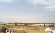
Ikara is a town and local government area (LGA) in Kaduna State, northern Nigeria, located around (85 km) north-east from the city of Zaria. Ikara as an LGA consists of these towns its located between 10°2¹ to 11°5¹ north and villages: Ikara, Malikachi, Furana, Danlawan, Kurmin Kogi, Janfalan, Auchan, Paki, and Pala.

<span class="mw-page-title-main">Plateau State</span> State of Nigeria

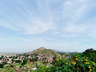
Plateau State is a north central Nigerian state. It is located near the centre of Nigeria and includes a range of hills surrounding the Jos Plateau. Plateau State is described as "The Home of Peace and Tourism". The state has a population of around 4.7 million people. Its capital city is Jos.

<span class="mw-page-title-main">Northern Region, Nigeria</span> Former autonomous division within Nigeria

Northern Nigeria was an autonomous division within Nigeria, distinctly different from the southern part of the country, with independent customs, foreign relations and security structures. In 1962, it acquired the territory of the British Northern Cameroons, which voted to become a province within Northern Nigeria.

<span class="mw-page-title-main">Ningi, Nigeria</span> Place in Bauchi State, Nigeria

Ningi is a town, a local government area, and an emirate in Bauchi State, Nigeria. The Ningi emirate comprises two local government areas, Ningi and Warji, with a combined area of 5,250 km2 and a population of 501,912 according to the 2006 Census. The Ningi local government area covers an area of 4,625 km2 with a population of 387,192 at the 2006 Census. The area is inhabited mostly by hausa people, Duwa, Ningawa. Yunusa Muhammadu Danyaya was the longes Emir to reigned who ascended the throne from 1978 until his death on 25 August 2024..

<span class="mw-page-title-main">Jalingo</span> Capital city of Taraba State, Nigeria

Jalingo is the capital city of Taraba State in north-eastern Nigeria, named in fulfulde and has been estimated with population of 418,000 as of 2018, The city has received the highest number of immigrants mainly from, Kano, Borno, Gombe and the neighboring Cameroon. As of November, 2022 the city is estimated to have around 581,000 people.

Tarok is an agrarian society in the hills and on the plains southeast of Plateau State, Middle Belt, Nigeria.

<span class="mw-page-title-main">Jukun people (West Africa)</span> West African ethno-linguistic group

Jukun are an ethno-linguistic group or ethnic nation in West Africa. The Jukun are traditionally located in Taraba, Benue, Nasarawa, Plateau, Adamawa, Bauchi and Gombe States in Nigeria and parts of northwestern Cameroon. They are descendants of the people of Kwararafa. Most of the tribes in the north central of Nigeria trace their origin to the Jukun people and are related in one way or the other to the Jukuns. Until the coming of both Christianity and Islam, the Jukun people were followers of their own traditional religions. Most of the tribes, Alago, Agatu, Rendere, Goemai in Shendam, and others left Kwararafa when it disintegrated as a result of a power tussle. The Jukuns are divided into two major groups; the Jukun Wanu and Jukun Wapa. The Jukun Wanu are fishermen residing along the banks of the river Benue and Niger where they run through Taraba State, Benue State and Nasarawa State. The Wukari Federation, headed by the Aku Uka of Wukari, is now the main centre of the Jukun people.

Daura is a town and local government area in Katsina State, northern Nigeria. It is the spiritual home of the Hausa people. The emirate is referred to as one of the "seven true Hausa states" because it was,, ruled by the descendants of Bayajidda's sons with Daurama and Magira . The University of California's African American Studies Department refers to Daura, as well as Katsina, as having been "ancient seats of Islamic culture and learning."

<span class="mw-page-title-main">Jamaare</span> LGA and town in Bauchi State, Nigeria

Jama'are is a Local Government Area of Bauchi State, Nigeria. Its headquarters are in the town of Jama'are. It has an area of 493 km2 and a population of 176,883 at the 2006 census. The postal code of the area is 751. It is populated by a Fulani tribe that migrated from Dulare in the Lake Chad basin in the Republic of Chad.

Dukku is a Local Government Area in Gombe State, Nigeria. Its headquarters is located in Dukku town. The Gongola River flows through the west and north of the LGA. It has an area of 3,815 km2 and a population of 207,190 from the 2006 census. The vast majority of the population are Muslims, but there is a Christian minority. The major ethnic group is Fulani with Fulfulde being spoken as a major language alongside Bole while Hausa, Kanuri, and Kare-Kare are also spoken.

<span class="mw-page-title-main">Nafada</span> LGA and town in Gombe State, Nigeria

Nafada is one of the eleven Local Government Areas (LGA) of Gombe State, Nigeria. Its headquarter is in the town of Nafada in the east of the area at 11°05′44″N11°19′58″E, on the Gongola River which traverses the area. According to the 2006 census, the LGA covers 1,586 square kilometers and has a population of 138,185 people. Nafada has ten wards namely: Nafada East, Nafada Central, Nafada West, Jigawa, Birnin Fulani East, Birnin Bolewa, Birnin Fulani West, Gudukku, Barwo/Nasarawo and Barwo Winde.

Ringim is a Local Government Area (LGA) of Jigawa State, Nigeria. Its headquarters are in the town of Ringim, the LGA has an area of 1,057 km² and a population of 192,024 at the 2006 census.

<span class="mw-page-title-main">Ingawa</span> LGA and town in Katsina State, Nigeria

Ingawa is a Local Government Area in Katsina State, Nigeria. Its headquarters is in the town of Ingawa.

Danja is a Local Government Area in Katsina State, Nigeria. Its headquarters is located in the town of Danja.

<span class="mw-page-title-main">Bichi</span> LGA emirate council and town in Kano State, Nigeria

Bichi is a Local Government Area and a headquarter of Bichi Emirate council in Kano State, Nigeria. Its headquarters are in the town of Bichi on the A9 highway. Bichi was founded by danejawa the white herders under the leadership of Ardo buba the grandfather of Malam danzabuwa

Kaura is a town and a Local Government Area in southern Kaduna State, Nigeria. Its headquarters are in the town of Kaura in Asholyio (Moroa) Chiefdom. The Local Government Council is chaired by Matthias Siman. Other towns include: Takad (Attakar)Manchok and Kagoro. It has an area of 461 km2 and a population of 174,626 at the 2006 census. The postal code of the area is 801.

Kagarko is a Local Government Area in southern Kaduna State of Nigeria. Its headquarters are in the town of Kagarko. It has an area of 2,356 km2 and a population of 239,058 at the 2006 census. The Local Government Council is chaired by Nasara Rabo. The postal code is 802.

Lere is a Local Government Area and town in the southern part of Kaduna State, Nigeria. Lere town is located geographically at the latitude of 10 degrees 39 North and longitude of 8 degrees 57 East. It is the headquarters of the Lere Emirate. The town and its environs have an estimated population of about 553,290 (2016). Lere Local Government has an area of 2,634 km2 and a population of 339,740 at the 2006 census. Its headquarters are in the town of Saminaka. The postal code of the area is 811.

Gassol is a Local Government Area in Taraba State, Nigeria. Its headquarters are in the town of Mutum Biyu on the A4 highway at8°38′00″N10°46′00″E.

Bashar is a town and district in Wase Local Government Area, Plateau State.

References

  1. Rabiu Tijjani. (2024), Important points about Wase Local Government Area. p.3
  2. "Official Website of Plateau State". www.plateaustate.gov.ng. Archived from the original on 2015-03-02.
  3. Rabiu Tijjani. (2024), Important points about Wase Local Government Area. p.3
  4. 1 2 "Climate, Weather By Month, Average Temperature (Nigeria) - Weather Spark". weatherspark.com. Retrieved 2023-10-02.
  5. Aminu A. (2010), Brief History of Wase district. p.1
  6. Administrator, O'Tarok. "Tarok History :: A Brief Historical Background". OTarok. Retrieved 5 March 2021.
  7. E. N., Lamle. "Origin, Migration and Clan Structure of the Tarok People: Tree in the Forest Mandyeng". Journal of Central Nigeria Studies: 25–56.
  8. "Wase Rock | ZODML". zodml.org. Archived from the original on 2018-05-16.
  9. "Inside closure of Plateau's 'juiciest' mining site". www.dailytrust.com.ng. Archived from the original on 2017-08-26.
  10. "Nigeria: Six Eye Wase Emir's Throne". Daily Trust. 23 September 2010. Retrieved 2012-03-24.
  11. GONJI PALANG (18 September 2010). "Nigeria: Emir of Wase Dies at 64". Leadership (Abuja). Retrieved 2012-03-24.
  12. MAHMUD LALO (29 October 2010). "Nigeria: Wase Gets New Emir". Daily Trust. Retrieved 2012-03-24.

9°06′N9°58′E / 9.100°N 9.967°E / 9.100; 9.967