
Aldersyde is a hamlet in Alberta, Canada within the Foothills County. Located between Highway 2 and Highway 2A south of Highway 7, the hamlet is approximately 8 kilometres (5.0 mi) southeast of Okotoks, 10 kilometres (6.2 mi) north of High River and 25 kilometres (16 mi) south of Calgary. The Canadian Pacific Kansas City Aldersyde subdivision runs through the hamlet.
Welling is a hamlet in southern Alberta, Canada within Cardston County. It is located north of the junction of Highway 5 and Highway 52, approximately 30 kilometres (19 mi) south of the City of Lethbridge.
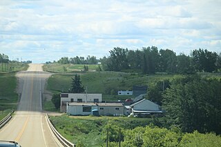
Abee is a hamlet in Alberta, Canada within Thorhild County. It is located on the Canadian National Railway and Highway 63, approximately 16 kilometres (9.9 mi) northeast of Thorhild and 49 kilometres (30 mi) south of Boyle. It has an elevation of 665 metres (2,182 ft).
Brule is a hamlet in west-central Alberta, Canada within Yellowhead County. It is located on the northwest shore of Brûlé Lake, approximately 20 kilometres (12 mi) west of Hinton. It has an elevation of 1,040 metres (3,410 ft).

Orion is a hamlet in Alberta, Canada within the County of Forty Mile No. 8. The hamlet is located approximately 78 kilometres (48 mi) south of Medicine Hat along Highway 61.

Cherhill is a hamlet in Alberta, Canada within Lac Ste. Anne County. It is located along Highway 43, approximately 35 kilometres (22 mi) east of Mayerthorpe and 82 kilometres (51 mi) northwest of Edmonton.
Condor is a hamlet in Alberta, Canada within Clearwater County.

Priddis is a hamlet in Alberta, Canada within Foothills County. It is located in the foothills of the Canadian Rockies at an elevation of 1,160 metres (3,810 ft). The hamlet is located southwest of the intersection of the Cowboy Trail and Highway 22X, approximately 10 kilometres (6.2 mi) west of Calgary's city limits.

Millarville is a hamlet in Alberta, Canada within the Foothills County. It is located in the foothills of the Canadian Rockies at an elevation of 1,185 metres (3,888 ft). The hamlet is located northwest of the intersection of the Cowboy Trail and Highway 549, approximately 11 kilometres (6.8 mi) north of Turner Valley and 35 kilometres (22 mi) southwest of Calgary's city limits.
Duvernay is a hamlet in central Alberta, Canada within the County of Two Hills No. 21. It is located 1.6 km (1.0 mi) north of the intersection of Highway 36 and Highway 29 along the south bank of the North Saskatchewan River, approximately 53 km (33 mi) southwest of St. Paul. The hamlet of Brosseau is located immediately across the river along the north bank.
Ensign is a hamlet in southern Alberta, Canada within Vulcan County. It is located approximately 11 kilometres (6.8 mi) south of Highway 23 and 78 kilometres (48 mi) southeast of Calgary.
Fabyan is a hamlet in central Alberta, Canada within the Municipal District of Wainwright No. 61. It is located on Highway 14, approximately 10 kilometres (6.2 mi) west of Wainwright, Alberta, and 78 kilometres (48 mi) southwest of Lloydminster. It is located near the Fabyan Trestle Bridge.
Greenshields is a hamlet in central Alberta, Canada within the Municipal District of Wainwright No. 61. It is located 4 kilometres (2.5 mi) east of Highway 41, approximately 74 kilometres (46 mi) southwest of Lloydminster.

Herronton is a hamlet in southern Alberta, Canada within Vulcan County. It is located 6 kilometres (3.7 mi) north of Highway 23, approximately 64 kilometres (40 mi) southeast of Calgary. The post office was opened in 1912 and named after John Herron of the North-West Mounted Police.
Kirkcaldy is a hamlet in southern Alberta, Canada within Vulcan County. It is located 0.3 kilometres (0.19 mi) west of Highway 23, approximately 98 kilometres (61 mi) southeast of Calgary.
Mearns is a hamlet in central Alberta, Canada within Sturgeon County. It is located approximately 11 kilometres (6.8 mi) west of Highway 2 and 31 kilometres (19 mi) northwest of Edmonton's city limits.
Pine Sands is a hamlet in central Alberta, Canada within Sturgeon County. It is located approximately 13 kilometres (8.1 mi) west of Highway 44 and 29 kilometres (18 mi) northwest of Edmonton's city limits.
Shouldice is a hamlet in southern Alberta, Canada within Vulcan County. It is located approximately 16 kilometres (9.9 mi) south of Highway 1 and 85 kilometres (53 mi) southeast of Calgary.
Village at Pigeon Lake is a hamlet in central Alberta, Canada within the County of Wetaskiwin No. 10. It is located 0.3 kilometres (0.19 mi) north of Highway 13, approximately 44 kilometres (27 mi) west of Wetaskiwin.

