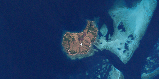
Thursday Island, colloquially known as TI, or in the indigenous language, Waiben, is an island of the Torres Strait Islands archipelago located approximately 39 kilometres north of Cape York Peninsula in the Torres Strait, Queensland, Australia. Thursday Island is also the name of the town in the south and west of the island and also the name of the locality which contains the island within the Shire of Torres. The town of Rose Hill is located on the north-eastern tip of the island.

Murray Island, officially Merr Island or Mer Island, also called Mer in the native Meriam language, is a small island of volcanic origin, the most easterly inhabited island of the Torres Strait Islands archipelago, just north of the Great Barrier Reef. The island is populated by the Melanesian Meriam people, which has a population of around 485 as of 2006 census.

Boigu Island is the most northerly inhabited island of Queensland and of Australia. It is part of the top-western group of the Torres Strait Islands, which lie in the Torres Strait separating Cape York Peninsula from the island of New Guinea. The mainland of Papua New Guinea is only 6 kilometres (3.7 mi) away from Boigu. Boigu has an area of 89.6 square kilometres (34.6 sq mi). Boigu is also the name of the town and Boigu Island is the name of the locality on the island within the Torres Strait Island Region.

Warraber is the middle island of The Three Sisters, Torres Strait, Queensland, Australia. This island is one of the Torres Strait Islands and is within the locality of Warraber Island in the Torres Strait Island Region.

The Three Sisters are three islands in the Vigilant Channel of the Torres Strait, Queensland, Australia. The islands are, from north to south, Bet Islet, Sue Islet and Poll Islet. The islands are within the Torres Strait Island Region local government area.

Darnley Island or Erub in the native language, is an island formed by volcanic action and situated in the eastern section of the Torres Strait, Queensland, Australia. It is one of the Torres Strait Islands and is located near the Great Barrier Reef and just south of the Bligh entrance. The town on the island is also called Darnley but the locality is called Erub Island, both being within the local government area of Torres Strait Island Region.

The Bourke Isles are a group of islands in the Torres Strait Islands archipelago, located west of the Cumberland Passage in the Torres Strait in Queensland, Australia. The isles are situated approximately 130 kilometres (81 mi) northeast of Thursday Island and 54 kilometres (34 mi) southwest of Darnley Island. The Bourke Isles are located within the Torres Strait Island Region local government area.

The Belle Vue Islands are a group of islands within the Torres Strait Islands, Queensland, Australia.

Poll Islet,, is an Australian island in the center of the Torres Strait Islands. It lies in the southern part of The Three Sisters island group and is located 5.2 kilometres (3.2 mi) south off Sue Island, the middle and only inhabited island in The Three Sisters. It is within the Guijar Islet locality in the Torres Strait Island Region local government area.

Burrar Islet is an island locality in the Torres Strait Island Region, Queensland, Australia. The locality consists of a single island, Bet Islet, also known as Burrar Islet. In the 2016 census, Burrar Islet had a population of 0 people.

Dowar Islet is an island locality in the Torres Strait Island Region, Queensland, Australia. It consists of a single island, Daua Island which is one of the Murray Islands group in the Torres Strait. In the 2016 census, Dowar Islet had a population of 0 people.
Murray Islands are an island group in the Torres Strait, Queensland, Australia. The group consists of Meer Island, Daua Island and Waua Islet. The islands are within the Torres Strait Island Region local government area.

Erub Island is a locality in the Torres Strait Island Region, Queensland, Australia. The locality consists only of Darnley Island. In the 2016 census, Erub Island had a population of 328 people.

Guijar Islet is an island locality in the Torres Strait Island Region, Queensland, Australia. It consists solely of Poll Island. In the 2016 census, Guijar Islet had a population of 0 people.

Keriri Island is an island locality in the Torres Strait Island Region, Queensland, Australia. It consists only of Hammond Island. In the 2016 census, Keriri Island had a population of 268 people.

Masig Island is an island locality in the Torres Strait Island Region, Queensland, Australia. The locality consists of a single island, Yorke Island. In the 2016 census, Masig Island had a population of 270 people.

Mer Island is an island locality in the Torres Strait Island Region, Queensland, Australia. The locality consists of a single island, Meer Island. In the 2016 census, Mer Island had a population of 450 people.

Warraber Islet is an island locality in the Torres Strait Island Region, Queensland, Australia. It consists of a single island, Sue Islet, the middle island of The Three Sisters. In the 2016 census, Warraber Islet had a population of 245 people.

Ugar Island is an island locality in the Torres Strait Island Region, Queensland, Australia. It consists of a single island, Stephens Island in the Torres Strait. In the 2016 census, Ugar Island had a population of 85 people.


