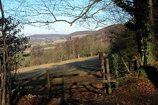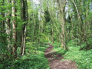
Kent Wildlife Trust (KWT) is a conservation charity in the United Kingdom that was founded in 1958, previously known as the Kent Trust for Nature Conservation. It aims to "work with people to restore, save and improve our natural spaces" and to "ensure that 30% of Kent and Medway – land and sea – is managed to create a healthy place for wildlife to flourish". In 2016 it had thirty-one thousand members and an annual income of £4 million. KWT manages over sixty-five nature reserves, of which twenty-four are Sites of Special Scientific Interest, two are national nature reserves, nine are Nature Conservation Review sites, seven are Special Areas of Conservation, three are Special Protection Areas, seven are local nature reserves, one is a Geological Conservation Review site, thirteen are in Areas of Outstanding Natural Beauty and one is a scheduled monument.

Blue Bell Hill is a chalk hill between Maidstone and Rochester in the English county of Kent. It overlooks the River Medway and is part of the North Downs. Settlements on the hill include the Walderslade suburb of Chatham and the villages of Blue Bell Hill and Kit's Coty. During the eighteenth and nineteenth centuries much of the hill was quarried for chalk.

Midger is a 65.7-hectare (162-acre) biological Site of Special Scientific Interest straddling the border of Gloucestershire and South Gloucestershire, notified in 1966 and renotified in 1984. Since the last revision in 1974, the size has been reduced to a 56-hectare (140-acre) site. It lies east of Hillesley, Gloucestershire and north of Hawkesbury Upton, South Gloucestershire. It is at the head of the Kilcott Valley.

Queendown Warren is a 22.2-hectare (55-acre) biological Site of Special Scientific Interest south-east of Rainham in Kent. It is a Local Nature Reserve, a Nature Conservation Review site, Grade 2, and a Special Area of Conservation. It is in the Kent Downs Area of Outstanding Natural Beauty. It is managed by the Kent Wildlife Trust, and part of it is owned by Plantlife.

Burham Down is a 110-hectare (270-acre) nature reserve between Maidstone and Chatham in Kent. It is managed by the Kent Wildlife Trust. It is part of the Wouldham to Detling Escarpment Site of Special Scientific Interest and Nature Conservation Review site, Grade I, the Kent Downs Area of Outstanding Natural Beauty, and the North Downs Woodlands Special Area of Conservation.

Combe Bottom is a 42.1-hectare (104-acre) biological Site of Special Scientific Interest north of Shere in Surrey. It is designated a Local Nature Reserve called Shere Woodlands, and is managed by the Surrey Wildlife Trust.

Wotton Hill is a hill on the edge of the Cotswold Hills in Gloucestershire, England, 0.5 miles (0.80 km) north of Wotton-under-Edge. The Cotswold Way passes over the hill.
Lower Wye Gorge is a 65-hectare (160-acre) biological and geological Site of Special Scientific Interest in Gloucestershire, notified in 1954 and renotified 1987. The site includes two Gloucestershire Wildlife Trust nature reserves being Ban-y-gor Wood and Lancaut. The Natural England citation states a revision for Lancaut inclusion.

Upper Wye Gorge is a Site of Special Scientific Interest (SSSI), noted for its biological and geological characteristics, around Symonds Yat in the Wye Valley on the Wales–England border. The site is listed in the 'Forest of Dean Local Plan Review' as a Key Wildlife Site (KWS).

Bull Cross, The Frith and Juniper Hill is a 42.33-hectare (104.6-acre) biological and geological Site of Special Scientific Interest in Gloucestershire, notified in 1954. The site is listed in the ‘Stroud District’ Local Plan, adopted November 2005, Appendix 6 as an SSSI and Regionally Important Geological Site (RIGS).

Shorn Cliff And Caswell Woods is a 69.2-hectare (171-acre) biological Site of Special Scientific Interest in Gloucestershire, notified in 1986. The site is listed in the 'Forest of Dean Local Plan Review' as a Key Wildlife Site (KWS).

Three Groves Wood is a 3.3-hectare (8.2-acre) nature reserve in Gloucestershire. The site is listed in the ‘Stroud District’ Local Plan, adopted November 2005, Appendix 6 as a Key Wildlife Site (KWS).

Halling to Trottiscliffe Escarpment is a 600.6-hectare (1,484-acre) biological Site of Special Scientific Interest which runs from Cuxton to Wrotham, west of Rochester in Kent. It is a Nature Conservation Review site, Grade I. and a Special Area of Conservation.

Spuckles and Kennelling Woods is a 20-hectare (49-acre) nature reserve north of Charing in Kent. It is managed by Kent Wildlife Trust. It is in the Kent Downs Area of Outstanding Natural Beauty.

Wouldham to Detling Escarpment is a 311.2-hectare (769-acre) biological and geological Site of Special Scientific Interest which stretches from Wouldham to Detling, north of Maidstone in Kent. Part of it is a Geological Conservation Review site, and it is part of the North Downs Woodlands Special Area of Conservation and the Kent Downs Area of Outstanding Natural Beauty. It is a Nature Conservation Review site, Grade I and it includes three Kent Wildlife Trust nature reserves and a Local Nature Reserve,

Boxley Warren is a 83-hectare (210-acre) Local Nature Reserve north of Maidstone in Kent. It is privately owned and managed by Maidstone Borough Council. It is part of North Downs Woodlands Special Area of Conservation and Wouldham to Detling Escarpment Site of Special Scientific Interest

The Larches is a 25-hectare (62-acre) nature reserve north of Detling, which is north of Maidstone in Kent. It is managed by Kent Wildlife Trust. It is part of the Wouldham to Detling Escarpment Site of Special Scientific Interest and Nature Conservation Review site, Grade I It is also part of the North Downs Woodlands Special Area of Conservation, and Kent Downs Area of Outstanding Natural Beauty,

Fraser Down is a 10-hectare (25-acre) nature reserve north of Betchworth in Surrey. It is managed by the Surrey Wildlife Trust. It is part of the Mole Gap to Reigate Escarpment Site of Special Scientific Interest and Special Area of Conservation.

Woodchester Park is a 214.9-hectare (531-acre) biological Site of Special Scientific Interest in Gloucestershire, notified in 1966.


