Blue Bell Hill | |
---|---|
Type | Nature reserve |
Location | Aylesford, Kent |
OS grid | TQ743621 |
Area | 5 hectares (12 acres) |
Managed by | Kent Wildlife Trust |
Blue Bell Hill | |
---|---|
Highest point | |
Elevation | 160 m (520 ft) |
Prominence | c. 30 m |
Geography | |
Location | North Downs, England |
OS grid | TQ740625 |
Topo map | OS Landranger 188 |
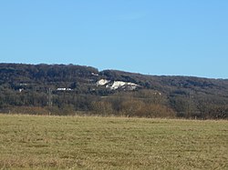
Blue Bell Hill is a chalk hill between Maidstone and Rochester in the English county of Kent. It overlooks the River Medway and is part of the North Downs. Settlements on the hill include the Walderslade suburb of Chatham and the villages of Blue Bell Hill and Kit's Coty. During the eighteenth and nineteenth centuries much of the hill was quarried for chalk. [1]
The hill is a 5-hectare (12-acre) nature reserve which is managed by Kent Wildlife Trust. [2] It is also part of the Kent Downs Area of Outstanding Natural Beauty [3] and Wouldham to Detling Escarpment Sites of Special Scientific Interest [4] and is a Nature Conservation Review site, Grade I. [5]
A picnic area serves as a rest point for walkers on the North Downs Way which runs along the top of the hill, whilst the prehistoric trackway of the Pilgrims' Way skirts its foot. A modern crematorium also surmounts the hill.
The A229 dual carriageway follows the route of a former Roman road and climbs the hill, today linking the M2 and M20 motorways. High Speed 1 runs beneath the hill, via the North Downs Tunnel, and archaeological work in advance of it uncovered a Neolithic long house on its slopes. The Bluebell Hill transmitting station is on the hill, [6] as is the Lower Bell pub. [7] The Upper Bell pub was closed around March 2005 due to the reduced demand caused by the closure of a slip-lane onto the southbound A229, and then demolished in 2013.[ citation needed ]
A famous feature of the hill is the eastern group of the prehistoric tombs called the Medway megaliths including Kit's Coty House and Countless Stones.
The Blue Bell Hill Dolmen was a now lost member of the group of Neolithic chamber tombs in the English county of Kent. It is thought to have been one of the Medway Megaliths. Its precise location is unclear but it stood on Blue Bell Hill on the North Downs between Maidstone and Rochester, to the north of Kit's Coty House. Only fragments of antiquarians' records now remain. It was possibly investigated in 1844 and was still extant in the early twentieth century. A sketch in Maidstone Museum indicates that three sarsen standing stones survived to heights of 7 feet forming the walls of the burial chamber. A stone that may have formed the capstone lay between them. The tomb was found to have contained the skeleton of a man and fragments of red pottery were found although none of these has since survived. A kerb of smaller stones surrounded the larger ones and beneath the standing stones was a large circular pit dug into the natural chalk and filled with many flints. Local people told the investigating antiquarians that many such pits had been found on the hill and that the flints were used as a source of stone to metal new roads. From these fragments it is thought that one, or possibly more, chamber tombs stood on Blue Bell Hill in addition to the surviving Medway Megaliths. [8]
Remains of a Roman building containing human remains and traces of burnt wood had been excavated near to Kit's Coty. They are claimed to be the ruins of a roman temple to have been built on the hill later. [9]
The North Downs are a ridge of chalk hills in south east England that stretch from Farnham in Surrey to the White Cliffs of Dover in Kent. Much of the North Downs comprises two Areas of Outstanding Natural Beauty (AONBs): the Surrey Hills and the Kent Downs. The North Downs Way National Trail runs along the North Downs from Farnham to Dover.
The Coldrum Long Barrow, also known as the Coldrum Stones and the Adscombe Stones, is a chambered long barrow located near the village of Trottiscliffe in the south-eastern English county of Kent. Probably constructed in the fourth millennium BCE, during Britain's Early Neolithic period, today it survives only in a state of ruin.
The Medway Megaliths, sometimes termed the Kentish Megaliths, are a group of Early Neolithic chambered long barrows and other megalithic monuments located in the lower valley of the River Medway in Kent, South-East England. Constructed from local sarsen stone and soil between the 4th and 3rd millennia BCE, they represent the only known prehistoric megalithic group in eastern England and the most south-easterly group in Britain.
Kit's Coty is a small village on the slopes of Blue Bell Hill between Maidstone and Rochester in the English county of Kent. The population of the village is included in the civil parish of Aylesford.
Little Kit's Coty House, also known as Lower Kit's Coty House and the Countless Stones, is a chambered long barrow located near to the village of Aylesford in the southeastern English county of Kent. Constructed circa 4000 BCE, during the Early Neolithic period of British prehistory, today it survives in a ruined state.
The Coffin Stone, also known as the Coffin and the Table Stone, is a large sarsen stone at the foot of Blue Bell Hill near Aylesford in the south-eastern English county of Kent. Now lying horizontally, the stone probably once stood upright nearby. Various archaeologists have argued that the stone was part of a now-destroyed chambered long barrow constructed in the fourth millennium BCE, during Britain's Early Neolithic period.
The White Horse Stone is a name given to two separate sarsen megaliths east of Blue Bell Hill, near the hamlet of Sandling and the village of Aylesford, north of Maidstone, in the south-eastern English county of Kent.
Smythe's Megalith, also known as the Warren Farm Chamber, was a chambered long barrow east of Blue Bell Hill, north of Maidstone, in the south-eastern English county of Kent, close to Aylesford village and the hamlet of Sandling.
Chestnuts Long Barrow, also known as Stony Warren or Long Warren, is a chambered long barrow near the village of Addington in the south-eastern English county of Kent. Probably constructed in the fifth millennium BC, during Britain's Early Neolithic period, today it survives only in a ruined state.
Addington Long Barrow is a chambered long barrow located near the village of Addington in the southeastern English county of Kent. Probably constructed in the fourth millennium BCE, during Britain's Early Neolithic period, today it survives only in a ruined state. Built of earth and about fifty local sarsen megaliths, the long barrow consisted of a sub-rectangular earthen tumulus enclosed by kerb-stones. Collapsed stones on the northeastern end of the chamber probably once formed a stone chamber in which human remains might have been deposited, though none have been discovered.
Kit's Coty House or Kit's Coty is a chambered long barrow near the village of Aylesford in the southeastern English county of Kent. Constructed circa 4000 BCE, during the Early Neolithic period of British prehistory, today it survives in a ruined state.
The A229 is a major road running north–south through Kent from Rochester to Hawkhurst via Maidstone. It is a former Roman road that ran from Rochester to Hastings.
Cossington is a small farm settlement on Blue Bell Hill north of Maidstone in the English county of Kent.
Westfield Wood is a 5-hectare (12-acre) nature reserve north of Maidstone in Kent, which is managed by the Kent Wildlife Trust. It is part of the Wouldham to Detling Escarpment Site of Special Scientific Interest and Nature Conservation Review site, Grade I. It is also in the North Downs Woodlands Special Area of Conservation and the Kent Downs Area of Outstanding Natural Beauty.
Burham Down is a 110-hectare (270-acre) nature reserve between Maidstone and Chatham in Kent. It is managed by the Kent Wildlife Trust. It is part of the Wouldham to Detling Escarpment Site of Special Scientific Interest and Nature Conservation Review site, Grade I, the Kent Downs Area of Outstanding Natural Beauty, and the North Downs Woodlands Special Area of Conservation.
Sandling is a hamlet to the north of the town of Maidstone, Kent, England, at the foot of the North Downs. It falls within the parish of Boxley.
Wouldham to Detling Escarpment is a 311.2-hectare (769-acre) biological and geological Site of Special Scientific Interest which stretches from Wouldham to Detling, north of Maidstone in Kent. Part of it is a Geological Conservation Review site, and it is part of the North Downs Woodlands Special Area of Conservation and the Kent Downs Area of Outstanding Natural Beauty. It is a Nature Conservation Review site, Grade I and it includes three Kent Wildlife Trust nature reserves and a Local Nature Reserve,
The Larches is a 25-hectare (62-acre) nature reserve north of Detling, which is north of Maidstone in Kent. It is managed by Kent Wildlife Trust. It is part of the Wouldham to Detling Escarpment Site of Special Scientific Interest and Nature Conservation Review site, Grade I It is also part of the North Downs Woodlands Special Area of Conservation, and Kent Downs Area of Outstanding Natural Beauty,
Shrub's Wood Long Barrow is an unchambered long barrow located near to the village of Elmsted in the south-eastern English county of Kent. It was probably constructed in the fourth millennium BCE, during Britain's Early Neolithic period. Built out of earth, the long barrow consists of a sub-trapezoidal tumulus flanked by side ditches.
Jacket's Field Long Barrow is an unchambered long barrow located near to the village of Boughton Aluph in the south-eastern English county of Kent. It was probably constructed in the fourth millennium BCE, during Britain's Early Neolithic period. Built out of earth, the long barrow consists of a sub-trapezoidal tumulus flanked by side ditches.