
The River Ure in North Yorkshire, England, is about 74 miles (119 km) long from its source to the point where it becomes the River Ouse. It is the principal river of Wensleydale, which is the only major dale now named after a village rather than its river. The old name for the valley was Yoredale after the river that runs through it.

Aldborough is a village in the civil parish of Boroughbridge, 1km to the south-west of Boroughbridge in North Yorkshire, England.

Aysgarth is a village and civil parish in Wensleydale, in North Yorkshire, England. The village is in the Yorkshire Dales National Park, about 16 miles (26 km) south-west of Richmond and 22.6 miles (36.4 km) west of the county town of Northallerton.

Bainbridge is a village and civil parish in North Yorkshire, England. The population of the civil parish at the 2011 census was 480. The village is situated in the Yorkshire Dales National Park, near the confluence of the River Bain with the River Ure. It is 27+1⁄2 miles west of Northallerton, the county town.

Bishopdale is a dale in the Yorkshire Dales National Park in North Yorkshire, England. The dale is a side dale on the south side of Wensleydale, and extends for some 6 miles (10 km) south west from Aysgarth. Bishopdale is also the name of a civil parish, which includes only the sparsely populated upper reaches of the dale, from the head of the dale as far downstream as Howesyke and Howgill Gill.

Bridge Hewick is a village and civil parish in North Yorkshire, England. The village is situated on the River Ure, and approximately 2 miles (3 km) east of the cathedral city of Ripon. The population was recorded at less than 100 at the 2011 Census. Details are included on the statistics of the civil parish of Copt Hewick. North Yorkshire County Council estimate that the population at the 2011 census was 50, which had risen to 60 by 2015.

Burton-on-Yore is a civil parish in the former Harrogate district of North Yorkshire, England, facing Masham across the River Ure. There is no village in the parish, but there are two hamlets, Low Burton and High Burton. The parish also includes Nutwith Cote on the west bank of the Ure, between Masham and Grewelthorpe. The population of the parish was estimated at 80 in 2012.
East Witton is a village and civil parish in Wensleydale in North Yorkshire, England. It lies south of Leyburn, in the Richmondshire district. Richard Whiteley is buried there; he and his partner, Kathryn Apanowicz, lived in the village. In 2011 the parish had a population of 246.

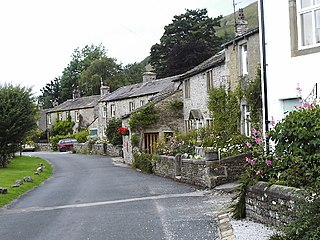
Thornton Rust is a village and civil parish in North Yorkshire, England. It lies in the Yorkshire Dales about 2 miles (3.2 km) west of Aysgarth, high on the south bank of the River Ure in Wensleydale.
Hawkswick is a hamlet and civil parish in the Craven district of North Yorkshire, England. Situated in the Yorkshire Dales, it lies in Littondale on the River Skirfare.

Rookwith is a hamlet and civil parish in the former Hambleton District of North Yorkshire, England, about 4 miles (6.4 km) west of Bedale and near the flow of the River Ure. The hamlet was mentioned in the Domesday Book as belonging to Count Alan and having four ploughlands.

Colsterdale is the valley of the River Burn, a tributary of the River Ure, in the Yorkshire Dales in North Yorkshire, England. It gives its name to a hamlet and civil parish in the upper part of the dale, about 7 miles (11 km) west of Masham. The population of the civil parish was estimated at 20 in 2010. The lower part of the dale around the hamlet of Gollinglith Foot is in the civil parish of Healey. The area was formerly in the Harrogate district of North Yorkshire.
Humberton is a hamlet and civil parish in the Harrogate district of North Yorkshire, England. It is situated 2 miles (3.2 km) east from Boroughbridge and on the north side of the River Ure. The hamlet lies about one mile to the west of the Swale, and comprises 2,320 acres (9 km2) of land.

Hutton Conyers is a village and civil parish in the Harrogate district of North Yorkshire, England. It is situated near the River Ure and 1-mile (1.6 km) north-east of Ripon. The parish extends from the River Ure to the A1(M) motorway, and includes the village of Nunwick.

Milby is a hamlet and civil parish in North Yorkshire, England. It is situated to the immediate north of Boroughbridge.

Roecliffe is a village and civil parish in the Harrogate district of North Yorkshire, England. It is situated near the A1 road motorway which connects London with Edinburgh and is 1 mile west of Boroughbridge. It is on the banks of the River Ure and the village centres on the village green which doubles up as the school playing field.

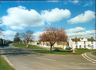
North Stainley with Sleningford is a civil parish in Harrogate district, North Yorkshire, England. The principal settlement and only village in the parish is North Stainley. The parish also includes the small settlements of Sleningford, North Lees and Sutton Grange. The Lightwater Valley theme park is also in the parish.

East Tanfield is a civil parish in North Yorkshire, England. There is no modern village in the parish, and the population was estimated at 30 in 2013. The deserted medieval village of East Tanfield lies near Manor Farm on the banks of the River Ure.

Newby with Mulwith is a civil parish in the Harrogate district of North Yorkshire, England. It lies 3 miles (5 km) south east of Ripon, on the north bank of the River Ure and adjacent to the village of Skelton-on-Ure. Most of the parish consists of the grounds of Newby Hall. Mulwith is a single farm in the south east of the parish. The population of the parish was estimated at 40 in 2013.
Swinton with Warthermarske is a civil parish in the former Harrogate district of North Yorkshire, England. The parish includes the village of Swinton and the hamlets of Roomer and Warthermarske. It also includes Swinton Park, although the wider Swinton Estate extends well beyond the parish. To the north it is separated from the parish of Masham by the River Burn, and is bounded on the east by the River Ure.

