The Barossa Valley is a valley in South Australia located 60 kilometres (37 mi) northeast of Adelaide city centre. The valley is formed by the North Para River. It is notable as a major wine-producing region and tourist destination.

Upper Lachlan Shire is a local government area in the Southern Tablelands region of New South Wales, Australia. The Shire was formed in February 2004 from Crookwell Shire and parts of Mulwaree, Gunning and Yass Shires.

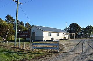
Binda is a village in the Southern Tablelands region of New South Wales, Australia in Upper Lachlan Shire. At the 2016 census, Binda had a population of 280 people.

Allendale East is a town and locality in the Australian state of South Australia located in the state's south-east about 391 kilometres (243 mi) south-east of the state capital of Adelaide and about 20 kilometres (12 mi) south of the municipal seat of Mount Gambier.

Nangwarry is a town and a locality in the Australian state of South Australia located about 352 kilometres (219 mi) south-east of the state capital of Adelaide and about 32 kilometres (20 mi) north-west of the regional centre of Mount Gambier.

Yahl is a locality in the Australian state of South Australia, and located in the state's south-east about 7 kilometres (4.3 mi) south-east of Mount Gambier, which is itself about 384 kilometres (239 mi) south east of the state capital of Adelaide.

OB Flat is a rural locality near Mount Gambier in South Australia.

The Jerrara Creek, a watercourse that is part of the Lachlan sub-catchment of the Murrumbidgee catchment within the Murray–Darling basin, is located in the South West Slopes region of New South Wales, Australia.

Kumbarilla is a town and rural locality in the Western Downs Region, Queensland, Australia. In the 2016 census, Kumbarilla had a population of 197 people.

Narraburra is a locality in the Riverina region of New South Wales, Australia. The locality is in the Temora Shire, 431 kilometres (268 mi) west of the state capital, Sydney.

Bectric is a locality in the Riverina region of New South Wales, Australia. The locality is in the Temora Shire, 431 kilometres (268 mi) west of the state capital, Sydney.

Logie Brae is a locality in the Riverina region of New South Wales, Australia. The locality is in the Murrumbidgee Council local government area, 647 kilometres (402 mi) south west of the state capital, Sydney and 311 kilometres (193 mi) from Melbourne.

North Isis is a rural locality in the Bundaberg Region, Queensland, Australia. In the 2016 census North Isis had a population of 533 people.

Tilley Swamp is a locality in the Australian state of South Australia located in the state's south-east about 199 kilometres (124 mi) south-east of the state capital of Adelaide and about 55 kilometres (34 mi) north of the municipal seat of Kingston SE. The 2016 Australian census, which was conducted in August 2016, reports that the area had a population of 27 people.

Bringalily is a rural locality in the Toowoomba Region, Queensland, Australia. In the 2016 census Bringalily had a population of 83 people.

Crownthorpe is a locality split between the South Burnett Region and the Gympie Region, in Queensland, Australia. In the 2016 census Crownthorpe had a population of 41 people.

Johnstown is a rural locality split between the South Burnett Region and the Gympie Region, both in Queensland, Australia. In the 2016 census Johnstown had a population of 30 people.

No. 5 Branch is a rural locality in the Cassowary Coast Region, Queensland, Australia. In the 2016 census the population of the locality was 9 people.
Winduella Parish is a civil parish of King County, New South Wales.

Upper Pilton is a locality split between the Toowoomba Region and the Southern Downs Region, both in Queensland, Australia. In the 2016 census Upper Pilton had a population of 63 people.


