Whitehorse, South Dakota

Last updated

Whitehorse, South Dakota
CDP
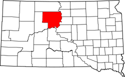
Dewey County South Dakota Incorporated and Unincorporated areas Whitehorse Highlighted.svg
Location in Dewey County and the state of South Dakota
Coordinates: 45°16′29″N100°54′04″W / 45.27472°N 100.90111°W / 45.27472; -100.90111
Country United States
State South Dakota
Counties Dewey
Area
  Total2.7 sq mi (6.9 km2)
  Land2.7 sq mi (6.9 km2)
  Water0 sq mi (0 km2)
Elevation
[1]
1,706 ft (520 m)
Population
 (2020)
  Total106
  Density52.2/sq mi (20.4/km2)
GNIS feature ID2393856 [1]

Whitehorse is a census-designated place (CDP) in Dewey County, South Dakota, United States. The population was 106 at the 2020 census. [2]

Contents

The community has the name of a Native American chieftain. [3]

Geography

According to the United States Census Bureau, the CDP has a total area of 2.7 square miles (6.9 km2), all land.

Whitehorse has been assigned the ZIP code 57661.

Demographics

As of the census [4] of 2000, there were 141 people, 37 households, and 31 families residing in the CDP. The population density was 52.7 inhabitants per square mile (20.3/km2). There were 43 housing units at an average density of 16.1/sq mi (6.2/km2). The racial makeup of the CDP was 2.84% White, 94.33% Native American, and 2.84% from two or more races.

There were 37 households, out of which 64.9% had children under the age of 18 living with them, 32.4% were married couples living together, 37.8% had a female householder with no husband present, and 16.2% were non-families. 16.2% of all households were made up of individuals, and none had someone living alone who was 65 years of age or older. The average household size was 3.81 and the average family size was 4.10.

In the CDP, the population was spread out, with 52.5% under the age of 18, 7.8% from 18 to 24, 28.4% from 25 to 44, 9.2% from 45 to 64, and 2.1% who were 65 years of age or older. The median age was 16 years. For every 100 females, there were 80.8 males. For every 100 females age 18 and over, there were 97.1 males.

The median income for a household in the CDP was $16,250, and the median income for a family was $13,750. Males had a median income of $16,250 versus $16,667 for females. The per capita income for the CDP was $8,266. There were 60.0% of families and 56.6% of the population living below the poverty line, including 61.5% of under eighteens and 40.0% of those over 64.

Related Research Articles

Old Eucha is a census-designated place (CDP) in Delaware County, Oklahoma, United States. The population was 52 at the 2010 census.

<span class="mw-page-title-main">Wickliffe, Oklahoma</span> CDP in Oklahoma, United States

Wickliffe is a census-designated place (CDP) in Mayes County, Oklahoma, United States. The population was 99 at the 2000 census, which declined to 75 in 2010, a drop of 25 percent.

<span class="mw-page-title-main">Slabtown, Pennsylvania</span> Census-designated place in Pennsylvania, United States

Slabtown is a census-designated place in Columbia County, Pennsylvania, United States. It is part of Northeastern Pennsylvania. The population was 156 at the 2010 census. It is part of the Bloomsburg-Berwick micropolitan area.

<span class="mw-page-title-main">Adamsville, Pennsylvania</span> Census-designated place in Pennsylvania, United States

Adamsville is a census-designated place (CDP) in Crawford County, Pennsylvania, United States. The population was 67 at the 2010 census, down from 117 in 2000.

Shiloh is a census-designated place (CDP) in Sumter County, South Carolina, United States. The population was 259 at the 2000 census. It is included in the Sumter, South Carolina Metropolitan Statistical Area.

<span class="mw-page-title-main">Storla, South Dakota</span> CDP in South Dakota, United States

Storla is a census-designated place (CDP) in Aurora County, South Dakota, United States. The population was 6 in the 2020 census.

<span class="mw-page-title-main">Loomis, South Dakota</span> CDP in South Dakota, United States

Loomis is a census-designated place (CDP) in Davison County, South Dakota, United States. The population was 33 at the 2020 census. It is part of the Mitchell, South Dakota Micropolitan Statistical Area.

<span class="mw-page-title-main">St. Charles, South Dakota</span> CDP in South Dakota, United States

St. Charles or Saint Charles is a census-designated place (CDP) in Gregory County, South Dakota, United States. The population was 15 at the 2020 census.

<span class="mw-page-title-main">Kaylor, South Dakota</span> CDP in South Dakota, United States

Kaylor is a census-designated place (CDP) in Hutchinson County, South Dakota, United States. The population was 30 at the 2020 census.

<span class="mw-page-title-main">Milltown, South Dakota</span> CDP in South Dakota, United States

Milltown is a census-designated place (CDP) in Hutchinson County, South Dakota, United States. The population was 8 at the 2020 census.

<span class="mw-page-title-main">Lower Brule, South Dakota</span> Census-designated place in South Dakota, United States

Lower Brule is a census-designated place (CDP) in Lyman County, South Dakota, United States. The population was 703 at the 2020 census. The community is located within the Lower Brule Indian Reservation, from which it takes its name.

<span class="mw-page-title-main">Veblen, South Dakota</span> City in South Dakota, United States

Veblen is a city in Marshall County, South Dakota, United States. The population was 317 at the 2020 census.

<span class="mw-page-title-main">Long Lake, South Dakota</span> Town in South Dakota, United States

Long Lake is a town in McPherson County, South Dakota, United States. The population was 27 at the 2020 census.

<span class="mw-page-title-main">Green Valley, South Dakota</span> CDP in South Dakota, United States

Green Valley is a census-designated place (CDP) and unincorporated community in Pennington County, South Dakota, United States. The population was 1,051 at the 2020 census.

<span class="mw-page-title-main">Oglala, South Dakota</span> CDP in South Dakota, United States

Oglala is a census-designated place (CDP) in West Oglala Lakota Unorganized Territory equivalent, Oglala Lakota County, South Dakota, United States. The population was 1,282 at the 2020 census. Its location is in the northwest of the Pine Ridge Indian Reservation.

<span class="mw-page-title-main">Turton, South Dakota</span> Town in South Dakota, United States

Turton is a town in Spink County, South Dakota, United States. The population was 55 at the 2020 census. The town was served by Turton High School from 1915 to 1956; students attended Doland High School thereafter.

<span class="mw-page-title-main">Spring Creek, South Dakota</span> CDP in South Dakota, United States

Spring Creek is a census-designated place (CDP) in Todd County, South Dakota, United States. The population was 236 at the 2020 census.

<span class="mw-page-title-main">White Horse, South Dakota</span> CDP in South Dakota, United States

White Horse also Šuŋgská oyáŋke is a census-designated place (CDP) in Todd County, South Dakota, United States. The population was 234 at the 2020 census.

<span class="mw-page-title-main">Hamill, South Dakota</span> CDP in South Dakota, United States

Hamill is a rural hamlet in Tripp County, South Dakota, United States. The population was 14 at the 2020 census. There is a post office at Hamill, also two churches and a community hall; otherwise, no businesses or services.

<span class="mw-page-title-main">Tulsita, Texas</span> Census-designated place in Texas, United States

Tulsita is a census-designated place (CDP) in Bee County, Texas, United States. The population was 14 at the 2010 census.

References

  1. 1 2 U.S. Geological Survey Geographic Names Information System: Whitehorse, South Dakota
  2. "U.S. Census Bureau: Whitehorse CDP, South Dakota". www.census.gov. United States Census Bureau. Retrieved February 13, 2022.
  3. Federal Writers' Project (1940). South Dakota place-names, v.1-3. University of South Dakota. p. 68.
  4. "U.S. Census website". United States Census Bureau . Retrieved January 31, 2008.