Interstate 97 (I-97) is a part of the Interstate Highway System that runs entirely within Anne Arundel County, Maryland. The intrastate Interstate runs 17.62 miles (28.36 km) from U.S. Route 50 (US 50) and US 301 in Parole near Annapolis north to I-695 and I-895 in Brooklyn Park near Baltimore. The Interstate is the primary highway between Baltimore and Annapolis. I‑97 connects Annapolis with Baltimore–Washington International Airport and links the northern Anne Arundel County communities of Crownsville, Millersville, Severna Park, Glen Burnie, and Ferndale. It is the second shortest primary Interstate Highway after I-87 in North Carolina.

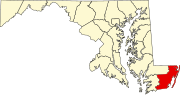
Brandywine is the name of an unincorporated area in Prince George's County, Maryland, United States, that refers both to a census-designated place (CDP) and a zip code area which is much larger (20613), whose areas overlap. The population of Brandywine at the 2010 U.S. Census was 6,719 for the CDP, and the population of ZIP code 20613 was 11,860 in 2010.
U.S. Route 340 is a part of the U.S. Highway System that runs from Greenville, Virginia to Frederick, Maryland. In Virginia, it runs north–south, parallel and east of U.S. Route 11, from US 11 north of Greenville via Waynesboro, Grottoes, Elkton, Luray, Front Royal, and Berryville to the West Virginia state line. A short separate piece crosses northern Loudoun County on its way from West Virginia to Maryland.
Mary Whiton Calkins was an American philosopher and psychologist. Calkins was also the first woman to become president of the American Psychological Association and the American Philosophical Association.

Maryland Route 7 (MD 7) is a collection of state highways in the U.S. state of Maryland. Known for much of their length as Philadelphia Road, there are five disjoint mainline sections of the highway totaling 40.23 miles (64.74 km) that parallel U.S. Route 40 (US 40) in Baltimore, Harford, and Cecil counties in northeastern Maryland. The longest section of MD 7 begins at US 40 just east of the city of Baltimore in Rosedale and extends through eastern Baltimore County and southern Harford County to US 40 in Aberdeen. The next segment of the state highway is a C-shaped route through Havre de Grace on the west bank of the Susquehanna River. The third mainline section of MD 7 begins in Perryville on the opposite east bank of the Susquehanna River and ends at US 40 a short distance west of the start of the fourth section, which passes through Charlestown and North East before ending at US 40, just west of Elkton. The fifth segment of the highway begins at South Street and passes through the eastern part of Elkton before reconnecting with US 40 just west of the Delaware state line.

Maryland Route 354 is a state highway in the U.S. state of Maryland. The state highway runs 14.98 miles (24.11 km) from MD 12 near Snow Hill north to MD 346 in Willards. MD 354 parallels the Pocomoke River, connecting eastern Wicomico County and northwestern Worcester with Snow Hill. The state highway was first constructed from Willards in the mid-1910s. The remainder of MD 354 was completed in the late 1920s and early 1930s, with little change in the highway since.

Maryland Route 12 is a state highway on the Eastern Shore in the U.S. state of Maryland. The route runs 30.57 mi (49.20 km) from the Virginia border south of Stockton, Worcester County, where it continues into Virginia as State Route 679, north to Main Street in the city of Salisbury in Wicomico County. The route is known as Snow Hill Road for most of its length and passes mostly through areas of woods and farms as well as the communities of Stockton, Girdletree, and Snow Hill. MD 12 intersects several roads including MD 366 in Stockton, U.S. Route 113 and US 113 Business in Snow Hill, MD 354 in Indiantown, and US 13 near Salisbury. Portions of MD 12 near Snow Hill and Stockton existed as unnumbered state roads by 1910. When the first state highways in Maryland were designated by 1927, MD 12 was assigned to run from Stockton north to Salisbury. By 1940, the route was extended south to the Virginia border and a small incomplete portion between Snow Hill and Salisbury was finished. A dumbbell interchange is planned at the US 113 intersection; however, this project is currently on hold.

The 6 Metre was a sailing event on the Sailing at the 1952 Summer Olympics program in Harmaja. Seven races were scheduled. 56 sailors, on 11 boats, from 11 nations competed.

Herman Frasch Whiton was an American sailor and Olympic champion. He was born in Cleveland the grandson of inventor Herman Frasch and died in New York City. He was married to Emelyn Thatcher Whiton from 1939 to 1957.
Emelyn Thatcher Whiton was an American sailor.