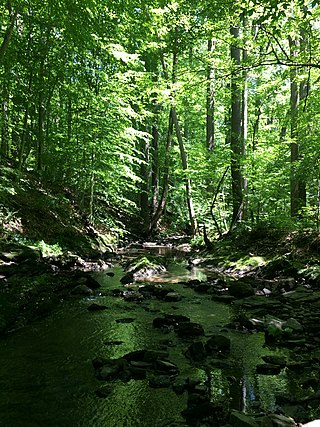
Rocky Run is a stream in northern New Castle County, Delaware. The stream flows for several miles through Brandywine Creek State Park and part of First State National Historical Park before feeding the larger Brandywine Creek. Rocky Run itself is fed by Hurricane Run, also located in Brandywine Creek State Park.
West Branch Gum Branch is a 5.61 mi (9.03 km) long 2nd tributary to Gum Branch in Sussex County, Delaware. This is the only stream of this name in the United States.
Crony Pond Branch is a 1.44 mi (2.32 km) long 1st order tributary to Toms Dam Branch in Sussex County, Delaware. This is the only stream of this name in the United States.
Long Branch is a 2.17 mi (3.49 km) long 1st order tributary to Toms Dam Branch in Sussex County, Delaware.
Owens Branch is a 2.72 mi (4.38 km) long 1st order tributary to West Branch Gum Branch in Sussex County, Delaware.
Kent-Sussex Line Branch is a 3.50 mi (5.63 km) long 2nd order tributary to the Nanticoke River in Sussex County, Delaware. The lower part of this branch flows along the Kent and Sussex County line, hence the name.
White Marsh Branch is a 3.09 mi (4.97 km) long 2nd order tributary to the Nanticoke River in Sussex County, Delaware.
Booth Branch is a 2.40 mi (3.86 km) long 1st order tributary to White Marsh Branch in Kent County, Delaware.
Matson Run is a 2.25 mi (3.62 km) long 1st order tributary to Shellpot Creek in New Castle County, Delaware. This is the only stream of this name in the United States.
Turkey Run is a 1.67 mi (2.69 km) long 1st order tributary to Shellpot Creek in New Castle County, Delaware.
Beaver Creek is a 2.62 mi (4.22 km) long 2nd order tributary to Brandywine Creek in New Castle County, Delaware.
Ramsey Run is a 1st order tributary to Brandywine Creek in New Castle County, Delaware.
Hurricane Run is a 1st order tributary to Rocky Run in New Castle County, Delaware.
Cod Creek is a 5.51 mi (8.87 km) long 2nd tributary to the Nanticoke River in Sussex County, Delaware.
Broad Creek is a 8.00 mi (12.87 km) long 4th order tributary to the Nanticoke River in Sussex County, Delaware.
Tussocky Branch is a 7.54 mi (12.13 km) long 2nd order tributary to Broad Creek in Sussex County, Delaware.
Mill Branch is a 1.70 mi (2.74 km) long 1st order tributary to Tussocky Branch in Sussex County, Delaware.
Turkey Branch is a 0.9 mi (1.4 km) long 1st order tributary to Tussocky Branch in Sussex County, Delaware.
Meadow Branch is a 5.83 mi (9.38 km) long 3rd order tributary to Little Creek in Sussex County, Delaware. Meadow Branch forms Little Creek along with Holly Branch.
Husband Run is a 1.86 mi (2.99 km) long 1st order tributary to Oil Creek in Venango County, Pennsylvania. This is the only of this name in the United States. Husband Run flows most of its distance through Oil Creek State Park.

