Windsor, Victoria

Last updated • 3 min readFrom Wikipedia, The Free Encyclopedia

Windsor
Melbourne,  Victoria
SW6 954 (Melbourne tram) in Windsor, on route 79, September 2006.jpg
Tram on Chapel Street stopping at Windsor railway station
Australia Victoria metropolitan Melbourne location map.svg
Red pog.svg
Windsor
Windsor, Victoria
Coordinates 37°51′14″S144°59′17″E / 37.854°S 144.988°E / -37.854; 144.988
Population7,273 (2021 census) [1]
 • Density7,000/km2 (19,000/sq mi)
Established1860s
Postcode(s) 3181
Elevation24 m (79 ft)
Area1 km2 (0.4 sq mi)
Location7 km (4 mi) from Melbourne
LGA(s)
State electorate(s) Prahran
Federal division(s) Higgins
Suburbs around Windsor:
Melbourne CBD Prahran Prahran
Melbourne CBD Windsor Prahran
St Kilda St Kilda East St Kilda East

Windsor is an inner suburb in Melbourne, Victoria, Australia, 5 km south-east of Melbourne's Central Business District, located within the Cities of Port Phillip and Stonnington local government areas. Windsor recorded a population of 7,273 at the 2021 census. [1]

Contents

Windsor is bounded by Dandenong Road, St Kilda Road, Williams Road and High Street.

History

Known at first as Prahran South, the suburb's name was changed to Windsor in 1891, after Windsor, Berkshire. [2] It is often incorrectly referred to as Prahran, Windsor's northern neighbour. In the past, Windsor was within the City of Prahran's boundaries and many institutions still refer to this.

A Windsor Post Office opened in 1856, but was renamed St Kilda in 1858. The Windsor Post Office in the area opened in 1886. [3]

Demographics

62.1% were born in Australia. Other countries of birth were England 5%, Greece 3.1%, New Zealand 3.1%, China (excluding Taiwan & SARs) 1.5% & Ireland 1.2%.

71.8 Spoke only English at home. Other Language used at home top responses were Greek 5.6%, Mandarin 1.9, Spanish 1.6%, Russian 1.1% & Turkish 1%.

Today

Although Stonnington's smallest suburb, Windsor has its own bank, supermarket and historic pubs, along with a growing number of independent clothing stores, restaurants, bars, lounges and cafés. Windsor contains a diverse mix of housing, including medium density apartments, Victorian terrace housing and a high-rise public housing tower. The Prahran campus of Swinburne University used to be located just south of High Street in Windsor, but this is now Melbourne Polytechnic – Prahran Campus, although it is actually in Windsor. The National Institute of Circus Arts is in Green Street, Windsor.

The painkiller Aspro was invented by the chemist George Nicholas in Windsor. [4] Nuttelex margarine was also manufactured in Windsor for many years but production shifted in the last few years to Knoxfield.

Landmarks

The suburb has many landmarks, including the historic Presentation Convent (now the secondary school St Mary's College), the Windsor Primary School, old post office, Telstra exchange tower and a campus of Swinburne University. In recent times, the large Empire Cinemas, converted into a nightclub, was gutted by fire before eventually being demolished and replaced by high-rise apartments, also named the Empire.

The remains of one side of Punt Road at the Windsor end contains one of Windsor's lesser shopping strips, called Little Windsor on Punt.

The suburb also features new design, including the award-winning Windsor Fire station, by architects Edmund and Corrigan. In Raleigh Street are the K2 apartments, a Sustainable architecture built in 2006, to the design of Hansen Yuncken and features passive solar design, recycled and sustainable materials, photovoltaic cells, wastewater treatment, rainwater collection and solar hot water.

There are many remaining hotels in the suburb, including the popular Windsor Castle and The Windsor Alehouse.

The new Prahran High School has been built on part of the grounds of what is now Melbourne Polytechnic. The new High School is a vertical school consisting of 4 levels with a gymnasium on the top floor. The school officially opened in 2019.

Transport

Windsor railway station Windsor railway station looking down.jpg
Windsor railway station

Windsor is serviced by a number of trams along Dandenong Road, High Street and Chapel Street (routes 5, 6, 64, and 78) with Metro Trains Melbourne's Sandringham railway line takes commuters from Windsor station to the CBD in 10 minutes. The 216 and 219 bus routes operate along Williams Road.

Punt Road is one of the main bus thoroughfares in Melbourne, with route 246 passing through the western side of the suburb.

Notable people

See also

Related Research Articles

<span class="mw-page-title-main">City of Port Phillip</span> Local government area in Australia

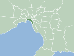
The City of Port Phillip is a local government area of Victoria, Australia on the northern shores of Port Phillip, south of Melbourne's central business district. It has an area of 20.7 km2 and had a population of 113,200 in June 2018.
<span class="mw-page-title-main">City of Stonnington</span> Local government area in Melbourne, Victoria, Australia

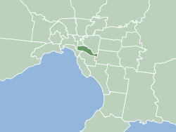
The City of Stonnington is a local government area located within the metropolitan area of Melbourne, Australia. It comprises the inner south-eastern suburbs, between 3 and 13 km, from the Melbourne CBD. The city covers an area of 25.7 km2 (9.9 sq mi).
<span class="mw-page-title-main">South Melbourne</span> Suburb of Melbourne, Victoria, Australia

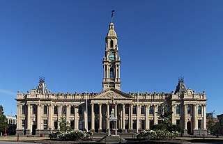
South Melbourne is an inner suburb in Melbourne, Victoria, Australia, 3 kilometres (1.9 mi) south of Melbourne's Central Business District, located within the City of Port Phillip local government area. South Melbourne recorded a population of 11,548 at the 2021 census.
<span class="mw-page-title-main">Collingwood, Victoria</span> Suburb of Melbourne, Victoria, Australia

Collingwood is an inner-city suburb in Melbourne, Victoria, Australia, 3km north-east of the Melbourne central business district, located within the City of Yarra local government area. Collingwood recorded a population of 9,179 at the 2021 census.

<span class="mw-page-title-main">Glen Waverley, Victoria</span> Suburb of Melbourne, Victoria, Australia

Glen Waverley is a suburb in Melbourne, Victoria, Australia, 19 km (12 mi) south-east of Melbourne's Central Business District, located within the City of Monash local government area. Glen Waverley recorded a population of 42,642 at the 2021 census.
<span class="mw-page-title-main">Armadale, Victoria</span> Suburb of Melbourne, Victoria, Australia

Armadale is an inner suburb in Melbourne, Victoria, Australia, 7 km south-east of Melbourne's Central Business District, located within the City of Stonnington local government area. Armadale recorded a population of 9,368 at the 2021 census.

<span class="mw-page-title-main">Malvern, Victoria</span> Suburb of Melbourne, Victoria, Australia

Malvern ( ) is a suburb of Melbourne, Victoria, Australia, 8 km south-east of Melbourne's Central Business District, located within the City of Stonnington local government area. Malvern recorded a population of 9,929 at the 2021 census.

<span class="mw-page-title-main">South Yarra</span> Suburb of Melbourne, Victoria, Australia

South Yarra is an inner-city suburb in Melbourne, Victoria, Australia, 4 km south-east of Melbourne's Central Business District, located within the Cities of Melbourne and Stonnington local government areas. South Yarra recorded a population of 25,028 at the 2021 census.

<span class="mw-page-title-main">Toorak</span> Suburb of Melbourne, Victoria, Australia

Toorak is a suburb of Melbourne, Victoria, Australia, 5 km (3.1 mi) south-east of Melbourne's Central Business District, located within the City of Stonnington local government area. Toorak recorded a population of 12,817 at the 2021 census.

<span class="mw-page-title-main">Prahran</span> Suburb of Melbourne, Victoria, Australia

Prahran, is an inner suburb in Melbourne, Victoria, Australia, 5 km south-east of Melbourne's Central Business District, located within the City of Stonnington local government area. Prahran recorded a population of 12,203 at the 2021 census.

<span class="mw-page-title-main">Windsor railway station, Melbourne</span> Railway station in Melbourne, Australia

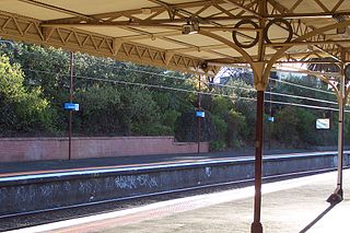
Windsor railway station is a commuter railway station on the Sandringham line, which is part of the Melbourne railway network. It serves the south-eastern suburb of Windsor, in Melbourne, Victoria, Australia. Windsor station is a ground level unstaffed station, featuring two side platforms. It opened on 19 December 1859.

<span class="mw-page-title-main">St Kilda Road</span> Road in Melbourne, Victoria, Australia

St Kilda Road is a street in Melbourne, Victoria, Australia. It is part of the locality of Melbourne which has the postcode of 3004, and along with Swanston Street forms a major spine of the city.

<span class="mw-page-title-main">Melbourne tram route 5</span> Tram route in metropolitan Melbourne, Victoria, Australia

Melbourne tram route 5 is operated by Yarra Trams on the Melbourne tram network from Melbourne University to Malvern. The 12.6-kilometre (7.8 mi) route is operated out of Malvern depot with Z and D1 class trams.

<span class="mw-page-title-main">St Kilda Junction</span> Road intersection in St Kilda, Australia

St Kilda Junction is a major intersection in Melbourne, Australia. It is in the suburb of St Kilda, bordering Windsor and St Kilda East, and is the meeting point of the major roads Punt Road, St Kilda Road, Dandenong Road/Queens Way/Princes Highway and Fitzroy Street.

<span class="mw-page-title-main">Chapel Street, Melbourne</span> Street in Melbourne, Australia

Chapel Street is a street in Melbourne, Victoria, running along the inner suburbs of South Yarra, Prahran, Windsor, St Kilda and St Kilda East.

<span class="mw-page-title-main">Balaclava, Victoria</span> Suburb of Melbourne, Victoria, Australia

Balaclava is an inner suburb in Melbourne, Victoria, Australia, 7 km south-east of Melbourne's Central Business District, located within the City of Port Phillip local government area. Balaclava recorded a population of 5,392 at the 2021 census.

The St Kilda-Windsor railway line was a short-lived section of railway that linked the isolated Windsor to Brighton section of the Melbourne railway network to the city. The branch line fell into disuse when an alternative route was built between Windsor and Richmond stations.
<span class="mw-page-title-main">Glenferrie Road</span> Road in Melbourne, Australia

Glenferrie Road is a major north–south thoroughfare in Melbourne, Australia. It runs from Kew to Caulfield North, and includes major shopping districts at both Hawthorn and Malvern. There are a number of rail transport options on Glenferrie Road and also some landmarks.
<span class="mw-page-title-main">Prahran and Malvern Tramways Trust</span>

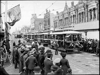
The Prahran and Malvern Tramways Trust (PMTT) was a former tram operator in Melbourne, Australia. The trust was formed in 1907, with its first line operating in 1910. Its functions were taken over by the Melbourne & Metropolitan Tramways Board in 1920.

The Melbourne tram network began in 1884 with the construction of the Fairfield Horse Tramway. However, the purpose of the line was to increase land prices in the area, and it soon closed during the depression in 1890. The first genuine attempt to construct a tramway network was the construction of the Richmond cable tram line by the Melbourne Tramway & Omnibus Company in 1885. Over the next few years, 16 more cable tram lines were constructed, as well as numerous other horse tramways. The depression of the early 1890s slowed further expansion of the cable network. The first electric tram line was the Box Hill and Doncaster tramway which opened in 1889. This was a pioneering line in what was then the countryside and thus didn't receive much patronage. It closed in 1896. The next attempt at an electric tramway was Victorian Railways' St Kilda to Brighton line, which opened in 1906. Later that year, the North Melbourne Electric Tramway & Lighting Company opened lines to Essendon and Maribyrnong. Many local councils formed their own tramway trusts and built tramways within their own constituency. The most successful of these was the Prahran & Malvern Tramways Trust.

References

  1. 1 2 Australian Bureau of Statistics (28 June 2022). "Windsor (Vic.) (Suburbs and Localities)". 2021 Census QuickStats. Retrieved 17 July 2022. OOjs UI icon edit-ltr-progressive.svg
  2. "Windsor (Registered)". VICNAMES. Department of Environment, Land, Water and Planning. Retrieved 27 April 2019.
  3. PhoenixAuctions History, Post Office List , retrieved 1 April 2021
  4. Slough Museum: Aspro History