Withamsville, Ohio

Last updated
Withamsville, Ohio
WithamsvilleOH2.JPG
Looking east on Ohio State Route 125
OHMap-doton-Withamsville.png
Location of Withamsville, Ohio
Coordinates: 39°03′46″N84°16′51″W / 39.06278°N 84.28083°W / 39.06278; -84.28083
Country United States
State Ohio
County Clermont
Townships Pierce, Union
Area
[1]
  Total3.13 sq mi (8.10 km2)
  Land3.13 sq mi (8.10 km2)
  Water0.00 sq mi (0.00 km2)
Elevation
[2]
919 ft (280 m)
Population
 (2020)
  Total7,357
  Density2,351.98/sq mi (908.14/km2)
Time zone UTC-5 (Eastern (EST))
  Summer (DST) UTC-4 (EDT)
ZIP code
45245
Area code 513
FIPS code 39-86254 [3]
GNIS feature ID2393863 [2]

Withamsville is a census-designated place (CDP) in Pierce and Union townships of Clermont County, Ohio, United States. The population was 7,357 at the 2020 census.

Contents

History

A post office called Withamsville was established in 1828, and remained in operation until 1923. [4] The community was named for Rev. Maurice Witham, a pioneer who settled there around 1800. [5]

Geography

Withamsville is located in western Clermont County along the southern border of Union Township. The southeast corner of the CDP crosses into Pierce Township to the south. Ohio State Route 125 runs through the center of the community, leading southeast 12 miles (19 km) to Bethel and northwest (via U.S. Route 50) 16 miles (26 km) to downtown Cincinnati. Interstate 275 forms the northwest border of Withamsville, with access from Exit 65 where it crosses Route 125.

According to the United States Census Bureau, the CDP has a total area of 3.1 square miles (8.1 km2), all land. [6]

Demographics

Historical population
CensusPop.Note
2020 7,357
U.S. Decennial Census [7]

As of the census [3] of 2000, there were 3,145 people, 1,305 households, and 848 families residing in the CDP. The population density was 1,796.9 inhabitants per square mile (693.8/km2). There were 1,350 housing units at an average density of 771.3 per square mile (297.8/km2). The racial makeup of the CDP was 97.42% White, 0.76% African American, 0.10% Native American, 0.79% Asian, 0.03% Pacific Islander, 0.45% from other races, and 0.45% from two or more races. Hispanic or Latino of any race were 0.76% of the population.

There were 1,305 households, out of which 31.0% had children under the age of 18 living with them, 52.7% were married couples living together, 8.5% had a female householder with no husband present, and 35.0% were non-families. 29.4% of all households were made up of individuals, and 7.5% had someone living alone who was 65 years of age or older. The average household size was 2.41 and the average family size was 3.01.

In the CDP the population was spread out, with 24.5% under the age of 18, 9.6% from 18 to 24, 33.3% from 25 to 44, 21.9% from 45 to 64, and 10.7% who were 65 years of age or older. The median age was 35 years. For every 100 females there were 97.8 males. For every 100 females age 18 and over, there were 94.3 males.

The median income for a household in the CDP was $45,802, and the median income for a family was $57,153. Males had a median income of $39,223 versus $26,767 for females. The per capita income for the CDP was $22,352. About 4.2% of families and 7.8% of the population were below the poverty line, including 3.9% of those under age 18 and 4.7% of those age 65 or over.

Related Research Articles

<span class="mw-page-title-main">Olde West Chester, Ohio</span> Census-designated place in Ohio, United States

Olde West Chester is a census-designated place (CDP) in West Chester Township, Butler County, Ohio, United States. The population was 201 at the 2020 census.

<span class="mw-page-title-main">Ross, Ohio</span> Census-designated place in Ohio, United States

Ross is a census-designated place (CDP) in Ross Township, Butler County, Ohio, United States. The population was 3,478 at the 2020 census. Ross sits along U.S. Route 27 between Cincinnati, Ohio and Oxford, Ohio. Ross is part of the Cincinnati metropolitan area.

<span class="mw-page-title-main">Northridge, Clark County, Ohio</span> Census-designated place in Ohio, United States

Northridge is a census-designated place (CDP) in Clark County, Ohio, United States. The population was 7,518 at the 2020 census. It is part of the Springfield, Ohio Metropolitan Statistical Area.

<span class="mw-page-title-main">Park Layne, Ohio</span> Census-designated place in Ohio, United States

Park Layne is a census-designated place (CDP) in Bethel Township, Clark County, Ohio, United States. The population of the CDP was 4,248 at the 2020 census. It is part of the Springfield, Ohio Metropolitan Statistical Area. Park Layne became a CDP in the 1980 United States Census.

<span class="mw-page-title-main">Batavia, Ohio</span> Village in Clermont County, Ohio, United States

Batavia is a village in and the county seat of Clermont County, Ohio, United States. The population was 1,972 at the 2020 census. It is part of the Cincinnati metropolitan area.

<span class="mw-page-title-main">Day Heights, Ohio</span> Census-designated place in Ohio, United States

Day Heights is a census-designated place (CDP) in Clermont County, Ohio, United States. The population was 2,625 at the 2020 census.
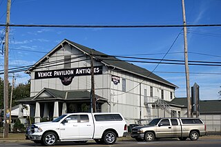
<span class="mw-page-title-main">Mount Carmel, Ohio</span> Census-designated place in Ohio, United States

Mount Carmel is a census-designated place (CDP) in Clermont County, Ohio, United States. The population was 4,828 at the 2020 census.

<span class="mw-page-title-main">Mount Repose, Ohio</span> Census-designated place in Ohio, United States

Mount Repose is a census-designated place (CDP) in Miami Township, Clermont County, Ohio, United States. The population was 4,648 at the 2020 census.

<span class="mw-page-title-main">Mulberry, Ohio</span> Census-designated place in Ohio, United States

Mulberry is a census-designated place (CDP) in Miami Township, Clermont County, Ohio, United States. The population was 3,459 at the 2020 census.

<span class="mw-page-title-main">Summerside, Ohio</span> Census-designated place in Ohio, United States

Summerside is a census-designated place (CDP) in Union Township, Clermont County, Ohio, United States. Its population was 4,941 as of the 2020 census.

Blacklick Estates is a census-designated place (CDP) in Franklin County, Ohio, United States: partly in Madison Township and partly in Truro Township. As of the 2020 census the population was 8,990.

<span class="mw-page-title-main">Chesterland, Ohio</span> Census-designated place in Ohio, United States

Chesterland is a census-designated place (CDP) in Geauga County, Ohio, United States. As of the 2020 census, the CDP had a population of 7,074.

<span class="mw-page-title-main">Grandview, Hamilton County, Ohio</span> Census-designated place in Ohio, United States

Grandview is a census-designated place (CDP) in Hamilton County, Ohio, United States. The population was 1,312 at the 2020 census.

<span class="mw-page-title-main">Beechwood Trails, Ohio</span> Census-designated place in Ohio, United States

Beechwood Trails is a census-designated place (CDP) in Harrison Township, Licking County, Ohio, United States. The population was 3,276 at the 2020 census.

<span class="mw-page-title-main">Granville South, Ohio</span> Census-designated place in Ohio, United States

Granville South is a census-designated place (CDP) in Licking County, Ohio, United States. The population was 1,420 at the 2020 census.

<span class="mw-page-title-main">Harbor Hills, Ohio</span> Census-designated place in Ohio, United States

Harbor Hills is a census-designated place (CDP) in southern Licking County, Ohio, United States. The population was 1,565 at the 2020 census.

<span class="mw-page-title-main">Vinco, Pennsylvania</span> Census-designated place in Pennsylvania, United States

Vinco is an unincorporated community and census-designated place (CDP) in Jackson Township, Cambria County, in the U.S. state of Pennsylvania. The population was 1,305 at the 2010 census.

<span class="mw-page-title-main">Conneaut Lakeshore, Pennsylvania</span> Census-designated place in Pennsylvania, United States

Conneaut Lakeshore is a census-designated place (CDP) in Crawford County, Pennsylvania, United States. The population was 2,395 at the 2010 census.

<span class="mw-page-title-main">Oakwood, Pennsylvania</span> Census-designated place in Pennsylvania, United States

Oakwood is an unincorporated area and census-designated place (CDP) in Lawrence County, Pennsylvania, United States. The population was 2,270 at the 2010 census.

<span class="mw-page-title-main">Loveland Park, Ohio</span> Census-designated place in Ohio, United States

Loveland Park is a census-designated place (CDP) located in Symmes Township, Hamilton County and Deerfield Township, Warren County, in the southwestern part of the U.S. state of Ohio. The CDP is named after the city of Loveland. The population was 1,737 at the 2020 census.

References

  1. "ArcGIS REST Services Directory". United States Census Bureau. Retrieved September 20, 2022.
  2. 1 2 U.S. Geological Survey Geographic Names Information System: Withamsville, Ohio
  3. 1 2 "U.S. Census website". United States Census Bureau . Retrieved 2008-01-31.
  4. "Clermont County". Jim Forte Postal History. Retrieved 16 January 2016.
  5. Everts, Louis H. (1880). History of Clermont County, Ohio, with Illustrations and Biographical Sketches of Its Prominent Men and Pioneers. Philadelphia: J.B. Lippincott & Co. p. 443.
  6. "Geographic Identifiers: 2010 Demographic Profile Data (G001): Withamsville CDP, Ohio". U.S. Census Bureau, American Factfinder. Archived from the original on January 21, 2015. Retrieved January 21, 2015.
  7. "Census of Population and Housing". Census.gov. Retrieved June 4, 2016.