Woman's Club of New Smyrna

Last updated
Woman's Club of New Smyrna
New Smyrna Woman's Club01.jpg
Volusia County Florida No Highlights.svg
Red pog.svg
Location New Smyrna Beach, Florida
Coordinates 29°1′20″N80°55′16″W / 29.02222°N 80.92111°W / 29.02222; -80.92111
Built1924, 1934
NRHP reference No. 89000410 [1]
Added to NRHPMay 11, 1989

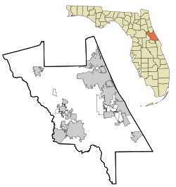
The Woman's Club of New Smyrna is a historic woman's club in New Smyrna Beach, Florida, United States. It is located at 403 Magnolia Street. On May 11, 1989, it was added to the U.S. National Register of Historic Places. It is currently For Sale.
Contents

See also

List of Registered Historic Woman's Clubhouses in Florida

Related Research Articles

<span class="mw-page-title-main">Volusia County, Florida</span> County in Florida, United States

Volusia County is a county located in the east-central part of the U.S. state of Florida between the St. Johns River and the Atlantic Ocean. As of the 2020 census, the county was home to 553,543 people, an increase of 11.9% from the 2010 census. It was founded on December 29, 1854, from part of Orange County, and was named for the community of Volusia, located in northwestern Volusia County. Its first county seat was Enterprise. Since 1887, its county seat has been DeLand.

<span class="mw-page-title-main">New Smyrna Beach, Florida</span> City in Florida, United States

New Smyrna Beach is a city in Volusia County, Florida, United States, located on the central east coast of the state, with the Atlantic Ocean to the east. The downtown section of the city is located on the west side of the Indian River and the Indian River Lagoon system. The Coronado Beach Bridge crosses the Intracoastal Waterway just south of Ponce de Leon Inlet, connecting the mainland with the beach on the coastal barrier island. The population was 30,142 at the 2020 census, and according to 2023 census estimates, the city is estimated to have a population of 32,655.

<span class="mw-page-title-main">Canaveral National Seashore</span> National Seashore in Florida, U.S.

The Canaveral National Seashore (CANA) is a National Seashore located between New Smyrna Beach and Titusville, Florida, in Volusia and Brevard Counties. The park, located on a barrier island, was created on January 3, 1975, by an act of Congress. The park is split between Brevard and Volusia counties, with 9 miles of the seashore in Brevard County, and 15 miles of the seashore in Volusia County. CANA consists of 24 miles of beaches, dunes, mangrove wetlands, and a large portion of the Mosquito Lagoon. The Canaveral National Seashore is also the longest expanse of undeveloped land along the East Coast of Florida. The Canaveral National Seashore is home to more than 1,000 plant species and 310 bird species. CANA occupies 57,662 acres (23,335 ha). There are 3 major beach sections in the seashore. The southern section is Playalinda Beach, the middle section is Klondike Beach, and the northern section is Apollo Beach.

<span class="mw-page-title-main">Tomoka State Park</span> State park in Florida, United States

Tomoka State Park is an 2,000-acre (8.1 km2) Florida State Park located along the Tomoka River, three miles (5 km) north of Ormond Beach on North Beach Street.

<span class="mw-page-title-main">Mosquito County, Florida</span> Former county in Florida, United States

Mosquito County is the historic name of an early county that once comprised most of the eastern part of Florida. Its land included all of present-day Volusia, Brevard, Indian River, St. Lucie, Marion, Martin, Seminole, Osceola, Orange, Lake, Polk and Palm Beach counties.

<span class="mw-page-title-main">Strawn Historic Citrus Packing House District</span> Historic district in Florida, United States

The Strawn Historic Citrus Packing House District is a U.S. historic district located at 5707 Lake Winona Road in DeLeon Springs, Florida in Volusia County. It contains 12 historic buildings and 3 structures. The packing house is in a state of abandoned decay and has not been operation since 1983.

<span class="mw-page-title-main">Deltona–Daytona Beach–Ormond Beach, Florida Metropolitan Statistical Area</span> Metropolitan statistical area in Florida, United States

The Deltona–Daytona Beach–Ormond Beach, Florida Metropolitan Statistical Area is a metropolitan statistical area (MSA) in central and the north portions of Florida consisting of Volusia and Flagler counties in the state of Florida. As of 2023, it is the 83rd-largest MSA in the United States, with a census-estimated population of 721,796.

<span class="mw-page-title-main">Coronado Historic District</span> Historic district in Florida, United States

The Coronado Historic District is a U.S. historic district located in New Smyrna Beach, Florida. The district is bounded by Columbus, Due East, and Pine Avenues, and the Indian River. It contains 83 historic buildings.

<span class="mw-page-title-main">New Smyrna Beach Historic District</span> Historic district in Florida, United States

The New Smyrna Beach Historic District is a U.S. historic district located in New Smyrna Beach, Florida. The district is bounded by Riverside Drive, U.S. 1, Ronnoc Lane, and Smith Street. It contains 312 historic buildings.

<span class="mw-page-title-main">Turtle Mound</span> Prehistoric archaeological site in New Smyrna Beach, Florida, US

Turtle Mound is a prehistoric archaeological site located 9 miles (14 km) south of New Smyrna Beach, Florida, on State Road A1A. On September 29, 1970, it was added to the U.S. National Register of Historic Places. It is the largest shell midden on the mainland United States, with an approximate height of 50 feet (15 m). The mound extends for over 600 feet (180 m) along the Indian River shoreline and contains over 35,000 cubic yards (27,000 m3) of shells. Turtle Mound was estimated to be 75 feet (23 m) high before it was reduced by shellrock mining in the 19th and 20th centuries. Because it is visible seven miles out at sea, early Spanish explorers and subsequent mariners used the large mound as a landmark for coastal navigation. Today, the site is owned and managed by the National Park Service as part of Canaveral National Seashore.

<span class="mw-page-title-main">New Smyrna Sugar Mill Ruins</span> Historic site in New Smyrna Beach, Florida, U.S.

The New Smyrna Sugar Mill Ruins is a historic site in New Smyrna Beach, Florida, at 600 Old Mission Road, one mile west of the Intracoastal Waterway. On August 12, 1970, it was added to the U.S. National Register of Historic Places.

The Ross Hammock Site is a historic site nine miles south of New Smyrna Beach, Florida. It is located inland from the Intracoastal Waterway on A1A within the Canaveral National Seashore. On February 5, 1981, it was added to the U.S. National Register of Historic Places.

<span class="mw-page-title-main">United States Post Office (Daytona Beach, Florida)</span> United States historic place

The U.S. Post Office at 220 North Beach Street in Daytona Beach, Florida, United States is a historic building. On June 30, 1988, it was added to the U.S. National Register of Historic Places.

<span class="mw-page-title-main">Anderson–Price Memorial Library Building</span> United States historic place

The Anderson–Price Memorial Library Building is a historic library in Ormond Beach, Florida, United States. It is located at 42 North Beach Street, and was named for the City of Ormond Beach's co-founders John Anderson and Joseph D. Price. It was added to the National Register of Historic Places in 1984.

<span class="mw-page-title-main">El Real Retiro</span> Historic house in Florida, United States

The El Real Retiro is a Spanish Colonial Revival house in New Smyrna Beach, Florida, United States. Built in 1923 it is located at 636 North Riverside Drive and 647 Faulkner Street. On November 10, 1987, it was added to the U.S. National Register of Historic Places.

<span class="mw-page-title-main">Moulton–Wells House</span> Historic house in Florida, United States

The Moulton–Wells House is a historic house in New Smyrna Beach, Florida. It is located west of Eldora Road, and is part of the Canaveral National Seashore. On November 21, 2001, it was added to the U.S. National Register of Historic Places.

<span class="mw-page-title-main">Daytona Beach Bandshell</span> United States historic place

The Daytona Beach Bandshell is an amphitheatre in Daytona Beach, Florida, United States. It is located at Ocean Avenue, north of the junction of Main Street and Atlantic Avenue. On March 5, 1999, it was added to the U.S. National Register of Historic Places. On April 18, 2012, the AIA's Florida Chapter placed the Daytona Beach Bandshell on its list of Florida Architecture: 100 Years. 100 Places.

The following buildings were added to the National Register of Historic Places as part of the Daytona Beach Multiple Property Submission.

<span class="mw-page-title-main">National Register of Historic Places listings in Volusia County, Florida</span>

This is a list of the National Register of Historic Places listings in Volusia County, Florida.

<span class="mw-page-title-main">Eldora, Florida</span>

Eldora is an uninhabited place in Volusia County, Florida, United States. It is located within Canaveral National Seashore, south of Bethune Beach and west of County Road A1A. The average elevation is 3 feet above sea level.

References

  1. "National Register Information System". National Register of Historic Places . National Park Service. July 9, 2010.

Commons-logo.svg Media related to Woman's Club of New Smyrna at Wikimedia Commons