New Smyrna Beach, Florida

Last updated

New Smyrna Beach, Florida
City of New Smyrna Beach
NewSmyrnaBeachFromLighthouse3.jpg
New Smyrna Beach from observation deck on top of Ponce de León Inlet Light
Nickname: 
"Florida's Secret Pearl"
Motto: 
Cygnus Inter Anates (Swan among Ducks) [1]
Volusia County Florida Incorporated and Unincorporated areas New Smyrna Beach Highlighted.svg
Location in Volusia County and the state of Florida
Usa edcp location map.svg
Red pog.svg
New Smyrna Beach
Location in the USA
USA Florida location map.svg
Red pog.svg
New Smyrna Beach
Location in Florida
Coordinates: 29°1′50″N80°55′31″W / 29.03056°N 80.92528°W / 29.03056; -80.92528
CountryFlag of the United States.svg United States
State Flag of Florida.svg  Florida
County Volusia
Settled 1768
Incorporated (town) 1887
Incorporated (city) 1947
Government
  Type Commission–Manager
   Mayor Fred Cleveland
   City Manager Khalid Resheidat
Area
[2]
   City 41.29 sq mi (106.93 km2)
  Land37.79 sq mi (97.88 km2)
  Water3.49 sq mi (9.05 km2)
Elevation
[3]
7 ft (2 m)
Population
 (2020)
   City 30,142
  Density797.58/sq mi (307.95/km2)
   Urban
349,064
   Metro
590,289
Time zone UTC−5 (Eastern (EST))
  Summer (DST) UTC−4 (EDT)
ZIP codes
32168, 32169, 32170
Area code 386
FIPS code 12-48625 [4]
GNIS feature ID0287692 [3]
Website www.cityofnsb.com

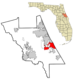
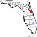
New Smyrna Beach is a city in Volusia County, Florida, United States, located on the central east coast of the state, with the Atlantic Ocean to the east. The downtown section of the city is located on the west side of the Indian River and the Indian River Lagoon system. The Coronado Beach Bridge crosses the Intracoastal Waterway just south of Ponce de Leon Inlet, connecting the mainland with the beach on the coastal barrier island. Its population is 30,142 in 2020 by the United States Census Bureau.

Contents

The surrounding area offers many opportunities for outdoor recreation; these include fishing, sailing, motorboating, golfing, and hiking. Visitors participate in water sports of all kinds, including swimming, scuba diving, kitesurfing, and surfing. In July 2009, New Smyrna Beach was ranked number nine on the list of "best surf towns" in Surfer. [5] It was recognized as "one of the world's top 20 surf towns" by National Geographic [6] in 2012. It has also been dubbed "The Shark Bite Capital of the World." [7]

History

Dr. Andrew Turnbull ANDREW TURNBULL.jpg
Dr. Andrew Turnbull

The area was first settled by Europeans in 1768, when Scottish physician Dr. Andrew Turnbull, a friend of James Grant, the governor of British East Florida, established the colony of New Smyrna. Dr. Turnbull had married Gracia Dura Bin (some sources give her name as Maria Gracia Rubini), [8] the daughter of a Greek London merchant from the Ottoman city of Smyrna (modern-day İzmir in Turkey) and named the settlement in honor of his wife's birthplace, [9] and the homeland of some of those in his future labor force who were Greek from the Mani peninsula. [10] [11] No one had previously attempted to settle so many people at one time in a town in North America. [12]

Turnbull recruited about 1,300 settlers, intending for them to grow hemp, sugarcane, and indigo, as well as to produce rum, at his plantation on the northeastern Atlantic coast of Florida. The majority of the colonists came from Menorca (historically called "Minorca" in English), one of the Mediterranean Balearic Islands of Spain, [13] and were of Catalan culture and language. [14] Around 500 or so came from the Mani peninsula of Greece.

Although the colony produced relatively large amounts of processed indigo in its first few years of operation, [15] it eventually collapsed after suffering major losses due to insect-borne diseases and Indian raids, and growing tensions caused by mistreatment of the colonists on the part of Turnbull and his overseers. [16] The survivors, about 600 in number, marched nearly 70 miles north on the King's Road and relocated to St. Augustine, [17] where their descendants live to this day. [18] In 1783, East and West Florida were returned to the Spanish, and Turnbull abandoned his colony to retire in Charleston, South Carolina. [19] [20] [21]

The St. Photios Greek Orthodox National Shrine on St. George Street in St. Augustine honors the Greeks among the settlers of New Smyrna; they were the first Greek Orthodox followers in North America. The historical exhibit adjoining the chapel tells the story of their plight, with accompanying exhibits, and of their contributions to the city. [22] [23]

Central Florida remained sparsely populated by white settlers well into the 19th century, and it was frequently raided by Seminole Indians trying to protect their territory. United States troops fought against them in the Seminole Wars, but they were never completely dislodged.

During the Civil War, on March 23, 1862, portions of the 3rd Florida Infantry Regiment defeated a small U.S. naval force that was attempting to land near New Smyrna. [24] Later on, in 1863, the "Stone Wharf" was shelled by Union gunboats. [25]

In 1887, when New Smyrna was incorporated, it had a population of 150. In 1892, Henry Flagler provided service to the town via his Florida East Coast Railway. This led to a rapid increase in the area's population. Its economy grew as tourism was added to its citrus and commercial fishing industries.

During Prohibition in the 1920s, the city and its river islands were popular sites for moonshine stills and hideouts for rum runners, who came from the Bahamas through Mosquito Inlet, now Ponce de León Inlet. "New Smyrna" became "New Smyrna Beach" in 1947, when the city annexed the seaside community of Coronado Beach. Today, it is a resort town of over 20,000 permanent residents.

Like St. Augustine, established by the Spanish, New Smyrna has been under the rule of four "flags": the British, Spanish, United States (from 1821, with ratification of the Adams–Onís Treaty), and the Confederate Jack. After the end of the Civil War in 1865, it returned with Florida to the United States.

Geography

New Smyrna Beach's motto is cygnus inter anates, which is Latin for "a swan among ducks." [26] The city is located in the so-called "Fun Coast" region of the state of Florida, a regional term created by the Daytona Beach/Halifax area Chamber of Commerce. This coincides with the local area code, 386, which spells FUN on touchtone phones. According to the United States Census Bureau, it has a total area of 37.8 square miles (98.0 km2); 34.6 square miles (89.7 km2) of it are land, and 0.31 square miles (0.8 km2) of it (8.46%) is covered by water. [27] It is bordered by the city of Port Orange to the northwest, unincorporated Volusia County to the north, the census-designated place of Samsula-Spruce Creek to the west, and the cities of Edgewater and Bethune Beach and the Canaveral National Seashore to the south. Bounded on the east by the Atlantic Ocean, New Smyrna Beach is on the Indian River. The city is connected to other parts of the state by Interstate 95, U.S. Route 1, and State Road 44.

Climate

New Smyrna Beach New smyrna beach.jpg
New Smyrna Beach

Like the rest of Florida north of Lake Okeechobee, New Smyrna Beach has a humid subtropical (Köppen Cfa) climate characterized by hot, humid summers and warm, mostly dry winters. The rainy season lasts from May until October, and the dry season, from November to April. New Smyrna averages only about two freezes per year, and many species of subtropical plants and palms are grown in the area. The city has recorded snowfall only three times in its 250-year history. The summers are long and hot, with frequent severe thunderstorms in the afternoon, as central Florida is the lightning capital of North America. [28] Winters are pleasant with frequent sunny skies and dry weather. [29]

Weather hazards include hurricanes from June until November, though direct hits are rare.[ citation needed ] Hurricane Charley exited over New Smyrna Beach on August 13, 2004, after crossing the state in a northeastern direction from its initial landfall in Punta Gorda. The storm caused extensive damage to the beachside portion of the city and toppled many historic oak trees in the downtown area and along historic Flagler Avenue.[ citation needed ]

Climate data for New Smyrna Beach, Florida (Marine Discovery Center), 1991–2020 normals, extremes 2001–present
MonthJanFebMarAprMayJunJulAugSepOctNovDecYear
Record high °F (°C)85
(29)
88
(31)
93
(34)
92
(33)
98
(37)
101
(38)
98
(37)
99
(37)
98
(37)
92
(33)
91
(33)
87
(31)
101
(38)
Mean maximum °F (°C)81.8
(27.7)
83.3
(28.5)
86.4
(30.2)
89.3
(31.8)
91.8
(33.2)
94.0
(34.4)
94.8
(34.9)
95.3
(35.2)
93.4
(34.1)
89.6
(32.0)
84.4
(29.1)
83.1
(28.4)
96.5
(35.8)
Average high °F (°C)68.1
(20.1)
70.1
(21.2)
73.4
(23.0)
79.3
(26.3)
83.2
(28.4)
86.8
(30.4)
88.4
(31.3)
88.5
(31.4)
86.2
(30.1)
82.1
(27.8)
75.9
(24.4)
71.4
(21.9)
79.5
(26.4)
Daily mean °F (°C)60.0
(15.6)
61.4
(16.3)
65.0
(18.3)
71.0
(21.7)
75.8
(24.3)
79.8
(26.6)
81.6
(27.6)
81.6
(27.6)
80.3
(26.8)
75.2
(24.0)
69.1
(20.6)
62.8
(17.1)
72.0
(22.2)
Average low °F (°C)51.9
(11.1)
52.6
(11.4)
56.6
(13.7)
62.7
(17.1)
68.4
(20.2)
72.8
(22.7)
74.7
(23.7)
74.7
(23.7)
74.3
(23.5)
68.2
(20.1)
62.3
(16.8)
54.2
(12.3)
64.4
(18.0)
Mean minimum °F (°C)34.3
(1.3)
37.6
(3.1)
42.0
(5.6)
51.4
(10.8)
59.1
(15.1)
67.9
(19.9)
70.1
(21.2)
71.0
(21.7)
68.2
(20.1)
54.6
(12.6)
45.2
(7.3)
38.6
(3.7)
32.3
(0.2)
Record low °F (°C)27
(−3)
30
(−1)
38
(3)
43
(6)
50
(10)
62
(17)
67
(19)
60
(16)
62
(17)
44
(7)
30
(−1)
23
(−5)
23
(−5)
Average precipitation inches (mm)2.76
(70)
2.47
(63)
3.00
(76)
2.62
(67)
3.72
(94)
7.45
(189)
6.06
(154)
6.47
(164)
6.88
(175)
4.49
(114)
2.32
(59)
2.32
(59)
50.56
(1,284)
Average precipitation days (≥ 0.01 in)7.06.86.75.56.411.511.911.310.59.07.57.6101.5
Source: NOAA (mean maxima/minima 20062020) [30] [31]

Demographics

Historical population
CensusPop.Note
1880 119
1890 287141.2%
1900 54389.2%
1910 1,121106.4%
1920 2,00779.0%
1930 4,149106.7%
1940 4,4026.1%
1950 5,77531.2%
1960 8,78152.1%
1970 10,58020.5%
1980 13,55728.1%
1990 16,54322.0%
2000 20,04821.2%
2010 22,46412.1%
2020 30,14234.2%
U.S. Decennial Census [32]
New Smyrna Beach racial composition
(Hispanics excluded from racial categories)
(NH = Non-Hispanic)
RacePop 2010 [33] Pop 2020 [34] % 2010% 2020
White (NH)19,95125,90088.81%85.93%
Black or African American (NH)1,3071,1765.82%3.90%
Native American or Alaska Native (NH)57550.25%0.18%
Asian (NH)2443681.09%1.22%
Pacific Islander or Native Hawaiian (NH)1140.01%0.05%
Some other race (NH)91010.04%0.34%
Two or more races/Multiracial (NH)2631,0521.17%3.49%
Hispanic or Latino (any race)6321,4762.81%4.90%
Total22,46430,142

As of the 2020 United States census, there were 30,142 people, 13,223 households, and 7,653 families residing in the city. [35]

As of 2013, the population continues to increase with new condominium development. [36]

As of the 2010 United States census, there were 22,464 people, 10,754 households, and 6,422 families residing in the city. [37]

As of the census of 2010, the population density was 724.1 inhabitants per square mile (279.6/km2). The 16,647 housing units averaged 491.9 per square mile (189.9/km2).

Of the 11,074 households in 2010, 14.8% had children under the age of 18 living with them, 44.1% were married couples living together, 9.4% had a female householder with no husband present, and 42.9% were not families. About 35.3% of all households were made up of individuals, and 18.2% had someone living alone who was 65 years of age or older. The average household size was 2.01 and the average family size was 2.54.

In 2010, in the city, the population was distributed as 13.9% under the age of 18, 3.6% from 20 to 24, 17.9% from 25 to 44, 31.3% from 45 to 64, and 31.6% who were 65 years of age or older. The median age was 54.3 years. Females were 52.1% of the population, and males were 47.9%.

In 2010, the median income for a household in the city was $49,625, and for a family was $62,267. Males had a median income of $38,132 versus $32,087 for females. The per capita income for the city was $31,013. About 10.9% of families and 13.0% of the population were below the poverty line, including 21.9% of those under age 18 and 8.3% of those aged 65 or over.

Education

Oceanside view of New Smyrna Beach New Smyrna Beach FL peninsula01.jpg
Oceanside view of New Smyrna Beach

All public education is run by Volusia County Schools.

Elementary schools

Middle school

High school

Charter school

Private School

Higher education

Culture

Atlantic Center for the Arts: Pabst Visitor Center and Gallery FL ACftA VC01.jpg
Atlantic Center for the Arts: Pabst Visitor Center and Gallery

Named one of "America's Top Small Cities for the Arts", [38] New Smyrna Beach is home to the Atlantic Center for the Arts, an artists-in-residence community and educational facility, the Harris House, the Little Theatre, and a gallery of fine arts, Arts on Douglas. Arts shows featuring visual and performing arts occur throughout the year.

The New Smyrna Speedway is a half-mile paved racetrack opened in 1967 that currently hosts the ARCA Menards Series East, NASCAR Whelen Modified Tour, Southern Super Series and World Series of Asphalt Stock Car Racing.

Shark attacks

According to the International Shark Attack File maintained by the University of Florida, in 2007, Volusia County had more confirmed shark bites than any other region in the world. [39] Experts from the university have referred to the county as having the "dubious distinction as the world's shark-bite capital". [40] The trend continued in 2008, when the town broke its own record, with 24 shark bites. [41] An Orlando Sentinel photographer shot a picture of a four-foot spinner shark jumping over a surfer, a reversal of "jumping the shark". [42] [43] Sharks bit three different surfers on September 18, 2016, in the span of a few hours at the same beach. [44] Very few of the shark bites are fatal. [45]

Government

Elected city government officials include:

Notable people

Athletes

Related Research Articles

<span class="mw-page-title-main">St. Johns County, Florida</span> County in Florida, United States

St. Johns County is a county in the northeastern part of the U.S. state of Florida. As of the 2020 United States Census, its population was 273,425. The county seat and largest incorporated city is St. Augustine, although the largest community, St. Johns, is much larger. St. Johns County is part of the Jacksonville metropolitan area.

<span class="mw-page-title-main">Volusia County, Florida</span> County in Florida, United States

Volusia County is located in the east-central part of the U.S. state of Florida between the St. Johns River and the Atlantic Ocean. As of the 2020 census, the county was home to 553,543 people, an increase of 11.9% from the 2010 census. It was founded on December 29, 1854, from part of Orange County, and was named for the community of Volusia, located in northwestern Volusia County. Its first county seat was Enterprise. Since 1887, its county seat has been DeLand.

<span class="mw-page-title-main">Daytona Beach, Florida</span> City in Florida, United States

Daytona Beach, or simply Daytona, is a coastal resort city in the U.S. state of Florida. Located on the eastern edge of Volusia County near the Atlantic coastline, its population was 72,647 at the 2020 census. Daytona Beach is approximately 42 miles (67.6 km) northeast of Orlando, 90 miles (144.8 km) southeast of Jacksonville, and 231 miles (371.8 km) northwest of Miami. It is part of the Deltona–Daytona Beach–Ormond Beach metropolitan area which has a population of about 600,000 and is also a principal city of the Fun Coast region of Florida.

<span class="mw-page-title-main">DeBary, Florida</span> City in Florida, United States

DeBary is a city in Volusia County, Florida, United States, on the eastern shore of the St. Johns River near Lake Monroe. According to the 2020 U.S. Census, the city had a population of 20,696. It is part of the Deltona–Daytona Beach–Ormond Beach, FL metropolitan statistical area, which was home to 553,284 people in 2019.

<span class="mw-page-title-main">DeLand, Florida</span> City in Florida, United States

DeLand is a city in and the county seat of Volusia County, Florida, United States. The city sits approximately 34 miles (55 km) north of the central business district of Orlando, and approximately 23 miles (37 km) west of the central business district of Daytona Beach. It is a part of the Deltona–Daytona Beach–Ormond Beach metropolitan area. As of the 2020 U.S. census, the population was 37,351.

<span class="mw-page-title-main">Port Orange, Florida</span> City in Florida, United States

Port Orange is a city in Volusia County, Florida. The city's population was estimated at 64,842 in 2019 by the U.S. Census Bureau.

<span class="mw-page-title-main">El Camino Real (Florida)</span>

El Camino Real is the name that the Spanish gave to a trail they cleared in the 1680s, mostly over the traditional trails of Native Americans, from St. Augustine westward to the Spanish missions in north Florida. Before this time, transpeninsular traffic in La Florida between the western mission settlements and the capital depended on water routes from Apalachee to St. Augustine. Agricultural commodities produced in Apalachee were carried by canoes to the Gulf of Mexico and southward on the coast to the mouth of the Suwanee River, then upriver to a location on the Santa Fe River. There they were loaded onto pack animals or the backs of Indian burderners (porters) for the remainder of the overland trip. Provisions and funds from the real situado were sent on the same route in reverse.

<span class="mw-page-title-main">Patrick Tonyn</span> British Army general

Patrick Tonyn (1725–1804) was a British General who served as the last British governor of East Florida, from 1774 to 1783. His governorship lasted the span of the American Revolution. East Florida was a Loyalist colony during the war.

Andrew Turnbull was a Scottish physician and diplomat who served as the British consul at Smyrna, Ottoman Empire. In 1768, he founded the colony of New Smyrna, Florida, named in honor of his wife's birthplace, the ancient Greek city of Smyrna on the Aegean coast of Anatolia. Turnbull was married to Gracia Dura Bin, the daughter of a Greek merchant from Smyrna. His colony was located in the province of British East Florida, and encompassed some 101,400 acres (410 km2); it was nearly three times the size of the colony at Jamestown.

<span class="mw-page-title-main">Joseph Marion Hernández</span> American planter, politician and military officer

Joseph Marion Hernández was an American slave-owner, politician and military officer. He was the first delegate from the Florida Territory and the first Hispanic American to serve in the United States Congress. A member of the Whig Party, he served from September 1822 to March 1823.

<span class="mw-page-title-main">Deltona–Daytona Beach–Ormond Beach, Florida Metropolitan Statistical Area</span> Metropolitan statistical area in Florida, United States

The Deltona–Daytona Beach–Ormond Beach, Florida Metropolitan Statistical Area is a metropolitan statistical area (MSA) in central and the north portions of Florida consisting of Volusia and Flagler counties in the state of Florida. As of 2013, it is the 88th-largest MSA in the United States, with a census-estimated population of 600,756.

<span class="mw-page-title-main">U.S. Route 1 in Florida</span> Highway in Florida

U.S. Highway 1 (US 1) in Florida runs 545 miles (877 km) along the state's east coast from Key West to its crossing of the St. Marys River into Georgia north of Boulogne and south of Folkston. US 1 was designated through Florida when the U.S. Numbered Highway System was established in 1926. With the exception of Monroe County, the highway runs through the easternmost tier of counties in the state, connecting numerous towns and cities along its route, including nine county seats. The road is maintained by the Florida Department of Transportation (FDOT).

<span class="mw-page-title-main">Datil pepper</span> Variety of chili pepper

The datil is a very hot pepper, a variety of the species Capsicum chinense.

Evan Geiselman has been a competing surfer since the age of seven. He has won 12 East Coast Championship titles. He is the younger brother of professional surfer Eric Geiselman. He has been trying to be part of the ASP World Championship Tour for three years now, but the Qualification Series are competitive. He didn't get the results he was hoping for on the 2014 WQS. At the beginning of 2014, he moved from San Clemente, California back home, to New Smyrna Beach, Florida.

The King's Road was a road built by the British in their colony of East Florida. It stretched from the St. Marys River, the border between East Florida and Georgia, to south of New Smyrna, and was mostly completed by 1773.

Antonia Paula de la Resurreccion Bonelly (1786-1870), was a colonial woman of Spanish East Florida who was captured by Miccosukee Indians in 1802 and held captive for twenty-two months. Her rescue and ransom involved many of the major power players that defined relations in this period between the Florida tribes and the nations of Britain, Spain, and the United States.

<span class="mw-page-title-main">Triay House</span> United States historic place

The Triay House is a historic property located at 31 St. George Street in St. Augustine, Florida. It is a reconstruction of the First Spanish Period structure that stood on the site.

<span class="mw-page-title-main">Pellicer-De Burgo House</span> United States historic place

The Pellicer-De Burgo House is located at 53 St. George Street in St. Augustine, Florida. It is a reconstruction of two connected houses built during the British Period (1763-1783) of East Florida.

The Minorcans of Florida are an ethnically diverse group of people that settled in St. Augustine, Florida in the late 18th century.

References

  1. "cygnus inter anates in English - Latin-English Dictionary | Glosbe". glosbe.com. Retrieved December 19, 2022.
  2. "2020 U.S. Gazetteer Files". United States Census Bureau. Retrieved October 31, 2021.
  3. 1 2 "US Board on Geographic Names". United States Geological Survey. October 25, 2007. Retrieved January 31, 2008.
  4. "Quickfacts". United States Census Bureau. Archived from the original on June 25, 2012. Retrieved December 14, 2014.
  5. Surfer (April 5, 2009). "Best Surf Towns: No. 9 New Smyrna, Florida". Surfer Magazine. GrindMedia. Archived from the original on March 28, 2013. Retrieved November 14, 2013. Smyrna Inlet is easily the most consistent break along Florida's 1,200+ miles of surfable coastline, and likely the most performance-friendly.
  6. National Geographic Magazine. "World's 20 Best Surf Towns". National Geographic Adventure Trips. National Geographic Society. Archived from the original on November 3, 2013. Retrieved November 14, 2013.
  7. Murphy, Paul P. (January 22, 2020). "Florida is the shark attack capital of the world, again". CNN. Retrieved June 4, 2020.
  8. Moskos, Charles C. (2018). Greek Americans: Struggle and Success. Routledge. ISBN   978-1-351-51672-3.
  9. Panagopoulos, E. P. (1956). "The Background of the Greek Settlers in the New Smyrna Colony". The Florida Historical Quarterly. 35 (2): 97. ISSN   0015-4113 . Retrieved August 13, 2021.
  10. Charles C. Moskos (January 1, 1989). Greek Americans: Struggle and Success. Transaction Publishers. p. 3. ISBN   978-1-4128-2483-5.
  11. George Kaloudis (February 20, 2018). Modern Greece and the Diaspora Greeks in the United States. Lexington Books. p. 26. ISBN   978-1-4985-6228-7.
  12. Kenneth Henry Beeson (2006). Fromajadas and Indigo: The Minorcan Colony in Florida. The History Press. p. 42. ISBN   978-1-59629-113-3.
  13. Jane G. Landers (2000). Colonial Plantations and Economy in Florida. University Press of Florida. pp. 41–42. ISBN   978-0-8130-1772-3.
  14. Kenneth Henry Beeson (2006). Fromajadas and Indigo: The Minorcan Colony in Florida. The History Press. p. 17. ISBN   978-1-59629-113-3.
  15. James W. Raab (November 5, 2007). Spain, Britain and the American Revolution in Florida, 1763–1783. McFarland. pp. 53–54. ISBN   978-0-7864-3213-4.
  16. Bernard Romans (1776). A concise natural history of East and West-Florida. Pelican Publishing. pp.  268–270.
  17. Federal Writers' Project (1939). Florida: A Guide to the Southern-Most State. US History Publishers. p. 543. ISBN   978-1-60354-009-4.
  18. Patricia C. Griffin (1991). Mullet on the Beach: The Minorcans of Florida, 1768–1788. St. Augustine Historical Society. p. 195. ISBN   978-0-8130-1074-8.
  19. Landers 2000, p. 62
  20. Roger Grange, "Saving Eighteenth-Century New Smyrna: Public Archaeology in Action." Present Pasts vol 3 #1 (2011). online
  21. ""Episode 08 European Earthenware" by Robert Cassanello and Chip Ford". stars.library.ucf.edu. Retrieved January 10, 2016.
  22. "The Saint Photios Greek Orthodox Chapel". St. Photios National Shrine. Archived from the original on December 2, 2013. Retrieved December 25, 2013.
  23. Peter C. Moskos; Charles C. Moskos (November 27, 2013). Greek Americans: Struggle and Success. Transaction Publishers. p. 16. ISBN   978-1-4128-5310-1.
  24. Coles, David J. (1988). Fretwell, Jacqueline K. (ed.). Civil War times in St. Augustine. Port Salerno, Fla.: Florida Classics Library. p. 78. ISBN   0912451238.
  25. Redd, Robert (2014). St. Augustine and the Civil War (e-book ed.). Charleston, SC: The History Press. p. 22. ISBN   9781625846570.
  26. "Classical Latin: CYGNUS INTER ANATES". Latin R. Latinr.com. English translations of common Latin phrases...
  27. "Geographic Identifiers: 2010 Demographic Profile Data (G001): New Smyrna Beach city, Florida". United States Census Bureau . Retrieved February 15, 2012.
  28. Morschauser, Lindsey. "Florida, The Lightning Capital of the U.S." Campus Connect. Mississippi State University Weather. Retrieved June 22, 2021.
  29. National Park Service. "Fire Management" (PDF). Canaveral National Seashore. U.S. Department of the Interior. Retrieved November 10, 2013.
  30. "NOWData - NOAA Online Weather Data". National Oceanic and Atmospheric Administration . Retrieved June 2, 2021.
  31. "Summary of Monthly Normals 1991-2020". National Oceanic and Atmospheric Administration . Retrieved June 2, 2021.
  32. "Census of Population and Housing". Census.gov. Retrieved June 4, 2015.
  33. "P2 HISPANIC OR LATINO, AND NOT HISPANIC OR LATINO BY RACE - 2010: DEC Redistricting Data (PL 94-171) - New Smyrna Beach city, Florida". United States Census Bureau .
  34. "P2 HISPANIC OR LATINO, AND NOT HISPANIC OR LATINO BY RACE - 2020: DEC Redistricting Data (PL 94-171) - New Smyrna Beach city, Florida". United States Census Bureau .
  35. "S1101 HOUSEHOLDS AND FAMILIES - 2020: New Smyrna Beach city, Florida". United States Census Bureau .
  36. Koslow, Bob (July 31, 2013). "Project gets new life: Planned condo development would be first in six years in Southeast Volusia". Daytona Beach News. GateHouse Media, LLC. Retrieved September 5, 2017.
  37. "S1101 HOUSEHOLDS AND FAMILIES - 2010: New Smyrna Beach city, Florida". United States Census Bureau .
  38. "Surfscape Contemporary Dance Theatre". New Smyrna Beach Observer. October 13, 2012. Archived from the original on March 14, 2016. Retrieved September 21, 2013.
  39. ISAF 2007 Worldwide Shark Attack Summary (2007). "Death Total Lowest in Two Decades". International Shark Attack File. Florida Museum of Natural History, University of Florida. Archived from the original on October 7, 2013. Retrieved November 10, 2013.
  40. Cathy Keen; George Burgess (February 12, 2008). "Human deaths from shark attacks hit 20-year low last year" (PDF). University of Florida News. University of Florida. Archived from the original (PDF) on January 14, 2009. Retrieved November 10, 2013. Within Florida, Volusia County continued its dubious distinction as the world's shark bite capital with 17 incidents, its highest yearly total since 2002, Burgess said.
  41. Ludmilla Lelis (February 20, 2009). "Volusia again claims shark-bite record". Orlando Sentinel. Archived from the original on March 1, 2010. Retrieved November 10, 2013.
  42. Ramsess, Akili C. (June 25, 2011), "Shark jumps over surfer at New Smyrna Beach", Florida360, Orlando Sentinel , retrieved June 28, 2011
  43. Steinmetz, Katy (June 28, 2011), "Amazing Video: 'Spinner' Shark Flies Over Surfer", Newsfeed, Time, retrieved June 28, 2011
  44. "3 surfers bitten by sharks at Florida beach". Fox News . September 19, 2016.
  45. Brashear, Abigail (January 21, 2020), Shark bite capital: Volusia County still leads world as overall attacks decrease, Daytona Beach News-Journal , retrieved February 24, 2021
  46. "Eric Geiselman - Official Website". ericgeiselman.com.
  47. "Pro Surfer: Eric Geiselman".

Further reading