Osteen, Florida

Last updated

Osteen
Osteen Florida 1.jpg
Feed & Hay Store in Osteen
Volusia County Florida No Highlights.svg
Red pog.svg
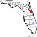
Osteen
Location in Volusia County and the state of Florida
Coordinates: 28°50′46″N81°09′45″W / 28.84611°N 81.16250°W / 28.84611; -81.16250 [1]
Country United States
State Florida
County Volusia
Elevation
[1]
46 ft (14 m)
Time zone UTC-5 (EST)
  Summer (DST) UTC-4 (EDT)
ZIP code(s)
32764
Area code(s) 407, 689
GNIS feature ID288269 [1]
World War I Memorial in Osteen Osteen Florida 2.jpg
World War I Memorial in Osteen

Osteen is an unincorporated community in southwest Volusia County, Florida, United States. Osteen is near the St. Johns River as well as typically native shopping malls, swamps, forests and wildlife of Florida. Osteen attracts a number of visitors for these qualities. There are numerous camping areas and preserves such as the Hickory Bluff Preserve, a 150-acre nature preserve with hiking and horse trails. [2]

Contents

The Cypress Point Golf Club & RV Retreat is an active adult over 55 community which features a nine-hole middle length golf course which is open to the public and includes full time and winter residents.

The north-south route of mostly two-lane State Road 415 serves as the main artery through Osteen. It connects State Road 44 in Volusia County to State Road 46 in Seminole County. State Road 415 is a two-lane road from State Road 44 until just north of Osteen. The road was recently four-laned beginning approximately three-miles north of Osteen and running the distance to State Road 46. The Osteen Bridge spans the St Johns River near State Road 46 to the south near the Orlando Sanford International Airport. Sanford and Lake Monroe border the community to the west, with Deltona to the north and the small community of Farmton to the east.

History

Osteen was named after Hezekiah Ellis Osteen (1821–1904) a cattle rancher, who with his wife, Susannah Gaskins Osteen (1826–?), originally settled in the community in the 19th century. Prior to Osteen, the community was known as Saulsville. A member of the Osteen family fought for the Confederacy in the American Civil War, and was either wounded or killed in battle. [3] A plaque is dedicated to the founders of the city in the civic center that was built in 1968. The city was once incorporated and the abandoned city hall is located on the corner of Railroad Avenue just west of the post office. Also located within Osteen is the Cypress Point Golf Club, a nine-hole executive length golf course.

Notable businesses

Related Research Articles

<span class="mw-page-title-main">Volusia County, Florida</span> County in Florida, United States

Volusia County is located in the east-central part of the U.S. state of Florida between the St. Johns River and the Atlantic Ocean. As of the 2020 census, the county was home to 553,543 people, an increase of 11.9% from the 2010 census. It was founded on December 29, 1854, from part of Orange County, and was named for the community of Volusia, located in northwestern Volusia County. Its first county seat was Enterprise. Since 1887, its county seat has been DeLand.

<span class="mw-page-title-main">Interstate 4</span> Interstate Highway in Florida, United States

Interstate 4 (I-4) is an Interstate Highway located entirely within the US state of Florida, maintained by the Florida Department of Transportation (FDOT). Spanning 132.30 miles (212.92 km) along a generally southwest–northeast axis, I-4 is entirely concurrent with State Road 400 (SR 400). In the west, I-4 begins at an interchange with I-275 in Tampa. I-4 intersects with several major expressways as it traverses Central Florida, including US Highway 41 (US 41) in Tampa; US 301 near Riverview; I-75 near Brandon; US 98 in Lakeland; US 27 in unincorporated Davenport; US 192 in Celebration; Florida's Turnpike in Orlando; and US 17 and US 92 in multiple junctions. In the east, I-4 ends at an interchange with I-95 in Daytona Beach, while SR 400 continues for roughly another four miles (6.4 km) and ends at an intersection with US 1 on the city line of Daytona Beach and South Daytona.

<span class="mw-page-title-main">Yulee, Florida</span> Census County Division in Florida, United States

Yulee is a Census County Division (CCD) in Nassau County, Florida, United States. It is situated in northeastern Florida, directly south of the Florida-Georgia state line, and 24 miles north of downtown Jacksonville, Florida. The CCD's population is currently 36,742 as of a 2021 U.S. Census Bureau survey. Yulee is part of the Jacksonville metropolitan area, which is home to approximately 1.68 million people as of 2022. Today, the Yulee CCD is a residential bedroom community for those who commute to Jacksonville, Naval Submarine Base Kings Bay, or other locations in Southeast Georgia, but is working to diversify its tax base.

<span class="mw-page-title-main">Deltona, Florida</span> City in Florida, United States

Deltona is a city in Volusia County, Florida, United States. It is located on the northern shore of Lake Monroe along the St. Johns River. As of the 2020 census, the city population was 93,692. It is a principal city of the Deltona–Daytona Beach–Ormond Beach metropolitan area, which was home to an estimated 685,344 people in 2021. It is the third largest city in the Greater Orlando combined statistical area.

<span class="mw-page-title-main">U.S. Route 92</span> Highway in the United States

U.S. Route 92 or U.S. Highway 92 is a 181-mile (291 km.) U.S. Route entirely in the U.S. state of Florida. The western terminus is at US 19 Alt. and SR 687 in downtown St. Petersburg. The eastern terminus is at SR A1A in Daytona Beach.

<span class="mw-page-title-main">Florida State Road 15</span> Highway in Florida

State Road 15 is part of the Florida State Road System. This route is part of a multi two-state route 15 that begins at Florida and ends at Georgia at the North Carolina state line.

<span class="mw-page-title-main">Florida State Road 15A</span> Highway in Florida

State Road 15A is part of the Florida State Road System, and a suffixed alternate of State Road 15. Along with its parent route, SR 15A is signed north–south.

<span class="mw-page-title-main">Central Florida</span> Region in Florida, United States

Central Florida is a region of the U.S. state of Florida. Different sources give different definitions for the region, but as its name implies it is usually said to comprise the central part of the state, including the Tampa Bay area and the Greater Orlando area, though in recent times the Tampa Bay area has often been described as its own region, with "Central Florida" becoming more synonymous with the Orlando area.

<span class="mw-page-title-main">Florida State Road 415</span>

State Road 415 is a north–south route in Central Florida running between State Road 44 in Volusia County and SR 46 in Seminole County.

<span class="mw-page-title-main">Florida State Road 44</span> Highway in Florida

State Road 44 is an east–west state highway in the U.S. state of Florida. It runs from Crystal River on the Gulf of Mexico east to New Smyrna Beach on the Atlantic Ocean, passing through Inverness, Wildwood, Leesburg and DeLand.

<span class="mw-page-title-main">Florida State Road 46</span> Highway in Florida, United States

State Road 46 is an east–west route in central Florida, running from U.S. Route 441 in Mount Dora to US 1 in Mims. Along the way, it crosses the Wekiva River and, further east, the St. Johns River near the Econlockhatchee River.

<span class="mw-page-title-main">Lake Monroe (Florida)</span> Lake in the state of Florida, United States

Lake Monroe is one of the lakes that make up the St. Johns River system. The port city of Sanford is situated along the southern shore, while DeBary and Deltona are located along the northern shore. Two major central Florida roadways that run near the lake are State Road 415 and Interstate 4. It forms the border of Seminole County and Volusia County It is the 8th largest lake in the Orlando metropolitan area, after Lake Jesup, 7 miles (11 km) to the south.

<span class="mw-page-title-main">Lake George State Forest</span> State forest in Florida, United States

The Lake George State Forest is a designated protected area and state forest in the U.S. state of Florida. The 21,176-acre (8,570 ha) forest is located in northwestern Volusia County, Florida, near Lake George and the communities of Pierson, Barberville, and Volusia. It is overseen by the Florida Forest Service within the Florida Department of Agriculture and Consumer Services.

<span class="mw-page-title-main">U.S. Route 17 in Florida</span> Section of U.S. Highway in Florida, United States

U.S. Highway 17 (US 17) in Florida is a north–south United States Numbered Highway that runs 317 miles (510 km) from the Punta Gorda, Florida Metropolitan Statistical Area northeast to the Jacksonville metropolitan area.

The South Florida Water Management District (SFWMD) is a regional governmental district that oversees water resources from Orlando to the Florida Keys. The mission of the SFWMD is to manage and protect water resources by balancing and improving water quality, flood control, natural systems and water supply, covering 16 counties in Central and Southern Florida. It is the largest water management district in the state, managing water needs for 7.7 million residents. A key initiative is the restoration of America's Everglades – the largest environmental restoration project in the nation's history. The District is also working to improve the Kissimmee River and its floodplain, Lake Okeechobee and South Florida's coastal estuaries.

Lemon Bluff is an unincorporated community located in south Volusia County, Florida, United States. It is located along the St. Johns River southeast of Osteen, Florida near the Lake Monroe Conservation Area.

<span class="mw-page-title-main">Ormond Scenic Loop and Trail</span>

The Ormond Scenic Loop and Trail is a series of scenic state and county highways in Volusia County, Florida. CR 2002 is the northern leg of the trail. CR 4011(Old Dixie Highway and North Beach Street) is the western leg, with a spur onto Pine Tree Drive. SR 40(East Granada Boulevard) is the southern leg of the trail. CR 2803(John Anderson Drive) is the central leg of the trail, and SR A1A is the eastern leg of the trail. Florida Scenic Highway, designated this route on July 9, 2007.

The Douglas Stenstrom Bridge, also known as the Osteen Bridge, is a steel-and-concrete bridge located in Indian Mound Village, Florida, east of Sanford, that carries State Road 415 over the St. Johns River. The current bridge was completed in 1977, replacing a 1920s vintage bridge that was considered the most dangerous in the state; a second parallel span was completed in 2015.

References

  1. 1 2 3 "US Board on Geographic Names". United States Geological Survey. October 25, 2007. Retrieved January 31, 2008.
  2. Hickory Bluff Preserve. Volusia County Government. Retrieved 2012-03-18.
  3. Gold, Pleasant Daniel (1927). History of Volusia County Florida. Daytona Beach, FL: Higginson Book Company (reprint). pp. 81, 89. ISBN   0-8328-7061-7.