DeLand Southwest, Florida

Last updated

DeLand Southwest, Florida
CDP
Volusia County Florida Incorporated and Unincorporated areas De Land Southwest Highlighted.svg
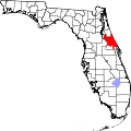
Location in Volusia County and the state of Florida
Coordinates: 29°0′33″N81°18′35″W / 29.00917°N 81.30972°W / 29.00917; -81.30972
Country Flag of the United States.svg  United States
State Flag of Florida.svg  Florida
County   Volusia
Area
[1]
  Total0.61 sq mi (1.58 km2)
  Land0.61 sq mi (1.58 km2)
  Water0.00 sq mi (0.00 km2)
Population
 (2020)
  Total1,056
  Density1,728.31/sq mi (667.43/km2)
Time zone UTC-5 (Eastern (EST))
  Summer (DST) UTC-4 (EDT)
ZIP code
32720 [2]
Area code 386
FIPS code 12-16937 [3]

DeLand Southwest is an unincorporated census-designated place located in Volusia County, Florida, United States. The population was 1,056 at the 2020 census.

Contents

Geography

DeLand Southwest is located at 29°0′33″N81°18′35″W / 29.00917°N 81.30972°W / 29.00917; -81.30972 (29.009037, -81.309675). [4]

According to the United States Census Bureau, the CDP has a total area of 0.62 square miles (1.6 km2), all land.

Demographics

Historical population
CensusPop.Note
2000 1,169
2010 1,052−10.0%
2020 1,0560.4%
U.S. Decennial Census [5]

2020 census

DeLand Southwest, Florida – Racial and ethnic composition
Note: the U.S. census treats Hispanic/Latino as an ethnic category. This table excludes Latinos from the racial categories and assigns them to a separate category. Hispanics/Latinos may be of any race.
Race / Ethnicity (NH = Non-Hispanic)Pop 2000 [6] Pop 2010 [7] Pop 2020 [8] % 2000% 20102020
White alone (NH)24915214421.30%14.45%13.64%
Black or African American alone (NH)82373064070.40%69.39%60.61%
Native American or Alaska Native alone (NH)1730.09%0.67%0.28%
Asian alone (NH)5390.43%0.29%0.85%
Pacific Islander alone (NH)0000.00%0.00%0.00%
Some Other Race alone (NH)02100.00%0.19%0.95%
Mixed Race or Multi-Racial (NH)79240.60%0.86%2.27%
Hispanic or Latino (any race)841492267.19%14.16%21.40%
Total1,1691,0521,056100.00%100.00%100.00%

2000 census

As of the census [3] of 2000, there were 1,169 people, 387 households, and 258 families residing in the CDP. The population density was 716.4/km2 (1,862.9/mi2). There were 459 housing units at an average density of 281.3/km2 (731.4/mi2). The racial makeup of the town was 25.15% White, 70.66% African American, 0.09% Native American, 0.43% Asian, 2.57% from other races, and 1.11% from two or more races. Hispanic or Latino of any race were 7.19% of the population.

There were 387 households, out of which 29.5% had children under the age of 18 living with them, 33.3% were married couples living together, 30.0% had a female householder with no husband present, and 33.1% were non-families. 26.6% of all households were made up of individuals, and 8.0% had someone living alone who was 65 years of age or older. The average household size was 2.73 and the average family size was 3.32.

In the CDP, the population was spread out, with 26.8% under the age of 18, 7.8% from 18 to 24, 23.8% from 25 to 44, 21.3% from 45 to 64, and 20.4% who were 65 years of age or older. The median age was 38 years. For every 100 females, there were 79.0 males. For every 100 females age 18 and over, there were 68.8 males.

The median income for a household in the CDP was $13,090, and the median income for a family was $18,929. Males had a median income of $17,083 versus $17,417 for females. The per capita income for the town was $8,373. About 41.9% of families and 45.7% of the population were below the poverty line, including 50.9% of those under age 18 and 43.7% of those age 65 or over.

Related Research Articles

<span class="mw-page-title-main">Charleston Park, Florida</span> Census-designated place in Florida, United States

Charleston Park is an unincorporated community and census-designated place (CDP) in Lee County, Florida, United States. The population was 235 at the 2020 census, up from 218 at the 2010 census. It is part of the Cape Coral-Fort Myers, Florida Metropolitan Statistical Area.

<span class="mw-page-title-main">Goulds, Florida</span> Census-designated place in Florida

Goulds is an unincorporated community and census-designated place (CDP) in Miami-Dade County, Florida, United States. The area was originally populated as the result of a stop on the Florida East Coast Railroad. The railroad depot was located near the current Southwest 224th Street. The community was named after its operator, Lyman Gould, who cut trees for railroad ties. It is part of the Miami metropolitan area of South Florida. As of the 2020 US census, the population stood at 11,446, up from 10,103 in 2010 US census.

<span class="mw-page-title-main">Homestead Base, Florida</span> Census-designated place in Florida

Homestead Base is a census-designated place (CDP) in Miami-Dade County, Florida, United States. The CDP comprises the extent of Homestead Air Reserve Base plus some surrounding land. It is part of the Miami metropolitan area of South Florida. The population was 999 at the 2020 census.

<span class="mw-page-title-main">The Hammocks, Florida</span> Census-designated place in Florida

The Hammocks is a planned community and census-designated place in Miami-Dade County, Florida, United States. It is part of the Miami metropolitan area of South Florida. The population was 59,480 at the 2020 census, up from 51,003 in 2010.

<span class="mw-page-title-main">West Perrine, Florida</span> Census-designated place in Florida

West Perrine is a census-designated place (CDP) in Miami-Dade County, Florida, United States. It is part of the Miami metropolitan area of South Florida. The population was 10,602 at the 2020 census, up from 9,460 in 2010.

<span class="mw-page-title-main">Lockhart, Florida</span> Census-designated place in Florida, United States

Lockhart is a census-designated place in Orange County, Florida, United States. The population was 13,060 at the 2010 census. It is part of the Orlando–Kissimmee–Sanford, Florida Metropolitan Statistical Area. The community is named for David Lockhart.

<span class="mw-page-title-main">Meadow Woods, Florida</span> Census-designated place in Florida, United States

Meadow Woods is a census-designated place (CDP) and an unincorporated suburban development area located in southern Orange County, Florida, United States, between Orlando International Airport and Kissimmee. It is part of the Orlando–Kissimmee–Sanford, Florida Metropolitan Statistical Area. As of 2020, the population was 43,790.

<span class="mw-page-title-main">South Apopka, Florida</span> Census-designated place in Florida, United States

South Apopka is a census-designated place and an unincorporated area in Orange County, Florida, United States. Per the 2020 census, the population was 6,803. It is part of the Orlando–Kissimmee Metropolitan Statistical Area.

<span class="mw-page-title-main">Tangelo Park, Florida</span> Census-designated place in Florida, United States

Tangelo Park is a census-designated place and an unincorporated area in Orange County, Florida, United States. The population was 2,231 at the 2010 census. It is part of the Orlando–Kissimmee Metropolitan Statistical Area.

<span class="mw-page-title-main">Tildenville, Florida</span> Census-designated place in Florida, United States

Tildenville is a census-designated place (CDP) and an unincorporated area in Orange County, Florida, United States. The population was 511 at the 2010 census, most of them African American. It is part of the Orlando–Kissimmee Metropolitan Statistical Area. Generally speaking, Tildenville is a narrow area alongside Orange County Road 545, south of Florida State Road 50 and north of the Stoneybrook West planned unit development. Residents utilize Winter Garden, Florida for mail delivery. The CDP takes its name from Luther F. Tilden, a prominent pioneer and citrus magnate who greatly contributed to the community. Historically, Tildenville referred to an area larger than the modern CDP. Landmarks such as Tildenville Elementary School, Tildenville Marketplace, and Meadow Marsh are now located within the city limits of Winter Garden.

<span class="mw-page-title-main">Union Park, Florida</span> Census-designated place in Florida, United States

Union Park is a census-designated place (CDP) in Orange County, Florida, United States. The population was 10,452 at the 2020 census. It is part of the Orlando–Kissimmee Metropolitan Statistical Area. The ZIP codes for Union Park are 32817 and 32825. The community is southwest of the University of Central Florida.

Fremd Village-Padgett Island is an unincorporated community and former census-designated place (CDP) in Palm Beach County, Florida, United States. The population was 2,264 at the 2000 census.

Juno Ridge is a census-designated place (CDP) in Palm Beach County, Florida, United States. It is part of the Miami metropolitan area of South Florida. The population was 1,186 at the 2020 US census.

Limestone Creek is a census-designated place (CDP) in Palm Beach County, Florida, United States. It is part of the Miami metropolitan area of South Florida. The population was 1,316 at the 2020 US census.

Stacy Street is a residential street and surrounding census-designated place (CDP) in Palm Beach County, Florida, United States. In the 2010 and 2020 US Census, the CDP is misspelled as Stacey Street. It is part of the Miami metropolitan area of South Florida. The population was 978 at the 2020 US census.

<span class="mw-page-title-main">East Lake, Pinellas County, Florida</span> Census-designated place in Florida, United States

East Lake is a census-designated place (CDP) in Pinellas County, Florida, United States. It was one of the last areas in the densely populated county to develop and often confused with East Lake in neighboring Hillsborough County. The population was 32,344 at the 2020 census.

<span class="mw-page-title-main">Midway, Seminole County, Florida</span> Place in Florida, United States

Midway is an unincorporated community and census designated place (CDP) in Seminole County, Florida, United States. The population was 1,524 at the 2020 census. It is part of the Orlando–Kissimmee–Sanford Metropolitan Statistical Area.

<span class="mw-page-title-main">North DeLand, Florida</span> CDP in Florida, United States

North DeLand is a census-designated place (CDP) in Volusia County, Florida, United States. The population was 1,510 at the 2020 census.

<span class="mw-page-title-main">West DeLand, Florida</span> CDP in Florida, United States

West DeLand is a census-designated place (CDP) in Volusia County, Florida, United States. The population was 3,908 at the 2020 census.

<span class="mw-page-title-main">South Miami Heights, Florida</span> Census-designated place in Florida

South Miami Heights is a census-designated place (CDP), originally known as Eureka, in Miami-Dade County, Florida. It is part of the Miami metropolitan area of South Florida. The population was 36,770 as of the 2020 census.

References

  1. "2020 U.S. Gazetteer Files". United States Census Bureau. Retrieved October 31, 2021.
  2. "DeLand Southwest FL ZIP Code". zipdatamaps.com. 2023. Retrieved February 17, 2023.
  3. 1 2 "U.S. Census website". United States Census Bureau . Retrieved January 31, 2008.
  4. "US Gazetteer files: 2010, 2000, and 1990". United States Census Bureau. February 12, 2011. Retrieved April 23, 2011.
  5. "Census of Population and Housing". Census.gov. Retrieved June 4, 2016.
  6. "P004 Hispanic or Latino, and Not Hispanic or Latino by Race – 2000: DEC Summary File 1 – DeLand Southwest CDP, Florida". United States Census Bureau .
  7. "P2 Hispanic or Latino, and Not Hispanic or Latino by Race – 2010: DEC Redistricting Data (PL 94-171) – DeLand Southwest CDP, Florida". United States Census Bureau .
  8. "P2 Hispanic or Latino, and Not Hispanic or Latino by Race – 2020: DEC Redistricting Data (PL 94-171) – DeLand Southwest CDP, Florida". United States Census Bureau .