Miami, officially the City of Miami, is a coastal metropolis and the seat of Miami-Dade County in South Florida. With a population of 442,241 as of the 2020 census, it is the second-most populous city in the state of Florida after Jacksonville. It is the core of the much larger Miami metropolitan area, which, with a population of 6.14 million, is the third-largest metro in the Southeast and ninth-largest in the United States. The city has the third-largest skyline in the U.S. with over 300 high-rises, 58 of which exceed 491 ft (150 m).

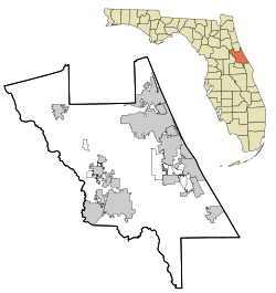
DeSoto County is a county located in the Florida Heartland region of the U.S. state of Florida. As of the 2020 census, the population was 33,976. Its county seat is Arcadia.

The contiguous United States consists of the 48 adjoining U.S. states and the District of Columbia of the United States of America. The term excludes the only two non-contiguous states, Alaska and Hawaii, and all other offshore insular areas, such as American Samoa, Guam, the Northern Mariana Islands, Puerto Rico, and the U.S. Virgin Islands. The colloquial term "Lower 48" is also used, especially in relation to Alaska.

The East Coast of the United States, also known as the Eastern Seaboard, the Atlantic Coast, and the Atlantic Seaboard, is the region encompassing the coastline where the Eastern United States meets the Atlantic Ocean.

Orlando is a city in, and the county seat of Orange County, Florida, United States. Part of Central Florida, it is the center of the Orlando metropolitan area, which had a population of 2,509,831 in 2017, according to the U.S. Census Bureau. It is the sixth-largest metropolitan area in the Southern United States and the third-largest metropolitan area in Florida behind Miami and Tampa Bay. Orlando had a city population of 307,573 in the 2020 census, making it the fourth-largest city in Florida behind Jacksonville, Miami, and Tampa. It is the state's largest inland city.

Weston is a city in Broward County, Florida, United States, just west of Fort Lauderdale. It is part of the Miami metropolitan area, which is anchored by Miami. The population was 68,107 at the 2020 census. Weston is 30 miles northwest of Miami, Florida.

Homestead is a city within Miami-Dade County in the U.S. state of Florida, between Biscayne National Park to the east and Everglades National Park to the west. The population was 80,737 as of the 2020 census. Homestead is primarily a Miami suburb and a major agricultural area. It is a principal city of the Miami metropolitan area, which was home to an estimated 6,012,331 people at the 2015 census. It is located approximately 26 miles (42 km) southwest of Miami, and 25 miles (40 km) northwest of Key Largo.
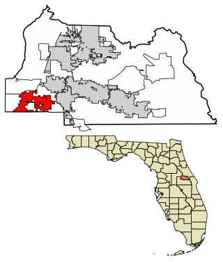
Altamonte Springs is a suburban city in central Florida in Seminole County, Florida, United States, which had a population of 46,231 at the 2020 United States Census. The city is in the northern suburbs of the Orlando–Kissimmee–Sanford Metropolitan Statistical Area, which the United States Census Bureau estimated had a population of 2,054,574 in 2008.

St. Augustine is a city in and the county seat of St. Johns County located 40 miles south of downtown Jacksonville. The city is on the Atlantic coast of northeastern Florida. Founded in 1565 by Spanish explorers, it is the oldest continuously inhabited European-established settlement in what is now the contiguous United States.

West Florida was a region on the northern coast of the Gulf of Mexico that underwent several boundary and sovereignty changes during its history. As its name suggests, it was formed out of the western part of former Spanish Florida, along with lands taken from French Louisiana; Pensacola became West Florida's capital. The colony included about two thirds of what is now the Florida Panhandle, as well as parts of the modern U.S. states of Louisiana, Mississippi, and Alabama.
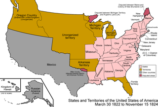
The Territory of Florida was an organized incorporated territory of the United States that existed from March 30, 1822, until March 3, 1845, when it was admitted to the Union as the state of Florida. Originally the major portion of the Spanish territory of La Florida, and later the provinces of East and West Florida, it was ceded to the United States as part of the 1819 Adams–Onís Treaty. It was governed by the Florida Territorial Council.

The Southeastern United States, also referred to as the American Southeast, the Southeast, or simply the South, is a geographical region of the United States. It is located broadly on the eastern portion of the Southern United States and the southern portion of the Eastern United States. It comprises at least a core of states on the lower East Coast of the United States and eastern Gulf Coast. Expansively, it reaches as far north as West Virginia and Maryland, which borders the Ohio River and Mason–Dixon line, and stretches as far west as Arkansas and Louisiana. There is no official U.S. government definition of the region, though various agencies and departments use different definitions.

The United States District Court for the Southern District of Florida is the federal United States district court with territorial jurisdiction over the southern part of the state of Florida.
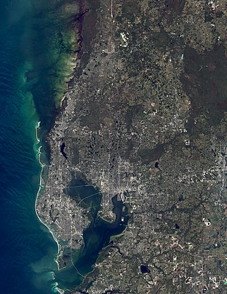
The Tampa Bay area is a major metropolitan area surrounding Tampa Bay on the Gulf Coast of Florida in the United States. It includes the main cities of Tampa, St. Petersburg, and Clearwater. It is the 18th-largest metropolitan area in the United States, with a population of 3,175,275 as of the 2020 U.S. Census.

The Wiregrass region, also known as the Wiregrass plains or Wiregrass country, is an area of the Southern United States encompassing parts of southern Georgia, southeastern Alabama, and the Florida Panhandle. The region is named for the native Aristida stricta, commonly known as wiregrass due to its texture.

Florida's 14th congressional district is an electoral district for the U.S. Congress and includes western Hillsborough County and southeastern Pinellas County, including most of Tampa. In the 2020 redistricting cycle, the district was redrawn to include almost all areas in both counties which faces Tampa Bay, while northeastern Tampa and its neighbouring suburbs are redistricted into the 15th district. The 14th district also includes MacDill Air Force Base and Tampa International Airport.

The Jacksonville Metropolitan Area, also called the First Coast, Metro Jacksonville, or Northeast Florida, is the metropolitan area centered on the principal city of Jacksonville, Florida and including the First Coast of North Florida. As of the 2020 United States census, the total population was 1,605,848. The Jacksonville–St. Marys–Palatka, FL–GA Combined Statistical Area (CSA) had a population of 1,733,937 in 2020 and was the 34th largest CSA in the United States. The Jacksonville metropolitan area is the 40th largest in the country and the fourth largest in the State of Florida, behind the Miami, Tampa, and Orlando metropolitan areas.

The Big Bend of Florida, United States, is an informally-named geographic region of North Florida where the Florida Panhandle transitions to the Florida Peninsula south and east of Tallahassee. The region is known for its vast woodlands and marshlands and its low population density relative to much of the state. The area is home to the largest single spring in the United States, the Alapaha Rise, and the longest surveyed underwater cave in the United States, the 32-mile (51 km) Wakulla-Leon Sinks cave system.

Florida is a state in the Southeastern region of the United States, bordered to the west by the Gulf of Mexico; Alabama to the northwest; Georgia to the north; the Bahamas and Atlantic Ocean to the east; and the Straits of Florida and Cuba to the south. It is the only state that borders both the Gulf of Mexico and the Atlantic Ocean. With a population exceeding 21 million, it is the third-most populous state in the nation and ranks 8th in population density as of 2020. It spans 65,758 square miles (170,310 km2), ranking 22nd in area among the 50 states. The Miami metropolitan area, anchored by the cities of Miami, Fort Lauderdale, and West Palm Beach, is the state's largest metropolitan area with a population of 6.138 million, and the state's most-populous city is Jacksonville with a population of 949,611. Florida's other major population centers include Tampa Bay, Orlando, Cape Coral, and the state capital of Tallahassee.