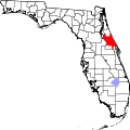
South Daytona, Florida

Last updated

South Daytona, Florida
Volusia County Florida Incorporated and Unincorporated areas South Daytona Highlighted.svg
Location in Volusia County and the state of Florida
Coordinates: 29°9′55″N81°0′33″W / 29.16528°N 81.00917°W / 29.16528; -81.00917
Country Flag of the United States.svg  United States
State Flag of Florida.svg  Florida
County   Volusia
Area
[1]
  Total5.05 sq mi (13.09 km2)
  Land3.70 sq mi (9.59 km2)
  Water1.35 sq mi (3.50 km2)
Elevation
10 ft (3 m)
Population
 (2020)
  Total12,865
  Density3,476.09/sq mi (1,342.07/km2)
Time zone UTC-5 (Eastern (EST))
  Summer (DST) UTC-4 (EDT)
ZIP codes
32119, 32121
Area code 386
FIPS code 12-67325 [2]
GNIS feature ID0291367 [3]
Website www.southdaytona.org

South Daytona is a city in Volusia County, Florida, United States. The population was 12,865 at the 2020 census. [4]

Contents

History

South Daytona was once a town called Blake (named after wealthy Boston businessman Alpheus P. Blake), with some forty resident families and as many more non-resident property holders. Many of the early settlers profitably engaged in orange culture and vegetable gardening. According to the National Archives in Washington, D.C., Blake opened its first post office on August 19, 1878. Then c. 1886, the first train came as far as Daytona, and ten years later the line was extended to Miami. Soon thereafter, a railroad station was built at Big Tree Crossing.

By 1926, the towns of Daytona, Daytona Beach and Seabreeze were consolidated to create the city of Daytona Beach. Daytona Beach then proceeded to annex all the adjacent territories, including the town of Blake. Because of new taxes and appraisals levied, residents of Blake were forced to hire an attorney and eventually, c. 1938, succeeded in breaking away from Daytona Beach to become the incorporated town of South Daytona.

Soon after World War II, the town created a Building Department, followed by a Planning and Zoning Board. Builders and developers soon became interested in the area, and South Daytona started to develop. South Daytona was then in a position to request financial assistance from the federal government for expansion of utilities, streets, etc. South Daytona was the second town in the Halifax area, after Daytona Beach, to install a sanitary sewer system. The town continued to prosper and was incorporated as the City of South Daytona in 1951. South Daytona has operated under a City Manager/Council form of government since 1980, with the Mayor and four council members serving four-year, staggered terms beginning in 1990.

Geography

South Daytona is located at 29°9′55″N81°0′33″W / 29.16528°N 81.00917°W / 29.16528; -81.00917 (29.165310, –81.009057), [5] on the Halifax River, just south of the city of Daytona Beach.

According to the United States Census Bureau, the city has a total area of 5.0 square miles (13.0 km2), of which 3.7 square miles (9.6 km2) is land and 1.3 square miles (3.4 km2) (26.29%) is water. [6] There are nearly 44.5 miles (71.6 km) of roadway, 40 miles (64 km) of sewer lines, and 55 miles (89 km) of water lines throughout the city.[ citation needed ] The average elevation is 6.5 feet (2.0 m) above sea level.

Demographics

Historical population
CensusPop.Note
1940 571
1950 69221.2%
1960 1,954182.4%
1970 4,979154.8%
1980 11,252126.0%
1990 12,48210.9%
2000 13,1775.6%
2010 12,252−7.0%
2020 12,8655.0%
U.S. Decennial Census [7]

2010 and 2020 census

South Daytona racial composition
(Hispanics excluded from racial categories)
(NH = Non-Hispanic)
RacePop 2010 [8] Pop 2020 [9] % 2010% 2020
White (NH)9,8629,66680.49%75.13%
Black or African American (NH)1,3151,43210.73%11.13%
Native American or Alaska Native (NH)31360.25%0.28%
Asian (NH)1331621.09%1.26%
Pacific Islander or Native Hawaiian (NH)7120.06%0.09%
Some other race (NH)18470.15%0.37%
Two or more races/Multiracial (NH)2145591.75%4.35%
Hispanic or Latino (any race)6729515.48%7.39%
Total12,25212,865100.00%100.00%

As of the 2020 United States census, there were 12,865 people, 5,587 households, and 3,177 families residing in the city. [10]

As of the 2010 United States census, there were 12,252 people, 5,485 households, and 2,885 families residing in the city. [11]

2000 census

As of the census of 2000, there were 13,177 people, 5,851 households, and 3,604 families residing in the city. The population density was 3,698.2 inhabitants per square mile (1,427.9/km2). There were 6,457 housing units at an average density of 1,812.2 per square mile (699.7/km2). The racial makeup of the city was 88.67% White, 7.85% African American, 0.12% Native American, 1.21% Asian, 0.05% Pacific Islander, 0.53% from other races, and 1.57% from two or more races. Hispanic or Latino of any race were 2.89% of the population.

In 2000, there were 5,851 households, out of which 25.0% had children under the age of 18 living with them, 44.4% were married couples living together, 13.0% had a female householder with no husband present, and 38.4% were non-families. 29.6% of all households were made up of individuals, and 11.9% had someone living alone who was 65 years of age or older. The average household size was 2.24 and the average family size was 2.75.

In 2000, in the city, the population was spread out, with 20.3% under the age of 18, 8.7% from 18 to 24, 28.6% from 25 to 44, 23.5% from 45 to 64, and 18.9% who were 65 years of age or older. The median age was 40 years. For every 100 females, there were 92.8 males. For every 100 females age 18 and over, there were 89.3 males.

In 2000, the median income for a household in the city was $31,180, and the median income for a family was $36,417. Males had a median income of $27,500 versus $21,676 for females. The per capita income for the city was $17,401. About 7.9% of families and 10.7% of the population were below the poverty line, including 12.9% of those under age 18 and 7.8% of those age 65 or over.

Economy

Among the numerous corporate partners that call South Daytona home are:

Shopping

Related Research Articles

<span class="mw-page-title-main">Callaway, Florida</span> City in Florida, United States

Callaway is a city in Bay County, Florida, United States, and is a suburb of Panama City. The population was 14,405 at the 2010 census. It is part of the Panama City–Lynn Haven–Panama City Beach Metropolitan Statistical Area.

<span class="mw-page-title-main">Panama City Beach, Florida</span> Resort town in Bay County, Florida, United States

Panama City Beach is a resort town in Bay County, Florida, United States, on the Gulf of Mexico coast. It had a population of 12,018 in 2010. The city is often referred to under the umbrella term of "Panama City". Panama City Beach's slogan is "The World's Most Beautiful Beaches" due to the unique, sugar-white sandy beaches of northwest Florida.

<span class="mw-page-title-main">Atlantic Beach, Florida</span> City in Florida, United States

Atlantic Beach is a city in Duval County, Florida, United States and the second largest of the Jacksonville Beaches communities. When the majority of communities in Duval County consolidated with Jacksonville in 1968, Atlantic Beach, along with Jacksonville Beach, Neptune Beach, and Baldwin, remained quasi-independent. Like the other towns, it maintains its own municipal government, but its residents vote in the Jacksonville mayoral election and have representation on the Jacksonville city council. The population was 13,513 at the 2020 census.

<span class="mw-page-title-main">Coral Terrace, Florida</span> Census-designated place in Florida

Coral Terrace is a suburban unincorporated community and census-designated place (CDP) in Miami-Dade County, Florida, United States. It is part of the Miami metropolitan area of South Florida. The population was 23,142 at the 2020 census, down from 24,376 in 2010.

<span class="mw-page-title-main">Goulds, Florida</span> Census-designated place in Florida

Goulds is an unincorporated community and census-designated place (CDP) in Miami-Dade County, Florida, United States. The area was originally populated as the result of a stop on the Florida East Coast Railroad. The railroad depot was located near the current Southwest 224th Street. The community was named after its operator, Lyman Gould, who cut trees for railroad ties. It is part of the Miami metropolitan area of South Florida. As of the 2020 US census, the population stood at 11,446, up from 10,103 in 2010 US census.

<span class="mw-page-title-main">Palm Springs North, Florida</span> Census-designated place in Florida

Palm Springs North is an unincorporated community and census-designated place (CDP) in Miami-Dade County, Florida, United States. It is part of the Miami metropolitan area of South Florida. The population was 5,030 at the 2020 census.

<span class="mw-page-title-main">Pinewood, Florida</span> Census-designated place in Florida

Pinewood is an unincorporated community and census-designated place (CDP) in Miami-Dade County, Florida, United States. It is part of the Miami metropolitan area of South Florida. The population was 17,246 at the 2020 census.

<span class="mw-page-title-main">Three Lakes, Florida</span> Census-designated place in Florida

Three Lakes is a census-designated place (CDP) and planned community in Miami-Dade County, Florida, United States. It is part of the Miami metropolitan area of South Florida. The population was 16,540 at the 2020 census, up from 15,047 in 2010.

<span class="mw-page-title-main">Westview, Florida</span> Census-designated place in Florida

Westview is a census-designated place (CDP) in Miami-Dade County, Florida, United States. It is part of the Miami metropolitan area of South Florida. The population was 9,923 at the 2020 census.

<span class="mw-page-title-main">Niceville, Florida</span> City in Florida, United States

Niceville is a city in Okaloosa County, Florida, United States, located near Eglin Air Force Base on Boggy Bayou that opens into Choctawhatchee Bay. It is part of the Fort Walton Beach–Crestview–Destin Metropolitan Statistical Area. The population was 15,772 at the 2020 census.

<span class="mw-page-title-main">Highland Beach, Florida</span> Town in the state of Florida, United States

Highland Beach is a town in Palm Beach County, Florida, United States. It is part of the Miami metropolitan area of South Florida, and situated 50 miles north of Miami and 28 miles south of Palm Beach. As of the 2020 US census, the population was 4,295.

<span class="mw-page-title-main">Ocean Ridge, Florida</span> Town in the state of Florida, United States

Ocean Ridge is a town in Palm Beach County, Florida, United States. The town is part of the Miami metropolitan area of South Florida. The population was 1,830 at the 2020 US census.

<span class="mw-page-title-main">Palm Beach Shores, Florida</span> Town in the state of Florida, United States

Palm Beach Shores is a town in Palm Beach County, Florida, United States. The town is part of the Miami metropolitan area of South Florida. The population was 1,330 at the 2020 US census.

<span class="mw-page-title-main">South Bay, Florida</span> City in Florida, United States

South Bay is a city in Palm Beach County, Florida, United States. It is the westernmost municipality in the South Florida metropolitan area. As of 2020, the population recorded by the U.S. Census Bureau was 4,860 residents. While the current estimates place South Bay's population in the incorporated city limits at more than 4,000 people, surrounding areas increase the population figures to 54,000 people in a 25-mile (40 km) radius and more than 1.4 million in a 50-mile (80 km) radius.

<span class="mw-page-title-main">Auburndale, Florida</span> City in Florida, United States of America

Auburndale is a city in Polk County, Florida, United States. It is part of the Lakeland-Winter Haven, Florida Metropolitan Statistical Area. The population was 15,616 at the 2020 census.

<span class="mw-page-title-main">Edgewater, Volusia County, Florida</span> City in Florida

Edgewater is a city in Volusia County, Florida, United States, situated along the Indian River North, adjacent to the Mosquito Lagoon. It is a part of the Deltona–Daytona Beach–Ormond Beach, FL metropolitan statistical area. As of the 2020 US census, the city had a population of 23,097.

<span class="mw-page-title-main">Holly Hill, Florida</span> City in Florida, United States

Holly Hill is a city in Volusia County, Florida, United States. Holly Hill's city limits lie entirely on the Florida mainland, unlike the larger cities on either side of it, Daytona Beach and Ormond Beach, which encompass both the mainland and the beachfront barrier island across the Halifax River. The population was 12,958 at the 2020 census.

<span class="mw-page-title-main">Ormond Beach, Florida</span> City in Volusia County, Florida, US

Ormond Beach is a city in Volusia County, Florida, United States. The population was 43,080 at the 2020 census. Ormond Beach lies directly north of Daytona Beach and is a principal city of the Deltona–Daytona Beach–Ormond Beach, FL Metropolitan Statistical Area. The city is known as the birthplace of speed, as early adopters of motorized cars flocked to its hard-packed beaches for yearlong entertainment, since paved roads were not yet commonplace. Ormond Beach lies in Central Eastern Florida.

<span class="mw-page-title-main">Port Orange, Florida</span> City in Florida, United States

Port Orange is a city in Volusia County, Florida. The city's population was estimated at 64,842 in 2019 by the U.S. Census Bureau.

<span class="mw-page-title-main">Sun City Center, Florida</span> Census-designated place in Florida, United States

Sun City Center is an unincorporated census-designated place (CDP) in southern Hillsborough County, Florida, United States. It is located south of Tampa and north of Sarasota on I-75. As of the 2020 census, the population was 30,952. The ZIP Code serving the community is 33573.

References

  1. "2020 U.S. Gazetteer Files". United States Census Bureau. Retrieved December 2, 2021.
  2. "U.S. Census website". United States Census Bureau . Retrieved January 31, 2008.
  3. "US Board on Geographic Names". United States Geological Survey. October 25, 2007. Retrieved January 31, 2008.
  4. "Explore Census Data". data.census.gov. Retrieved December 7, 2021.
  5. "US Gazetteer files: 2010, 2000, and 1990". United States Census Bureau. February 12, 2011. Retrieved April 23, 2011.
  6. "Geographic Identifiers: 2010 Demographic Profile Data (G001): South Daytona city, Florida". United States Census Bureau . Retrieved February 16, 2012.
  7. "Census of Population and Housing". Census.gov. Retrieved June 4, 2015.
  8. "P2 HISPANIC OR LATINO, AND NOT HISPANIC OR LATINO BY RACE - 2010: DEC Redistricting Data (PL 94-171) - South Daytona city, Florida". United States Census Bureau .
  9. "P2 HISPANIC OR LATINO, AND NOT HISPANIC OR LATINO BY RACE - 2020: DEC Redistricting Data (PL 94-171) - South Daytona city, Florida". United States Census Bureau .
  10. "S1101 HOUSEHOLDS AND FAMILIES - 2020: South Daytona city, Florida". United States Census Bureau .
  11. "S1101 HOUSEHOLDS AND FAMILIES - 2010: South Daytona city, Florida". United States Census Bureau .