Wonuarra, South Australia

Last updated

Wonuarra
South Australia
Australia South Australia location map.svg
Red pog.svg
Wonuarra
Coordinates 34°12′58″S140°52′48″E / 34.216°S 140.880°E / -34.216; 140.880 Coordinates: 34°12′58″S140°52′48″E / 34.216°S 140.880°E / -34.216; 140.880
Postcode(s) 5340
Location10 km (6 mi) south of Paringa
LGA(s) Renmark Paringa Council
State electorate(s) Chaffey
Federal Division(s) Barker
Localities around Wonuarra:
Paringa Murtho Lindsay Point, Victoria
Mundic Creek Wonuarra Murray-Sunset, Victoria
Pike River Yamba Murray-Sunset, Victoria

Wonuarra is a locality southeast of Paringa in the east end of the South Australian Riverland region. The locality is east of the Sturt Highway between Paringa and Yamba and extends from the highway to the state border. [1]

Paringa, South Australia Town in South Australia

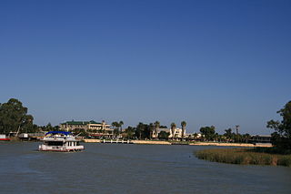
Paringa is a small town in the Riverland of South Australia. Paringa is famous for its vineyards, almond, citrus and stone fruit orchards, and the steel bridge with a span that can be raised to allow houseboats and paddlesteamers to pass underneath and across the Murray River to Renmark. At the 2006 census, Paringa had a population of 946.

South Australia State of Australia

South Australia is a state in the southern central part of Australia. It covers some of the most arid parts of the country. With a total land area of 983,482 square kilometres (379,725 sq mi), it is the fourth-largest of Australia's states and territories by area, and fifth largest by population. It has a total of 1.7 million people, and its population is the second most highly centralised in Australia, after Western Australia, with more than 77 percent of South Australians living in the capital, Adelaide, or its environs. Other population centres in the state are relatively small; Mount Gambier, the second largest centre, has a population of 28,684.

Riverland Region in South Australia

The Riverland is a region of South Australia. It covers an area of 9,386 square kilometres (3,624 sq mi) along the Murray River from where it flows into South Australia from New South Wales and Victoria downstream to Blanchetown. The major town centres are Renmark, Berri, Loxton, Waikerie, Barmera and Monash, along with many minor townships; the population is approximately 35,000 people.

Wonuarra was the next siding on the Barmera railway line south of Paringa and provided bagged wheat for rail transport out of the district. [2] The siding was originally named Koora, but renamed to Wonuarra as the original name was easily confused with Noora further south. [3]

The Barmera railway line was the second railway built to develop the Murray Mallee region of South Australia, in 1913. It followed the success of the Pinnaroo railway line in 1906. Both lines branched east from Tailem Bend to the north of the main Melbourne–Adelaide railway. The Brown's Well line was the more northerly, and extended into country which had not been developed much before the railway, partly due to the absence of any viable transport route for produce. The original terminus of the Brown's Well railway was at Meribah, not far from the Victorian border.

In the 1960s, a branch line joined the main line north of Wonuarra. It was 27.3 kilometres (17.0 mi) long, and went northeast to Murtho to the south bank of the Murray River to support construction of the proposed Chowilla Dam. The dam was never built, after the South Australian government negotiated a guaranteed supply of water from the Dartmouth Dam. The railway line was removed without ever being used. [4] [5]

Murtho, South Australia Town in South Australia

Murtho is a locality in South Australia. It is northeast of Renmark and Paringa. It is bounded by the Murray River on its north and west sides and the Victorian border on the east.

Murray River the longest river in Australia

The Murray River is Australia's longest river, at 2,508 kilometres (1,558 mi) in length. The Murray rises in the Australian Alps, draining the western side of Australia's highest mountains, and then meanders across Australia's inland plains, forming the border between the states of New South Wales and Victoria as it flows to the northwest into South Australia. It turns south at Morgan for its final 315 kilometres (196 mi), reaching the ocean at Lake Alexandrina.

Chowilla Dam dam in 60 kilometres (37 mi) upstream of Renmark, South Australia

Chowilla Dam was a proposed water storage reservoir on the Murray River in the 1960s. The dam wall would have been in South Australia, but the reservoir behind it would have stretched upstream into Victoria and New South Wales. The site was selected in 1960. Early preparations for its construction were conducted before the project was halted. These included a 23 km service railway from the Barmera railway line, which was dismantled without ever actually being used.

Related Research Articles

Sturt Highway Australian national highway in New South Wales, Victoria, and South Australia

The Sturt Highway is an Australian national highway in New South Wales, Victoria, and South Australia. The Sturt Highway is an important road link for the transport of passengers and freight between Sydney and Adelaide and the regions situated adjacent to the route.

Renmark, South Australia Town in South Australia

Renmark is a town in South Australia's rural Riverland area, and is located 254 km northeast of Adelaide, on the banks of the River Murray. The Sturt Highway between Adelaide and Sydney runs through the town; Renmark is the last major town encountered in South Australia when driving this route. It is 31 m above sea level. At the 2011 census, Renmark had a population of 7,491.

Renmark may refer to.

Rail transport in South Australia

The first railway in colonial South Australia was a horse-drawn tramway from the port of Goolwa on the Murray River to an ocean harbour at Port Elliot in 1854. Today the state has 1,600 mm broad gauge suburban railways in Adelaide, a number of country freight lines, as well as key 1,435 mm standard gauge links to other states.

Taldra, South Australia Town in South Australia

Taldra is a small settlement in the northeastern Murray Mallee region of South Australia adjoining the border with Victoria. The aboriginal word taldra means kangaroo. At the 2006 census, Taldra had a population of 150.

Taplan, South Australia Town in South Australia

Taplan is a town in the Murray Mallee region of South Australia near the border with Victoria. Taplan is an aboriginal word meaning grass tree. The town was laid out by Henry George in 1914. The railway from Adelaide to Paringa was laid past the site of the future township in 1913, 183.25 miles (294.91 km) by rail from Adelaide. The Taplan Post Office was open from 1 July 1914 to 14 May 1982.

Abbotsford Bridge bridge in New South Wales, Australia

Abbotsford Bridge is a steel Allan truss-type bridge spanning the Murray River between Curlwaa, New South Wales, and Yelta, Victoria. It is the only remaining steel truss bridge with a lift span that crosses the Murray. Opened in 1928, the bridge was built by the New South Wales (NSW) Department of Public Works and was designed by Percy Allan. It was the second last lift-span bridge to be built over the river, the last being the Nyah Bridge, which opened in 1941.

Renmark Paringa Council Local government area in South Australia

The Renmark Paringa Council is a local government area located adjacent to the Victorian border, in the Riverland, South Australia. The area is known for its various fruit production, and is heavily dependent on the River Murray as a water source. The council seat is at Renmark.

Morkalla railway line closed in railway line in the Millewa region of northwestern Victoria, Australia

The Morkalla railway line was a railway line in the Millewa region of northwestern Victoria, Australia. It extended west from Red Cliffs railway station on the Mildura railway line into the wheat farming areas established as soldier settlements after World War I.

The Milang railway line was a branch line, now closed, of the former South Australian Railways that left the mainline to Victor Harbor at the farming locality of Sandergrove, 9 km (6 mi) south of Strathalbyn and 89.7 km (55.75 mi) by rail from Adelaide. From there it proceeded in a south-easterly direction for 13.1 km (8.1 mi) to the riverport of Milang on Lake Alexandrina, in the estuary of the River Murray. The line was opened on 17 December 1884; it was formally closed on 17 June 1970. The route is now a "rail trail" that is popular with hikers. The precincts of the former Milang station house a railway museum, a locomotive driving simulator, and a centre for South Australian historical light railways.

Claypans, South Australia Town in South Australia

Claypans is a locality in the Murray Mallee region of South Australia. Claypans had a Methodist church in 1928. The school opened in 1907 and closed in 1947. The name refers to the claypan at which the settlers camped on their first night.

Chowilla, South Australia South Australia

Chowilla is a locality in the Australian state of South Australia located on the northern side of the Murray River about 250 kilometres to the north-east of the capital city of Adelaide and about 40 kilometres to the north-east of the town of Renmark, and which is bounded by the border with New South Wales in the east.

Paringa Bridge bridge on the Sturt Highway between Renmark and Paringa

The Paringa Bridge carries the Sturt Highway across the Murray River in Paringa, South Australia. Until 1982, it also carried the Barmera railway line.

Mundic Creek, South Australia Suburb of Renmark Paringa Council, South Australia

Mundic Creek is a locality in the Australian state of South Australia located in the Riverland in the state’s east on the southern side of the Murray River about 217 kilometres (135 mi) north-east of the state capital of Adelaide, and about 6 kilometres (3.7 mi) south-east of the municipal seat of Renmark.

Pike River, South Australia Suburb of Renmark Paringa Council, South Australia

Pike River is a locality in the Australian state of South Australia located in the Riverland in the state’s east on the southern side of the Murray River about 210 kilometres (130 mi) north-east of the state capital of Adelaide and about 9 kilometres (5.6 mi) south-east of the municipal seat of Renmark.

References

  1. "Property Location Browser (Suburbs and Localities)". Government of South Australia, Department of Planning, Transport and Infrastructure. SA0040088. Retrieved 9 October 2014.
  2. "THE PARINGA LINE". Murray Pioneer and Australian River Record (Renmark, SA : 1913 - 1942) . Renmark, SA: National Library of Australia. 15 February 1924. p. 1. Retrieved 30 September 2015.
  3. "WONUARRA". Murray Pioneer and Australian River Record (Renmark, SA : 1913 - 1942) . Renmark, SA: National Library of Australia. 15 June 1917. p. 6. Retrieved 9 October 2014.
  4. "Paringa - Chowilla Railway, S.A". RailPage. Interactive Omnimedia Pty Ltd. Retrieved 30 September 2015.[ self-published source ]
  5. "Chowilla branch". RailPage. Interactive Omnimedia Pty Ltd. Retrieved 30 September 2015.[ self-published source ]