
Murray Bridge is a city in the Australian state of South Australia, located 76 kilometres (47 mi) east-southeast of the state's capital city, Adelaide, and 77 kilometres (48 mi) north of the town of Meningie. The city had an urban population of approximately 18,779 as at June 2018 making it the fifth most populous urban area in the state after Adelaide, Mount Gambier, Victor Harbor - Goolwa and Whyalla.
Koraleigh is a small village in the west of the Riverina region of New South Wales, Australia. The village is on the Murray River and in Murray River Council local government area. Koraleigh is 6 kilometres (3.7 mi) northeast of Nyah, Victoria and 15 kilometres (9.3 mi) south of Tooleybuc.

Wellington is a township in South Australia, Australia on the Murray River just upstream of where it empties into Lake Alexandrina. Its postcode is 5259. Wellington is in the Rural City of Murray Bridge. At the 2006 census, Wellington had a population of 295.

Kingston On Murray is a town on the south bank of the Murray River in the Riverland region of South Australia. Its name is ultimately derived from Charles Kingston who was Premier of South Australia from 1893-99. At the 2006 census, the town had a population of 257.

Grong Grong is a small town that is located in the Riverina region of New South Wales, Australia. The town is situated on the Newell Highway, 23 kilometres (14 mi) east of Narrandera in the Shire of Narrandera.
Genoa is a town in Eastern Gippsland, Victoria, Australia. It is close to the New South Wales border where the Princes Highway crosses the Genoa River. The town is an important access point to the Croajingolong National Park. At the 2006 census, Genoa and the surrounding area had a population of 304.

Karuah is a locality in both the Port Stephens and Mid-Coast Councils in the Hunter Region of New South Wales, Australia. It is thought that the name means 'native plum tree' in the local Aboriginal dialect..In 1790 five convicts who escaped from Sydney and relocated to the area. In 1795 the Karuah River was first surveyed as part of a wider survey of Port Stephens..In 1811 Governor Lachlan Macquarie decided to name the area the Clyde. By 1816 permits were issued to allow cedar cutting in the area..In 1824 the Australian Agricultural Company purchased a million acres to create the township. In 1907 the name was changed from Sawyers Point to Karuah.

Tintaldra is a town in northeast Victoria, Australia in the Shire of Towong local government area and on the upper reaches of the Murray River, 440 kilometres (270 mi) northeast of the state capital, Melbourne and 131 kilometres (81 mi) east of the regional centre of Wodonga. At the 2006 census, Tintaldra and the surrounding area had a population of 203.

The City of Albury is a local government area in the Riverina region of New South Wales, Australia. The area covers 305.9 square kilometres (118.1 sq mi) to the north of the Murray River. The area extends around 10 to 12 kilometres east and west along the river from the centre of Albury and up to 20 kilometres (12 mi) north. The population of the City of Albury area was 53,767 in June 2018.

Woomargama is a locality in southeastern New South Wales, Australia. The locality is in the South West Slopes region, in the foothills of the Great Dividing Range. It is in the Greater Hume Shire local government area, 508 kilometres (316 mi) south west of the state capital, Sydney and 48 kilometres (30 mi) north east of the regional city of Albury. At the 2006 census, Woomargama had a population of 251.

Punyelroo is a town located on the Murray River in South Australia, Australia, approximately 5 kilometres downstream from Swan Reach, but on the opposite side of riverbank. The town is named after a local homestead. It accessible by sealed bitumen road most conveniently off the Sedan Swan Reach Road or by well made dirt road from Mannum. At the 2006 census, Punyelroo had a population of 256.

The Renmark Paringa Council is a local government area located adjacent to the Victorian border, in the Riverland, South Australia. The area is known for its various fruit production, and is heavily dependent on the River Murray as a water source. The council seat is at Renmark.

Milang is a town and locality located in the Australian state of South Australia on the west coast of Lake Alexandrina about 71 kilometres (44 mi) south-east of the state capital of Adelaide and about 20 kilometres (12 mi) north-east of the municipal seat of Goolwa.

Buxton is a rural locality in the Bundaberg Region, Queensland, Australia. In the 2016 census, Buxton had a population of 430 people.

Cobdogla is a town in the Riverland region of South Australia, The town is on the Murray River, 232 kilometres (144 mi) north-east of the state capital, Adelaide. At the 2006 census, Cobdogla had a population of 232.
Jervois is a town in South Australia, on the right (western) bank of the lower Murray River. At the 2006 census, Jervois and the surrounding area had a population of 283. Jervois is predominantly a farming community, especially dairy farming on the floodplain and gently rising ground behind it.

Keyneton is a locality in South Australia. The town is in the Mid Murray Council local government area, 82 kilometres (51 mi) north-east of the state capital, Adelaide. At the 2011 census, Keyneton and the surrounding area had a population of 534.

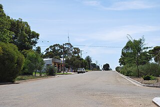
Koolunga is a town in the Mid North of South Australia. According to the 2016 Australian Census, the population of the town and surrounding area is approximately 200.

Ramco is a town in the Riverland region of South Australia 170 kilometres (110 mi) north-east of the state capital, Adelaide and 7 kilometres (4.3 mi) west of Waikerie. At the 2016 census, Ramco had a population of 166. It is on the south (left) bank of the Murray River downstream from Waikerie.
Willaston is a northern suburb 39 kilometres (24 mi) northeast of the Adelaide city centre in South Australia. It is located in the Town of Gawler.

