Land at Monash was allocated to repatriated soldiers returned from World War I as part of the State Government Soldier Settler Scheme. The southern part of the settlement was occupied first and was originally known as Lone Gum after a prominent local landmark, a river red gum tree (Eucalyptus camaldulensis). The tree still stands today, although it was nearly destroyed in a fire caused by a local land owner. The tree's image is used on the Monash Primary School emblem.
Monash Adventure Playground
Monash is best known in South Australia as the home of a major adventure playground for adults as well as children with tall, fast and twisty slippery dips and other equipment.[4] This was built by a local engineering company, and open for free public use. Concerns about public liability led to its scaling down and eventual closure. It reopened in 1996 without the high towers, but with better picnic facilities and less "dangerous" equipment now including a giant maze. In the mid-2000s the flying fox connected to the high towers were removed because citizens viewed them as a safety hazard.
Monash Adventure Park maze and lake
The main feature of the Monash adventure park is the flying fox at the top of this hill
One of the "Dangerous" playground attractions
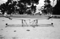
A very unusual see-saw at the original playground
A quite frightening slippery slide at the original playground
Another only slightly less frightening slippery slide
↑ Bice, John G. (25 August 1921). "TOWNS OF GLOSSOP AND MONASH"(PDF). The South Australian Government Gazette. Government of South Australia. p.382. Retrieved 31 March 2019.
This page is based on this Wikipedia article Text is available under the CC BY-SA 4.0 license; additional terms may apply. Images, videos and audio are available under their respective licenses.