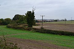
Anston is a civil parish in South Yorkshire, England, formally known as North and South Anston. The parish of Anston consists of the settlements of North Anston and South Anston, divided by the Anston Brook.

Woodsetts is a village and civil parish in the Metropolitan Borough of Rotherham in South Yorkshire, England, on the border with Nottinghamshire. It lies between the towns of Dinnington and Worksop at an elevation of around 60 metres above sea level, and has a population of 1,746 at the 2011 Census. The village originated as a medieval farming hamlet of the manor of Anston, nestled amongst the ancient woodland of which a few patches remain. The village grew rapidly in the late 19th century when a colliery was sunk at Dinnington. The village now serves as a commuter base for travellers between nearby towns.

Maltby is a former mining town and civil parish in the Metropolitan Borough of Rotherham, South Yorkshire, England. It was historically in the West Riding of Yorkshire. It is located 6 miles (10 km) east of Rotherham and 10 miles (16 km) north-east of Sheffield. It forms a continuous urban area with Hellaby, separated from the rest of Rotherham by the M18 motorway. It had a population of 16,688 at the 2011 Census.

Thorpe Salvin is a village and a civil parish in the Metropolitan Borough of Rotherham in South Yorkshire, England, on the border with Nottinghamshire. It lies between Worksop and Harthill, and is located at an elevation of around 110 metres above sea level. At the 2011 Census, it had a population of 476, down from 502 in 2001.
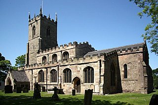
Harthill is a village in the Metropolitan Borough of Rotherham, on the border with Derbyshire. It lies between Killamarsh and Thorpe Salvin, and is located at approximately 53°19′10″N1°15′30″W, at an elevation of around 110 metres above sea level. In the 2001 census, the civil parish of Harthill with Woodall had a population of 1,909, reducing slightly to 1,879 at the 2011 Census.

Wales is a village and a civil parish in the Metropolitan Borough of Rotherham in South Yorkshire, England. Historically part of the West Riding of Yorkshire, it borders to the south Derbyshire and is astride the M1 motorway. The civil parish of Wales, which has a population of 6,455, increasing to 7,069 at the 2011 Census, encompasses the village and neighbouring settlement Kiveton Park.
Kiveton Park is a village within the Metropolitan Borough of Rotherham, in South Yorkshire, England. Historically a part of the West Riding of Yorkshire, from the Norman conquest to 1868, Kiveton was a hamlet of the parish of Harthill-with-Woodall. It subsequently transferred to the civil parish of Wales which takes its name from the neighbouring village.

Nether Edge and Sharrow Ward, which includes the districts of Nether Edge, Sharrow, Abbeydale, Brincliffe and parts of Banner Cross, Heeley and Highfield, is one of the 28 electoral wards in the City of Sheffield, England. It is located in the south west of the city and covers an area of 1.31 square miles (3.4 km2). In 2011, the population of this ward was 18,890 people in 7,592 households. Nether Edge & Sharrow ward is one of the wards that make up the Sheffield Central parliamentary constituency.

Ecclesfield is a village and civil parish in the City of Sheffield, South Yorkshire, England, about 4 miles (6 km) north of Sheffield City Centre. Ecclesfield civil parish had a population of 32,073 at the 2011 Census. Ecclesfield wards of the City of Sheffield had a population of 35,994 in 2011. The population of Ecclesfield village stood at 7,163 in the most recent census.

Treeton is a village and civil parish of the Metropolitan Borough of Rotherham in South Yorkshire, England. It is located about 4 miles (6 km) south of the town of Rotherham and 5 miles (8 km) east of Sheffield City Centre.
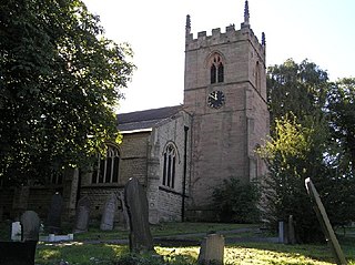
Killamarsh is a village and civil parish in North East Derbyshire, England, bordering Rotherham to the north and Sheffield to the north-west. It lies close to Derbyshire’s border with South Yorkshire.
Kiveton Park was a rural district in the West Riding of Yorkshire from 1894 to 1974.
Kiveton Park Football Club is a football club based in Kiveton Park, South Yorkshire, England. They are currently members of the Sheffield & Hallamshire County Senior League Division One and play at Wales High School.

Woodall services is a motorway service station on the M1 motorway in Rotherham close to Sheffield in England. It lies between junctions 30 and 31. It was opened in 1968 by Trust House Forte but was renamed Welcome Break after the takeover of the company. It takes its name from the nearby village of Woodall.

Todwick is a village in the Metropolitan Borough of Rotherham in South Yorkshire, England. It has a population of 1,637, reducing marginally to 1,634 at the 2011 Census, and contains a primary school. There is a village hall adjacent to the primary school, and this is on the corner of Kiveton Lane and The Pastures.

The A616 is a road that links Newark-on-Trent, Nottinghamshire, to the M1 motorway at Junction 30, then reappears at Junction 35A and goes on to Huddersfield, West Yorkshire.

The A631 is a road running from Sheffield, South Yorkshire to Louth, Lincolnshire in England. It passes through the counties of South Yorkshire, Nottinghamshire and Lincolnshire. The road has many towns on its route including Rotherham, Maltby, Gainsborough and Market Rasen. It is mostly single road throughout its length but has some stretches of dual carriageway as well.
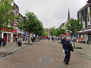
Rotherham is a Minster town in South Yorkshire, England. It lies at the confluence of the River Rother, from which the town gets its name, and the River Don. It is the largest settlement of the Metropolitan Borough of Rotherham.

The All Hallows Church is an Anglican parish church in the Diocese of Sheffield, located in Harthill, South Yorkshire, England. It is a Grade I listed building.
Harthill with Woodall is a civil parish in the Metropolitan Borough of Rotherham, South Yorkshire, England. The parish contains eleven listed buildings that are recorded in the National Heritage List for England. Of these, one is listed at Grade I, the highest of the three grades, one is at Grade II*, the middle grade, and the others are at Grade II, the lowest grade. The parish contains the villages of Harthill and Woodall and the surrounding countryside. The Chesterfield Canal passes through the periphery of the parish, and two bridges crossing it are listed. Most of the other listed buildings are houses and farmhouses, the rest including a church, a former threshing barn, the possible base of a medieval cross, and a schoolhouse.
