Woodford, Northamptonshire

Last updated

Woodford
St. Mary the Virgin Church at Woodford, Northamptonshire.jpg
Church of St. Mary the Virgin seen from the River Nene
Northamptonshire UK location map.svg
Red pog.svg
Woodford
Location within Northamptonshire
Population1,461  (2011 census)
OS grid reference SP9676
Unitary authority
Ceremonial county
Region
Country England
Sovereign state United Kingdom
Post town Kettering
Postcode district NN14
Dialling code 01832
Police Northamptonshire
Fire Northamptonshire
Ambulance East Midlands
UK Parliament
List of places
UK
England
Northamptonshire
52°22′53″N0°34′55″W / 52.3815°N 0.5819°W / 52.3815; -0.5819 Coordinates: 52°22′53″N0°34′55″W / 52.3815°N 0.5819°W / 52.3815; -0.5819

Woodford is a large village and civil parish located in North Northamptonshire, England. At the time of the 2011 census, the parish's population (including Woodwell) was 1,461 people. [1]

Contents

The village's name means 'wooded ford', [2] referring to woodland near a shallow fording place on the River Nene.

It is in two distinct parts, the easterly, lower, part being alongside the River Nene and the westerly, upper, part is on the through road out of the Nene valley. Its parish church is dedicated to St Mary the Virgin and has the nickname "the Cathedral of the Nene".

Inside the church can be found a number of curiosities. Within a niche cut into a pillar, there is a mummified human heart wrapped in coarse cloth. This was discovered during restoration work in 1867. A framed newspaper cutting depicts a photograph of an alleged ghost taken in the church in 1964. [3] A further display shows reproductions of photographs and newspapers from a time capsule concealed in the roof by the Reverend Smythe during the 1867 repair works, and rediscovered during further repairs in 1995. An unusual carving (particularly for places of Christian worship) can be found at the top of one of the pillars to the rear of the nave, depicting a Green Man, with vines growing out of the mouth. Finally, the combination of rounded and pointed arches in the nave indicate different periods of reconstruction in the Norman and Gothic styles respectively.

Woodford House, an early 19th-century mansion, was the home of the Arbuthnot family and scene of the death of the diarist Harriet Arbuthnot in 1833. The property was purchased in 1880 by Charles Henry Plevins from Arthur Arbuthnot, son of General Charles Arbuthnot. The house was altered between 1899 and 1910 and had a new garden created in 1909. [4] The Arbuthnots owned iron ore quarries on the estate which were dug from circa 1851, an early date for what was later to become a large industry in Northamptonshire. [5] The Arbuthnot's quarry appears to have been short-lived but a sample of the ore was exhibited at the Great Exhibition in Hyde Park, London, in 1851. There was a further experiment in commercial quarrying from about 1860 and again in 1866. The early attempts suffered from a lack of transport facilities and the ore must have been taken away by horse and cart but in 1866 the Kettering to Thrapston railway opened and a connecting tramway was constructed from close to Woodford House to the railway at Twywell. The quarrying (and some adit mining) lasted from 1866 to 1886, starting near Woodford Lodge and extending north of the road later on. There were also quarries south west of Twywell Station on the north side of the road between 1881 and 1883. There was also a brickworks near there. The main tramway (standard gauge) had steam locomotives from the start but some of the quarries were connected to it by narrow gauge lines and these were worked by hand or by horse until 1883. There were some visible remains of the quarries and buildings at least until 1986. [6]

Part of the ground north of the road near Woodford Lodge was reworked between 1914 and 1926 when quarries in Twywell Parish were extended. The ground here was landscaped and returned to cultivation in 1965. [7]

These quarries were to the west of Woodford village. Another quarry to the north of the village operated from 1867 but was closed by 1892. This quarry was connected to a tipping dock on the railway east of Twywell Station by a horse operated 4 foot gauge tramway. No landscaping was undertaken until 1970 and there were still some traces of the quarry as at 1986 [8]

Heritage assets

The following buildings and structures are listed by Historic England as of special architectural or historic interest. [9]

St Mary's Church was begun in the 12th century and has 13th,14th and 19th century features. The tower was complete by 1400. [10]

The Manor House, although a 16th-century house has buttresses and a doorway of the 13th or early 14th century.

The Round House is dated 1815 and commemorates the Battle of Waterloo

Woodford House was enlarged between 1813 and 1826 and in 1902. [11]

Demography

Notes

  1. Office for National Statistics: Woodford CP: Parish headcounts. Retrieved 15 July 2015
  2. "Key to English Place-names".
  3. Codd, Daniel. Mysterious Northamptonshire. Breedon Books (2009). p.131-132. ISBN   9781859836811
  4. NCC, Record Office
  5. The History of Ironstone Mining around Burton Latimer
  6. Tonks, Eric (1991). The ironstone Quarries of the Midlands Part V the Kettering Railway. Cheltenham: Runpast. pp. 79–85. ISBN   1-870754-05-0.
  7. Tonks, Eric work cited pages 124 and 125
  8. Tonks,Eric Pages 86-90
  9. National Heritage List for England (Historic England)
  10. Pevsner, Nikolaus (1973). Cherry, Bridget (ed.). Northamptonshire. Buildings of England (Second 1973 with additions 1985 ed.). Harmondsworth: Penguin. pp. 465–6. ISBN   0-14-0710-22-1.
  11. Pevsner :Buildings of England page 467
  12. 1 2 3 William Whellan & Co. (1849). History, Gazetteer and Directory Northamptonshire. Whittaker & Co. p. 885.
  13. Office for National Statistics

Related Research Articles

<span class="mw-page-title-main">East Northamptonshire</span> Non-metropolitan district in England

East Northamptonshire was from 1974 to 2021 a local government district in Northamptonshire, England. Its council was based in Thrapston and Rushden. Other towns include Oundle, Raunds, Irthlingborough and Higham Ferrers. The town of Rushden was by far the largest settlement in the district. The population of the district at the 2011 Census was 86,765.

<span class="mw-page-title-main">Old, Northamptonshire</span> Human settlement in England

Old is a village and civil parish in West Northamptonshire, England. At the time of the 2001 census, the parish's population was 308 people, and the population increased to 490 at the 2011 Census.
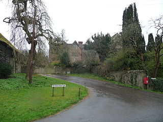
<span class="mw-page-title-main">Farthingstone</span> Village in Northamptonshire, England

Farthingstone is a village in West Northamptonshire in England. It is close to the major trunk routes of the M1 junction 16, M40 motorway, and A5 road, at the head of a valley and is 7 miles (11 km) south of Daventry and 3.5 miles (5.6 km) south west of Weedon Bec.

Hargrave is a small village and civil parish situated in rural Northamptonshire, England, approximately 21 miles east of Northampton and adjacent to the Northamptonshire-Cambridgeshire-Bedfordshire border. At the time of the 2001 census, the parish's population was 236 people,. increasing to 241 at the 2011 census.

<span class="mw-page-title-main">Ringstead, Northamptonshire</span> Human settlement in England

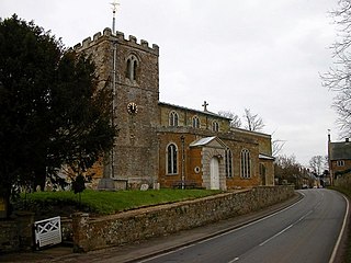
Ringstead is a village and civil parish in Northamptonshire, England, forming part of North Northamptonshire. It is located approximately 15 miles north-east of Northampton. At the time of the 2011 census, the parish's population was 1,461 people. The local primary school is situated next to St Mary's Church, which is host to the Ringstead Flower Festival.

Wootton is a former village about 3 miles (4.8 km) south of Northampton town centre that is now part of Northampton.

<span class="mw-page-title-main">Finedon</span> Human settlement in England

Finedon is a town in North Northamptonshire, England, with a population at the 2011 census of 4,309 people. In 1086 when the Domesday Book was completed, Finedon was a large royal manor, previously held by Queen Edith, wife of Edward the Confessor. From the 1860s the parish was much excavated for its iron ore, which lay underneath a layer of limestone and was quarried over the course of 100 years or more. Local furnaces produced pig iron and later the quarries supplied ore for the steel works at Corby. A disused quarry face in the south of the parish is a geological SSSI.

Stanwick is a village and civil parish in North Northamptonshire, England.
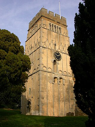
<span class="mw-page-title-main">Great Addington</span> Human settlement in England

Great Addington is a small village and civil parish in Northamptonshire, England. It lies near the west bank of the River Nene, about 5 miles (8 km) east of Kettering. It consists of approximately 100 households; at the time of the 2011 census, the population of the parish was 327 people. It has a school, church, manor house, village hall, a pub called the Hare & Hounds, playing fields and homes. There is a strong bond and rivalry with the neighbouring village Little Addington.

<span class="mw-page-title-main">Islip, Northamptonshire</span> Human settlement in England

Islip is a village and civil parish in North Northamptonshire, England. The village is just west of Thrapston and 7 miles (11 km) east of Kettering. The parish is bounded to the east by the River Nene and to the north by Harpurs Brook, a tributary of the Nene. The 2011 Census recorded the parish's population as 829 people.

<span class="mw-page-title-main">Chelveston</span> Human settlement in England

Chelveston is a small village in North Northamptonshire. It is about 2 miles (3.2 km) east of Higham Ferrers and 7 miles (11.3 km) east of Wellingborough on the B645 from Higham Ferrers to St Neots. To the south is the hamlet of Caldecott and the settlement of Chelston Rise which together comprise the civil parish of Chelveston cum Caldecott. The population is now included in the civil parish of Chelveston cum Caldecott.

<span class="mw-page-title-main">Twywell</span> Human settlement in England

Twywell is an English village and civil parish in the county of Northamptonshire. Twywell Hills and Dales Country Park is adjacent. It lies just to the north of the A14 road, about three miles (5 km) west of Thrapston, and forms part of North Northamptonshire. At the time of the 2011 census, the population of the parish was 176.

<span class="mw-page-title-main">Harrington, Northamptonshire</span> Human settlement in England

Harrington is a village and civil parish in Northamptonshire, England, administered by North Northamptonshire council. At the time of the 2001 census, the parish's population was 154 people, including Thorpe Underwood but reducing to 146 at the 2011 Census. The Church of England parish church of St Peter and St Paul is located north-east of the village itself.

Ditchford railway station is a former railway station on Ditchford Road, Northamptonshire on the former Northampton and Peterborough Railway line which connected Peterborough and Northampton.In 1846 the line, along with the London and Birmingham, became part of the London and North Western Railway.

<span class="mw-page-title-main">Ratley</span>

Ratley is a village in the civil parish of Ratley and Upton, Stratford-on-Avon District, Warwickshire, England. The population of the civil parish in 2011 was 327. It is on the northwest side of the Edge Hill escarpment about 200 metres (660 ft) above sea level. The village is close to the county border with north Oxfordshire, some 7 miles northwest of Banbury, the closest town.

<span class="mw-page-title-main">Hunsbury Hill</span>

Hunsbury Hill is an Iron Age hill fort two miles (3 km) south-west of the centre of the town of Northampton in the county of Northamptonshire.

<span class="mw-page-title-main">Twywell Gullet</span>

Twywell Gullet is a 17.1-hectare (42-acre) biological Site of Special Scientific Interest east of Kettering in Northamptonshire. It is part of the 54.6 hectare Twywell Hills and Dales nature reserve, which is managed by a partnership of the Woodland Trust and the Rockingham Forest Trust. The site is in turn a small part of the former royal hunting Rockingham Forest.

<span class="mw-page-title-main">Denford</span> Human settlement in England

Denford is a small village and civil parish situated in North Northamptonshire, England. At the time of the 2001 census, the parish population was 250 people, increasing to 282 at the 2011 census.

Little Addington is a village and civil parish in North Northamptonshire, England, about 8 miles (13 km) south-east of Kettering. At the time of the 2011 census, the parish's population was 328 people. Prior to local government restructuring in 2021 the village was in the area of East Northamptonshire District Council.

<span class="mw-page-title-main">Finedon Top Lodge Quarry</span>

Finedon Top Lodge Quarry, also known as Finedon Gullet is a 0.9-hectare (2.2-acre) geological Site of Special Scientific Interest east of Wellingborough in Northamptonshire. It is a Geological Conservation Review site revealing a sequence of middle Jurassic limestones, sandstones and ironstones, and is the type section for a sequence of sedimentary rocks known as the 'Wellingborough Member'. It was created by quarrying for the underlying ironstone for use at Wellingborough and Corby Steelworks; the ore was transported by the 1,000 mm gauge Wellingborough Tramway.

References