Worden, Montana

Last updated

Worden, Montana
CDP
Worden montana.jpg
Streetside in Worden
Yellowstone County Montana Incorporated and Unincorporated areas Worden Highlighted.svg
Location of Worden, Montana
Coordinates: 45°57′39″N108°9′49″W / 45.96083°N 108.16361°W / 45.96083; -108.16361
Country United States
State Montana
County Yellowstone
Area
[1]
  Total1.98 sq mi (5.12 km2)
  Land1.98 sq mi (5.12 km2)
  Water0.00 sq mi (0.00 km2)
Elevation
[2]
2,963 ft (903 m)
Population
 (2020)
  Total582
  Density294.53/sq mi (113.70/km2)
Time zone UTC-7 (Mountain (MST))
  Summer (DST) UTC-6 (MDT)
ZIP code
59088
Area code 406
FIPS code 30-81925
GNIS feature ID0778696 [2]

Worden is a census-designated place (CDP) in Yellowstone County, Montana, United States. The population was 582 at the 506 at the 2020 census. Worden, along with Ballantine, Huntley, and Pompey's Pillar, is part of the Huntley Project, an irrigation district established by the United States Bureau of Reclamation in 1907.

Contents

Worden is home to a number of restaurants, bars, stores, churches, and other services. It is also the home of the Huntley Project School System, consisting of an elementary, junior high, and high school. Huntley Project High School's team name is the "Red Devils." [3]

History

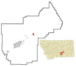
Worden is located on land designated in 1868 as part of the Crow Indian Reservation. When the Northern Pacific Railroad was surveyed and built in the early 1880s, a station called "Clermont" was supposedly built 21 miles from Billings, just across the tracks from present-day Worden.[ citation needed ]

The town of Worden was mapped out in 1907 as part of the Huntley Project. [4] Irrigation transformed the area into an agricultural district and attracted immigrants. The town had a German Congregational church and a Methodist church. A newspaper, The Yellowstone County News, was based here.[ citation needed ]

Geography

According to the United States Census Bureau, the CDP has a total area of 2.0 square miles (5.2 km2), all land. The Yellowstone River is just to the north.

Demographics

Historical population
CensusPop.Note
2020 582
U.S. Decennial Census [5]

As of the census [6] of 2000, there were 506 people, 223 households, and 136 families residing in the CDP. The population density was 254.1 inhabitants per square mile (98.1/km2). There were 239 housing units at an average density of 120.0 per square mile (46.3/km2). The racial makeup of the CDP was 96.25% White, 0.59% African American, 0.99% Native American, 0.20% Asian, 0.40% from other races, and 1.58% from two or more races. Hispanic or Latino of any race were 3.56% of the population.

There were 223 households, out of which 27.8% had children under the age of 18 living with them, 46.6% were married couples living together, 11.2% had a female householder with no husband present, and 39.0% were non-families. 35.4% of all households were made up of individuals, and 17.5% had someone living alone who was 65 years of age or older. The average household size was 2.27 and the average family size was 2.97.

In the CDP, the population was spread out, with 25.5% under the age of 18, 8.1% from 18 to 24, 25.7% from 25 to 44, 23.7% from 45 to 64, and 17.0% who were 65 years of age or older. The median age was 40 years. For every 100 females, there were 96.1 males. For every 100 females age 18 and over, there were 89.4 males.

The median income for a household in the CDP was $22,625, and the median income for a family was $38,393. Males had a median income of $22,434 versus $20,156 for females. The per capita income for the CDP was $14,319. About 3.8% of families and 8.5% of the population were below the poverty line, including 8.9% of those under age 18 and 16.5% of those age 65 or over.

Media

The FM radio station KCHH is licensed in Worden. [7] It plays an adult contemporary format.

Infrastructure

Worden is located along Shepherd Road, formerly Montana Highway 312. It is accessed via exit 6 on Interstate 94.

The nearest airport is Logan International Airport in Billings.

Education

The school district is Huntley Project K-12 Schools, a K-12 unified school district. [8]

Related Research Articles

<span class="mw-page-title-main">Yellowstone County, Montana</span> County in Montana, United States

Yellowstone County is the most populous county in the U.S. state of Montana. As of the 2020 census, the population was 164,731. Its county seat is Billings, the state's most populous city. Like the nearby park, Yellowstone County is named after the Yellowstone River which roughly bisects the county, flowing southwest to northeast. The river, in turn, was named for the yellow sandstone cliffs in what is now Yellowstone County.

<span class="mw-page-title-main">Wyola, Montana</span> Census-designated place in Montana, United States

Wyola is a census-designated place (CDP) in Big Horn County, Montana, United States. The population was 215 at the 2010 census. 79% of the residents are Native American, and the majority are members of the Crow Tribe.

<span class="mw-page-title-main">Belfry, Montana</span> Census-designated place in Montana, United States

Belfry is a census-designated place (CDP) in Carbon County, Montana, United States. It is part of the Billings, Montana Metropolitan Statistical Area. The population was 218 at the 2010 census. It is located approximately 11 miles (18 km) from the Wyoming border, roughly halfway between Billings, Montana and Cody, Wyoming.

<span class="mw-page-title-main">Simms, Montana</span> CDP in Montana, United States

Simms is a census-designated place (CDP) in Cascade County, Montana, United States. The population was 354 at the 2010 census. It is part of the Great Falls, Montana Metropolitan Statistical Area.

<span class="mw-page-title-main">Glendive, Montana</span> City in Montana, United States

Glendive is a city in and the county seat of Dawson County, Montana, United States, and home to Dawson Community College. Glendive was established by the Northern Pacific Railway when they built the transcontinental railroad across the northern tier of the western United States from Minnesota to the Pacific Coast. The town was the headquarters for the Yellowstone Division that encompassed 875 route miles (1,408 km); 546 (879) in main line and 328 (528) in branches with the main routes from Mandan, North Dakota, to Billings, Montana, and from Billings to Livingston. The town of Glendive is an agricultural and ranching hub of eastern Montana sited between the Yellowstone River and the Badlands. Makoshika State Park is located just east of Glendive.

<span class="mw-page-title-main">Hungry Horse, Montana</span> Unincorporated community in Montana, United States

Hungry Horse is an unincorporated community and census-designated place (CDP) in Flathead County, Montana, United States. The population was 828 at the 2020 census. The ZIP code for Hungry Horse is 59919.

<span class="mw-page-title-main">Four Corners, Montana</span> Census-designated place in Montana, United States

Four Corners is a census-designated place (CDP) in Gallatin County, Montana, United States. The population was 5,901 at the 2020 census, up from 3,146 in 2010. It is part of the Bozeman, MT Micropolitan Statistical Area.

<span class="mw-page-title-main">Gardiner, Montana</span> Unincorporated community in Park County, Montana, United States

Gardiner is a census-designated place (CDP) in Park County, Montana, United States, along the 45th parallel. As of the 2020 census, the population of the community and nearby areas was 833.

<span class="mw-page-title-main">Sidney, Montana</span> City in Montana, United States

Sidney is a city in and the county seat of Richland County, Montana, United States, less than 10 mi (16 km) west of the North Dakota border. The population was 6,346 at the 2020 census. The city lies along the Yellowstone River and is in proximity to the badlands of the Dakotas. Sidney is approximately midway between Glendive, Montana and Williston, North Dakota.

<span class="mw-page-title-main">Park City, Montana</span> CDP in Montana, United States

Park City is a census-designated place (CDP) in Stillwater County, Montana, United States. The population was 870 at the 2000 census.

<span class="mw-page-title-main">Reed Point, Montana</span> CDP in Montana, United States

Reed Point is a census-designated place (CDP) in Stillwater County, Montana, United States. The population was 247 at the 2020 census.

<span class="mw-page-title-main">Ballantine, Montana</span> CDP in Montana, United States

Ballantine is a census-designated place (CDP) in Yellowstone County, Montana, United States. It lies approximately nine miles (14 km) northeast of Billings on Interstate 94. The population was 346 at the 2000 census. Ballantine, along with the communities of Pompey's Pillar, Worden, and Huntley, is part of the Huntley Project, an irrigation district created by the United States Bureau of Reclamation. The majority of Ballantine's population lives on scattered farms and ranches surrounding the actual townsite.

<span class="mw-page-title-main">Custer, Montana</span> Village in Montana, United States

Custer is a village in Yellowstone County, Montana, United States. The population was 145 at the 2000 census.

<span class="mw-page-title-main">Huntley, Montana</span> CDP in Montana, United States

Huntley is a census-designated place (CDP) in Yellowstone County, Montana, United States. The population was 411 at the 2000 census. Huntley lent its name to the Huntley Project, a federal irrigation project that began delivering water to the arid district in 1907. Today, Huntley is an eastern suburb of Billings and is located east of Shepherd and west of Worden.

<span class="mw-page-title-main">Laurel, Montana</span> City in Montana, United States

Laurel is a city in Yellowstone County, Montana, United States. It is the third largest community in the Billings Metropolitan Statistical Area, and is located in the Yellowstone Valley, as an east–west terminal division point of the BNSF Railway. The population was 7,222 at the 2020 census.

<span class="mw-page-title-main">Lockwood, Montana</span> CDP in Montana, United States

Lockwood is a census-designated place (CDP) in Yellowstone County, Montana, United States. It is not an organized city or town. The population was 7,195 at the 2020 census.The population was 7,222 at the 2020 census. Lockwood is a suburb of Billings and is the second largest community in the Billings Metropolitan Statistical Area. Annexation of Lockwood to Billings has been studied; however, the June 2009 Billings City Council Annexation Plan states that the city has no plans to annex Lockwood in the foreseeable future. Lockwood is the site of a major Exxon refinery.

<span class="mw-page-title-main">Shepherd, Montana</span> CDP in Montana, United States

Shepherd is a census-designated place (CDP) in Yellowstone County, Montana, United States. The population was 193 at the 2000 census. Shepherd is a Billings suburb located to the northeast. The unincorporated town was named after R.E. Shepherd, a prominent early settler and owner of the Billings Land and Irrigation Company and the Merchants National Bank. The post office opened in 1915.

<span class="mw-page-title-main">West Glendive, Montana</span> Census-designated place in Montana, United States

West Glendive is a census-designated place (CDP) in Dawson County, Montana, United States. The population was 1,998 at the 2020 census.

<span class="mw-page-title-main">Cardwell, Montana</span> Census-designated place in Montana, United States

Cardwell is a census-designated place (CDP) in Jefferson County, Montana, United States. The population was 62 at the 2020 census. It is part of the Helena Micropolitan Statistical Area.

The Huntley Project is an irrigation project in southern Montana that was established by the United States Bureau of Reclamation in 1907. The district includes the towns of Huntley, Worden, Ballantine, and Pompeys Pillar.

References

  1. "ArcGIS REST Services Directory". United States Census Bureau. Retrieved September 5, 2022.
  2. 1 2 U.S. Geological Survey Geographic Names Information System: Worden, Montana
  3. "Member Schools". Montana High School Association. Retrieved April 19, 2021.
  4. "Worden". Montana Place Names Companion. Montana Historical Society. Retrieved April 11, 2021.
  5. "Census of Population and Housing". Census.gov. Retrieved June 4, 2016.
  6. "U.S. Census website". United States Census Bureau . Retrieved January 31, 2008.
  7. "KCHH". FCC. Retrieved December 24, 2023.
  8. "2020 CENSUS - SCHOOL DISTRICT REFERENCE MAP: Yellowstone County, MT" (PDF). U.S. Census Bureau . Retrieved March 15, 2024. - Text list