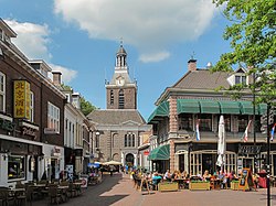
- The tower of Meppel in 2011
- The tower of St Willibord Church in 2013
- Amsterdam's Freedom Carillon in 1961
- St Eusebius' Church, Arnhem in 2005
- The tower of the Doesburg Martinikerk in 2013
- The tower of the Ruïnekerk in 2017
- The Oosterbeek carillon in 2008
- The carillon of the Curaçao Museum in 2010
List of World War II memorials and cemeteries in the Netherlands
Dutch war graves
In the Netherlands, about 9,000 war graves are located. [3]
- Field of Honour Loenen (Loenen) – 4,000 soldiers and civilians
- Grebbeberg War Cemetery (Rhenen) – 800 soldiers [4]
- Mierlo War Cemetery (Mierlo) – 1 soldier
- Erebegraafplaats Bloemendaal (Bloemendaal) – 373 people of the resistance [5]
- Rusthof cemetery (Amersfoort) – 150 victims of Kamp Amersfoort
- Field of Honour Loenen
- Field of Honour Grebbeberg
- Rusthof Amersfoort
Australian, British and Canadian war graves
- Arnhem Oosterbeek Airborne War Cemetery – 1,678 soldiers
- Beilen General Cemetery – 7 soldiers (of whom one is French)
- Bergen op Zoom Canadian War Cemetery – 1,118 soldiers (of whom 971 are Canadian)
- Brunssum War Cemetery – 328 soldiers
- Driel cemetery of the protestant church – 1 soldier
- Eindhoven (Woensel) General Cemetery – 700 soldiers
- Enschede – 50 soldiers (as well as 11 soldiers from the First World War)
- Groesbeek Canadian War Cemetery – 2,610 soldiers (of whom 2,339 are Canadian)
- Holten Canadian War Cemetery – 1,393 soldiers (of whom 1,355 are Canadian)
- Losser – 2 soldiers
- De Lutte – 5 soldiers
- Lonneker – 1 soldier
- Mierlo War Cemetery – 665 soldiers (of whom one is Dutch)
- Milsbeek War Cemetery – 210 soldiers
- Mook War Cemetery – 322 soldiers
- Nederweert War Cemetery – 363 soldiers
- Nijmegen Jonkerbos War Cemetery – 1,629 soldiers
- Overdinkel – 1 soldier
- Overloon War Cemetery – 279 soldiers
- Rusthof Cemetery – 234 soldiers
- Sittard War Cemetery – 239 soldiers
- Swartbroek Churchyard – 52 soldiers (of whom one is French)
- Uden War Cemetery – 703 soldiers (of whom two are Polish)
- Valkenswaard War Cemetery – 220 soldiers
- Venray War Cemetery – 693 soldiers (of whom one is Polish)
- Vredenhof Schiermonnikoog – 65 soldiers
- Wageningen general cemetery – 8 soldiers
- Werkendam War Cemetery – 23 soldiers (of whom one is Australian)
- Warnsveld (Wichmond) General Cemetery – 5 Canadian and 8 UK airmen in this civilian cemetery
- Zundert – 13 soldiers
- Arnhem Oosterbeek Airborne War Cemetery
- Beilen cemetery
- Holten Canadian War Cemetery
- Groesbeek Canadian War Cemetery
- Mierlo War Cemetery
- Mook War Cemetery
- Nederweert War Cemetery
- Swartbroek Churchyard
- Rusthof Leusden
- Vredenhof Schiermonnikoog
- Uden War Cemetery
- Jonkerbos War Cemetery
U.S. war graves
With few exceptions, all American war graves are located at the U.S. Military Cemetery Margraten.
- U.S. Military Cemetery Margraten (Margraten) – 8,302 soldiers
- Grave yard of the Old Church in Zoetermeer – 1 airman
- U.S. Military Cemetery Margraten
Belgian war graves
- Belgian Field of Honour 1940 (Maastricht) – 43 soldiers
- Belgian Military Field of Honour 1940 (Willemstad) – 153 soldiers
- Bergen op Zoom War Cemetery – 2 Belgian graves
- Dokkum Roman Catholic Cemetery – 1 Belgian grave
- Groesbeek Canadian War Cemetery – 3 Belgian graves
- Harlingen General Cemetery – 3 Belgian graves
- Holten Canadian War Cemetery – 1 Belgian grave
- Nijmegen Jonkerbos War Cemetery – 4 Belgian graves
- Vlissingen Noorder begraafplaats – 1 Belgian grave
French war graves
- France Military Field of Honour (Kapelle) – 229 soldiers
- Beilen General Cemetery – 1 soldier
- Schiermonnikoog Drenkelingenkerkhof Vredenhof – 9 soldiers [6]
- Soesterberg – 15 soldiers of World War One [7]
- Swartbroek (gem. Weert) Churchyard – 1 soldier
- Vlissingen Noorder Cemetery – 2 soldiers
- Beilen General Cemetery
- Vredenhof Schiermonnikoog
- Swartbroek Cemetery
Soviet war graves
- Russian Field of Honour Leusden (Leusden) – 865 soldiers
- Groesbeek Canadian War Cemetery (Groesbeek) – 1 soldier
Georgian war graves
- Field of Honour of the Georgians under Loladse (Texel) – 476 soldiers
- Georgian Field of Honour Leusden
- Field of Honour Georgiërs Loladse
Polish war graves
About 500 Polish war graves are located in the Netherlands. [8]
- Polish Military Field of Honour (Breda) – 156 soldiers
- Polish Field of Honour Oosterhof (Oosterhout) – 30 soldiers
- Polish Field of Honour Ginneken (Breda) – 80 soldiers
- Polish Field of Honour Alphen (Alphen) – 18 soldiers [9]
- Polish Field of Honour Axel – 22 soldiers
- Mook War Cemetery – 11 soldiers
- Arnhem Oosterbeek Airborne War Cemetery – 73 soldiers
- Schiermonnikoog drenkelingenkerkhof Vredenhof – 3 soldiers
- Uden War Cemetery – 2 soldiers
- Werkendam War Cemetery – 1 soldier
- Pools Militair Field of Honour Breda
- Vredenhof Schiermonnikoog
- Mook war cemetery
German war graves
- Ysselsteyn German war cemetery – 31,585 combatants from Germany, Austria and the SU; Dutch and other SS members (such as Julius Dettmann, who had Anne Frank arrested), Dutch traitors and collaborators [10]
- Vorden (gem. Lochem) General Cemetery – 10 soldiers
- Ysselsteyn, German War Cemetery
- Monument at Ysselsteyn, German War Cemetery
Cemeteries with Commonwealth War Graves
If Allied war graves are present at a cemetery, a green identification plate is placed at the entrance carrying the text: Oorlogsgraven van het Gemenebest (Commonwealth War Graves)


