
Adambakkam is a neighbourhood of Chennai, India. It is primarily a residential locality situated in South Chennai. Adambakkam area comes under Velachery taluk and Alandur taluk, Chennai District of Chennai Corporation. Adambakkam is surrounded by areas namely, Alandur in the North-West, Nanganallur in the West, Madipakkam in the South, Velachery in the East and Guindy in the North. Earlier, one part of Adambakkam was under the direct governance of Chennai Corporation. From October 2011 onwards, the entire area was merged with the Chennai Corporation. Upon completion of the MRTS extension line, the neighbourhood will be served by Adambakkam railway station. Its Proximity to commercial localities like Velachery, accessible railway stations, Metro Stations and road transport routes makes Adambakkam an ideal choice of location to live.

West Wyalong is the main town of the Bland Shire in the Riverina region of New South Wales, Australia. Located 467 kilometres (290 mi) west of Sydney and 262 m (860 ft) above sea level, it is situated on the crossroads of the Newell Highway between Melbourne and Brisbane, and the Mid-Western Highway between Sydney and Adelaide.

Kasba is a locality of South Kolkata, in West Bengal, India. It is situated in the southern part of the city encircled by the Sealdah South section of the Eastern Railways to the west, Dhakuria and Haltu to the south, the Eastern Metropolitan Bypass to the east and the locality of Tiljala to the north.
K.K. Nagar is a neighbourhood located in the southern part of Chennai, India. This is situated west of Ashok Nagar and the Chennai Airport is around 10 km southwest of this place. K.K. Nagar was a locality developed in the 1970s and early 1980s. K.K. Nagar is roughly 5 km2 in area. K.K. Nagar is organized by sectors and streets, and there are 15 sectors, and around 102 streets.

Mirrool is a town in the northern part of the Riverina region of south-west New South Wales, Australia. The town is in the Bland Shire local government area and adjacent to the Newell Highway, 473 kilometres (294 mi) south west of the state capital, Sydney. At the 2011 census, Mirrool and the surrounding area had a population of 234.

Ungarie is a town in New South Wales, Australia which is the second major town of the Bland Shire, located in the Central West region of New South Wales. It is located 513 kilometres (319 mi) west of Sydney and 615 kilometres (382 mi) north of Melbourne, between the towns of West Wyalong and Lake Cargelligo and is situated 262 metres (860 ft) above sea level. The town's name is derived from an Indigenous Australian word meaning "thigh".

Barmedman is a rural village in the Bland Shire in the New South Wales state of Australia, located approximately half-way between West Wyalong and Temora. Barmedman began as a service centre for gold-mining operations in the area. Nowadays the local district has an agricultural economic base, including wheat and canola cropping and sheep grazing. It is the home of two large wheat silos with a combined capacity of over a million bushels. At the 2011 census, Barmedman had a population of 212. The township's name is derived from an Aboriginal word meaning 'long water'.

Swanbank is an industrial locality in the City of Ipswich, Queensland, Australia. In the 2016 census Swanbank had a population of 0 people.

Macalister is a rural town and locality in the Western Downs Region, Queensland, Australia. In the 2016 census the locality of Macalister had a population of 153.

Gesundbrunnen is a locality (Ortsteil) of Berlin in the borough (Bezirk) of Mitte. It was created as a separate entity by the 2001 administrative reform, formerly the eastern half of the former Wedding district and locality. Gesundbrunnen has the highest percentage of non-German residents of any Berlin locality, at 35.1% as of the end of 2008.
ICF Colony is a locality in Chennai, Tamil Nadu, India, where the Integral Coach Factory, (ICF) is located. The area also consists of a bus depot and the ICF Hospital. The locality has an MTC bus depot connecting the locality to areas such as Thiruvanmiyur.

Baghajatin is a locality of South Kolkata in West Bengal, India. It is located in the southern part of the city and is surrounded by Jadavpur and Santoshpur in the north, Chak Garia and Panchasayar in the east, Baishnabghata Patuli Township in the south and Bijoygarh and Regent Estate in the west. The locality is referred to as the middle-class and currently growing very well-off, upper-middle-class people's locality in South Kolkata. Though it is surrounded by its rich and famous areas, over the it still remains primarily a nice upper-middle-class neighbourhood. Apart from its critical location in south Calcutta, it is also a place inhabited by prominent people with strong social and cultural background. The two most important landmarks that signify this locality are Baghajatin railway station, Baghajatin bus terminal and EM Bypass which are the lifeline of this locality and its USP.

Naradhan is a village and locality in the Central West region of New South Wales Australia. The locality is 452 kilometres (281 mi) from Sydney, the state capital. Naradhan is within the Bland Shire local government area. The village was proclaimed in 1930, and features a shop, primary school, public hall, and the now disused railway station. The town was named after Naradhan a grazing run that was in turn probably named for the Wiradjuri term "ngarradan" meaning "bat".
Rahatani is a suburb in the city of Pune, India. Rahatani is 7 kilometres (4.3 mi) from Hinjawadi and centered in between the suburbs of Pimple Saudagar and Kalewadi.
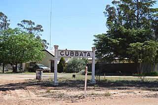
Gubbata is a locality in the Central West region of New South Wales. The locality is in the Bland Shire local government area 432 kilometres (268 mi) west of the state capital, Sydney.
Kennedy is a coastal locality in the Cassowary Coast Region, Queensland, Australia. In the 2016 census, Kennedy had a population of 161 people.
Hampden is a rural locality in the Mackay Region, Queensland, Australia. In the 2016 census, Hampden had a population of 566 people.

Eubenangee is a coastal locality split between the Cairns Region and the Cassowary Coast Region, Queensland, Australia. In the 2016 census, the population of Eubenangee was 242 people.
Kinleymore is a rural locality in the South Burnett Region, Queensland, Australia. In the 2016 census Kinleymore had a population of 93 people.

North Yalgogrin is a locality in the Bland Shire local government area of New South Wales. There once was a village there, named Yalgogrin, but better known as Yalgogrin North.
