
Boggabilla is a small town in the far north of inland New South Wales, Australia in Moree Plains Shire. At the 2016 census, the town had a population of 551, of which 63% identified as Aboriginal or Torres Strait Islander descent.

Wyong Shire was a local government area located in the Central Coast region of New South Wales, Australia, north of Sydney.

Nambucca Shire is a local government area in the mid north coast region of New South Wales, Australia.

Hornsby Shire is a local government area situated on the Upper North Shore and Northern Suburbs of Sydney, as well as parts of the Hills District, in the state of New South Wales, Australia. The shire stretches from the M2 Hills Motorway in the south to the Hawkesbury River town of Wisemans Ferry, some 53 kilometres (33 mi) to the north, making it the largest local government council in the Greater Sydney Metropolitan region by total area. As of the 2016 census the shire had an estimated population of 142,667.

Mullumbimby is an Australian town in Byron Shire in the Northern Rivers region of New South Wales. It promotes itself as "The Biggest Little Town in Australia". The town lies at the foot of Mount Chincogan in the Brunswick Valley about 9 kilometres by road from the coast. At the 2016 census, Mullumbimby and the surrounding area had a population of 3,596 people. Locals refer to the town as "Mullum".

Cowan is a small town and suburb near Sydney, in the state of New South Wales, Australia, approximately 40 kilometres (25 mi) north of the Sydney central business district, in the local government area of Hornsby Shire. It is described by some as part of the loosely defined North Shore region. Cowan shares the postcode of 2081 with Berowra. Brooklyn, which lies 6 kilometres (3.7 mi) to the north-east of Cowan, is considered the northernmost suburb of the Greater Sydney Metropolitan Area.

Tweed Shire is a local government area located in the Northern Rivers region of New South Wales, Australia. The shire is located adjacent to the border with Queensland where it meets the Tasman Sea coast. The shire, administered from the town of Murwillumbah, covers an area of 1,321.0 square kilometres (510.0 sq mi), and has existed as a local government entity since 1947. It was named for the Tweed River. It is also the location of the jungle used in the TV series I'm a Celebrity...Get Me Out of Here!
Eungai is a town on the mid-North Coast of New South Wales, Australia. It is made up of two localities, Eungai Creek and Eungai Rail, although both have the same postcode. The Eungai district is midway between Sydney (500 km) and Brisbane, midway between Port Macquarie (90 km) and Coffs Harbour, and midway between Kempsey (20 km) and Macksville. It is in the Nambucca Shire.

Wollondilly Shire is a periurban local government area adjacent to the south-western fringe of Sydney, parts of which fall into the Macarthur, Blue Mountains and Central Tablelands regions in the state of New South Wales, Australia.

Byrock is a small village in north western New South Wales, Australia in Bourke Shire. In 2016, Byrock had a population of 50 people.

Ungarie is a town in New South Wales, Australia which is the second major town of the Bland Shire, located in the Central West region of New South Wales. It is located 513 kilometres (319 mi) west of Sydney and 615 kilometres (382 mi) north of Melbourne, between the towns of West Wyalong and Lake Cargelligo and is situated 262 metres (860 ft) above sea level. The town's name is derived from an Indigenous Australian word meaning "thigh". Ungarie has the lowest median house price in Australia at $58,500 as of October 2013.

Barmedman is a rural town in the Bland Shire in the New South Wales state of Australia. It is the home of two large wheat silos with over a million bushels combined. At the 2011 census, Barmedman had a population of 212. The town's name appears to have been derived from an Aboriginal word meaning 'long water'.

Yellow Rock is a small village or locality in the Blue Mountains region of New South Wales, Australia. At the 2011 census, Yellow Rock had a population of 916.

Fitzroy Falls is a village in the Wingecarribee Shire, located within the Southern Highlands region of New South Wales, Australia. The locality was known as Yarrunga, but was renamed after the 81-metre (266 ft) waterfall. At the 2016 census, Fitzroy Falls had a population of 216.

Hobbys Yards is a small village in the Central West region of New South Wales, Australia, in Blayney Shire. It is situated within an hours driving time from the regional centres, townships, villages of Bathurst, Barry, Blayney, Neville and Trunkey Creek. At the 2006 census, Hobbys Yards locality had a population of 198 people, most of them living on neighbouring farms. The village is named after Thomas Hobby who accompanied John Oxley on his exploration expeditions, or his son.

Kikoira is a town in the Central West region of New South Wales, Australia. The town is in the Bland Shire local government area 548 kilometres (341 mi) west of the state capital, Sydney.
Ryhope is a small rural locality in the City of Lake Macquarie in New South Wales, Australia, located approximately eight kilometres west of the town of Toronto and west of Lake Macquarie.
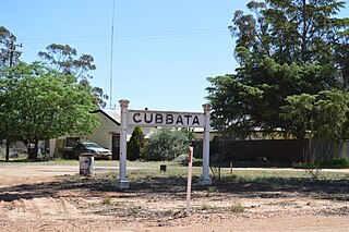
Gubbata is a locality in the Central West region of New South Wales. The locality is in the Bland Shire local government area 432 kilometres (268 mi) west of the state capital, Sydney.
Trewilga is a bounded rural locality in Parkes Shire, Central New South Wales. Trewilga is about 401 km (249 mi) west-northwest of New South Wales' capital city of Sydney. The postcode for Trewilga NSW is 2869. The area was opened up in the Australian Gold Rush, with a town of four streets by four streets gazetted in 1889 and a railway station.

Johns River is a locality in the Mid-Coast Council of New South Wales.

