Wagga Wagga is a major regional city in the Riverina region of New South Wales, Australia. Straddling the Murrumbidgee River, with an urban population of more than 57,003 as of 2021, it is an important agricultural, military, and transport hub of Australia. The ninth largest inland city in Australia, Wagga Wagga is located midway between the two largest cities in Australia—Sydney and Melbourne—and is the major regional centre for the Riverina and South West Slopes regions.

Harden–Murrumburrah is a town and community in the Hilltops Region and is located in the South West Slopes of New South Wales in Australia. Harden is adjacent to both the Canberra region of the Australian Capital Territory and the Riverina Region in the southwest area of NSW. The town is a twin town between Harden and Murrumburrah.
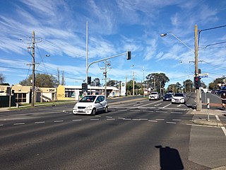
Vermont is a suburb of Melbourne, Victoria, Australia, 21 km (13 mi) east of Melbourne's Central Business District, located within the Cities of Maroondah and Whitehorse local government areas. Vermont recorded a population of 10,993 at the 2021 census.

Ashburton is a suburb of Melbourne, Victoria, Australia, 12 km (7.5 mi) southeast of Melbourne's Central Business District, located within the City of Boroondara local government area. Ashburton recorded a population of 7,952 at the 2021 census.

Noble Park is a suburb in Melbourne, Victoria, Australia, 25 km south-east of Melbourne's Central Business District, located within the City of Greater Dandenong local government area. Noble Park recorded a population of 32,257 at the 2021 census.
Heathmont is a suburb of Melbourne, Victoria, Australia, 26 kilometres (16 mi) east of Melbourne's Central Business District, located within the City of Maroondah local government area. Heathmont recorded a population of 9,933 at the 2021 census.

Oakleigh is a suburb in Melbourne, Victoria, Australia 14 km south-east of Melbourne's Central Business District, located within the City of Monash local government area. Oakleigh recorded a population of 8,442 at the 2021 census.

Hurlstone Park is a suburb in the Inner West of Sydney, New South Wales, Australia. Hurlstone Park is located nine kilometres south-west of the Sydney central business district and is mostly in the local government area of the City of Canterbury-Bankstown, and partly in the Inner West Council. The suburb is bounded by: the Cooks River to the south, Garnet Street to the east, New Canterbury Road to the north, Canterbury Road to the north-west, and Church Street to the west.

Cootamundra, nicknamed Coota, is a town in the South West Slopes region of New South Wales, Australia and within the Riverina. It is within the Cootamundra-Gundagai Regional Council. At the 2016 Census, Cootamundra had a population of 6,782. It is located on the Olympic Highway at the point where it crosses the Muttama Creek, between Junee and Cowra. Its railway station is on the Main Southern line, part of the Melbourne-to-Sydney line.

Berowra is an outer suburb of Northern Sydney located in the state of New South Wales, Australia. It is located 36 kilometres north of the Sydney central business district, in the local government area of Hornsby Shire. Berowra is south-east of the suburbs of Berowra Heights and east of Berowra Waters. The name Berowra means place of many shells, referring to the many shell middens on Berowra Creek.

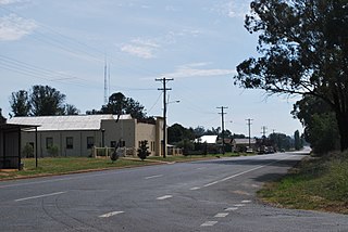
Grong Grong is a small town that is located in the Riverina region of New South Wales, Australia. The town is situated on the Newell Highway, 23 kilometres (14 mi) east of Narrandera in the Shire of Narrandera.

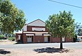
Murringo is a small village in the southwestern slopes of New South Wales, Australia in Hilltops Council. It was once better known as Marengo. The name is also applied to the surrounding area, for postal and statistical purposes.
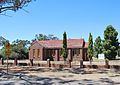
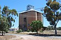
Ladysmith is a village approximately 19 km east of Wagga Wagga in the Riverina region of New South Wales, Australia. At the 2021 census, Ladysmith had a population of 215 people.

North Lakes is a suburb in the City of Moreton Bay, Queensland, Australia. In the 2021 census, North Lakes had a population of 23,030 people.
Beresfield is a north-western suburb of Newcastle, New South Wales, Australia 22 kilometres (14 mi) from Newcastle's central business district. It is part of the City of Newcastle local government area.

Tarro is a north-western suburb of the Newcastle City Council local government area in the Hunter Region of New South Wales, Australia. It, and parts of nearby Beresfield, was originally known as Upper Hexham, "lower" Hexham being an older settlement located about 5 kilometres (3 mi) to the east on the Hunter River. The name "Tarro" reportedly means "stone" in an Aboriginal language.

Linville is a rural town and locality in the Somerset Region, Queensland, Australia. In the 2021 census, the locality of Linville had a population of 133 people.
Bunnaloo is a village community in the central southern part of the Riverina and situated about 37 kilometres (23 mi) west of Mathoura and 45 kilometres (28 mi) south west of Deniliquin. In 2006, Bunnaloo had a population of 126.
Hill Top is a Northern Village of the Southern Highlands of New South Wales, Australia, in Wingecarribee Shire. Previous names of the village include Hilltop and Jellore. It is a 17 km drive to Mittagong and around 10 km drive to the Hume Highway via Colo Vale. It is roughly 6–8 km to Yerrinbool as the crow flies.

Freshwater is a suburb of Cairns, Queensland, Australia. In the 2021 census, Freshwater had a population of 2,142 people.