
Apache County is in the northeast corner of the U.S. state of Arizona. Shaped in a long rectangle running north to south, as of the 2020 census, its population was 66,021. The county seat is St. Johns.

Cochise County is a county in the southeastern corner of the U.S. state of Arizona. It is named after Cochise, a Chiricahua Apache who was a key war leader during the Apache Wars.

Gila County is in the central part of the U.S. state of Arizona. As of the 2020 census, the population was 53,272. The county seat is Globe.

Graham County is a county in the southeastern part of the U.S. state of Arizona. As of the 2020 census, the population was 38,533, making it the third-least populous county in Arizona. The county seat is Safford.
Greenlee County is a county in the southeastern part of the U.S. state of Arizona. As of the 2020 census, the population was 9,563, making it Arizona's least populous county. The county seat is Clifton.

Pinal County is in the central part of the U.S. state of Arizona. According to the 2020 census, the population of the county was 425,264, making it Arizona's third-most populous county. The county seat is Florence. The county was founded in 1875.

Santa Cruz is a county in southern Arizona, United States. As of the 2020 census, the population is 47,669. The county seat is Nogales. The county was established in 1899. It borders Pima County to the north and west, Cochise County to the east, and the Mexican state of Sonora to the south.

Hidalgo County is the southernmost county of the U.S. state of New Mexico. As of the 2020 census, the population was 4,178. The county seat and largest city is Lordsburg. A bill creating Hidalgo from the southern part of Grant County was passed on February 25, 1919, taking effect at the beginning of 1920. The county was named for the town north of Mexico City where the Treaty of Guadalupe Hidalgo was signed, which in turn was named for Miguel Hidalgo y Costilla, the priest who is known as the "Father of Mexican Independence." The county is located on the Mexico–United States border.

Grant County is a county located in the U.S. state of New Mexico. At the 2020 census, the population was 28,185. Its county seat is Silver City. The county was founded in 1868 and named for Ulysses S. Grant, the 18th President of the United States.

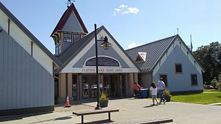
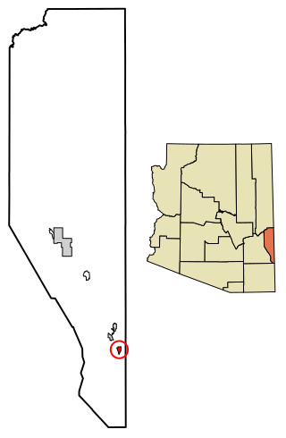
Clifton is a town in and is the county seat of Greenlee County, Arizona, United States, along the San Francisco River. The population of the town was 3,311 at the 2010 census, with a 2018 population estimate of 3,700. It was a place of the Arizona copper mine strike of 1983.

Duncan is a town in Greenlee County, Arizona, United States. As of the 2010 census, the population of the town was 696. In 2018 the estimated population was 789.
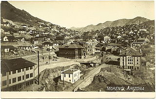
Morenci is a census-designated place (CDP) and company town in Greenlee County, Arizona, United States, and was founded by the Detroit Copper Mining Company of Arizona. The population was 2000 at the 2000 census and 1,489 at the 2010 census. The biggest employer in Morenci and the owner of the town is Freeport-McMoRan, the owner of the Morenci Mine, the largest copper mining operation in North America, and one of the largest copper mines in the world. The town was a site of the Arizona Copper Mine Strike of 1983. The large open-pit mine is north of the town.
Clifton Park is a suburban town in Saratoga County, New York, United States. According to the United States Census Bureau, the 2020 population was 38,029. The name is derived from an early land patent. The town is in the southern part of Saratoga County, approximately 12 miles (19 km) north of Albany, 7 miles (11 km) northeast of Schenectady, and 10 miles (16 km) south of Saratoga Springs.

Clifton is a town in St. Lawrence County, New York, United States. The population was 675 at the 2020 census. The town takes its name from a mining company.

Clifton is a village in Clark and Greene counties in the U.S. state of Ohio and is home to the Clifton Mill, one of the largest water-powered grist mills still in existence. The population was 131 at the 2020 census.

Alpine is a census-designated place in Apache County, Arizona, United States, in Bush Valley in the east central part of the state. As of the 2010 census, it had a population of 145. It is located near the eastern border of the state.
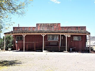
Wintersburg is an unincorporated community and census-designated place in Maricopa County, Arizona, United States, located 48 miles (77 km) west of downtown Phoenix and 17 miles (27 km) west of Buckeye along Salome Highway. It is 4 miles (6 km) south of Exit 98 on Interstate 10. As of the 2020 census, Wintersburg had a population of 51, down from 136 in 2010.
Clifton is a Census-designated place located in Spartanburg County in the U.S. State of South Carolina. According to the 2010 United States Census, the population was 541.
Franklin is an unincorporated community and census-designated place in Greenlee County, Arizona, United States. As of the 2010 census it had a population of 92. It is located in southern Greenlee County along U.S. Route 70, 3 miles (4.8 km) west of the border with New Mexico, 3 miles (4.8 km) south of Duncan, and 32 miles (51 km) south of Clifton. Residents of Franklin are zoned to Duncan public schools, such ase the nearby community of York as well as Virden, New Mexico. Many residents work for the Morenci Mine, owned by Freeport-McMoRan in Morenci.
Whispering Pines is a census-designated place (CDP) in Gila County, Arizona, United States. It is one of two locations in Arizona with this name, the other being a populated place in Greenlee County. The population was 148 at the 2010 United States Census.


