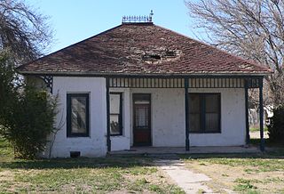
Greenlee County is a county in the southeastern part of the U.S. state of Arizona. As of the 2020 census, the population was 9,563, making it Arizona's least populous county. The county seat is Clifton.

The 2000 United States presidential election in Arizona took place on November 7, 2000, and was part of the 2000 United States presidential election. Voters chose eight representatives, or electors to the Electoral College, who voted for president and vice president.

Apache Grove is a populated place situated in Greenlee County, Arizona, United States. It has an estimated elevation of 3,550 feet (1,080 m) above sea level. The Apache Creek runs through the town and there is a small bar and convenience store north of the creek.
Whispering Pines is a census-designated place (CDP) in Gila County, Arizona, United States. It is one of two locations in Arizona with this name, the other being a populated place in Greenlee County. The population was 148 at the 2010 United States Census.
Guthrie is a ghost town in Greenlee County, Arizona, United States.
Hashan Chuchg is a populated place situated in Pima County, Arizona, close to the United States' international border with Mexico. It has an estimated elevation of 2,539 feet (774 m) above sea level.
Hilltop is a ghost town situated in Cochise County, Arizona, United States. Hilltop was established in the 1880s and was a successful mining town in the 1900s. Their economy declined steadily until the 1940s when it became a ghost town. The Hilltop Post office was erected on June 26, 1920, serving the local community. Hilltop has an estimated elevation of 5,702 feet (1,738 m) above sea level in the Chiricahua Mountains near the Arizona–New Mexico state line.
Newfield is a populated place situated in Pima County, Arizona, along the border between the United States and Mexico. It has an estimated elevation of 2,677 feet (816 m) above sea level.
Nicksville is a populated place in Cochise County, Arizona, just north of the international border between the United States and Mexico.
Sivili Chuchg is a populated place situated in Pima County, Arizona, United States, very near the international border with Mexico. The name comes from the O'odham sivili chuchg, which itself borrowed siwol from Spanish, meaning "onion". The O'odham phrase means "onions standing". It has an estimated elevation of 2,014 feet (614 m) above sea level.
South Bisbee is a populated place situated in Cochise County, Arizona, United States, just north of the international border with Mexico.
Stan Shuatuk is a populated place situated in Pima County, Arizona, United States, just north of the international border with Mexico. Historically, it has also been known as Cervantis Well, La Moralita, Molinitos, Molinton, Molonitos, and Serventi Well. In 1941, the name officially became Stan Shuatuk through a decision by the Board on Geographic Names. The name request came through a request by the Bureau of Indian Affairs, who stated that Stan Shuatuk was "used and understood by the residents and Papagos in general." In O'odham, stan shuatuk means "hot water". It has an estimated elevation of 1,772 feet (540 m) above sea level.
Tatkum Vo is a populated place situated in Pima County, Arizona, United States, adjacent to the international border with Mexico. It is a small village located on the San Xavier Indian Reservation. The name is an O'odham term meaning "snorer's chaco". Historically, it was also erroneously called Serape. The name was made official by a decision of the Board on Geographic Names on April 29, 1941. It has an estimated elevation of 2,287 feet (697 m) above sea level.
Vakamok is a populated place situated in Pima County, Arizona, United States, adjacent to the international border with Mexico. Historically, it has been known by several names, including Comot, Comoti, and Rusty Shovel. Vakamok is an O'odham word meaning "rusty". The traditional O'odham name for the village was Popolo Vakamakatuk, but the current name was made official as a result of a decision in 1941 by the Board on Geographic Names. It has an estimated elevation of 2,264 feet (690 m) above sea level.
Vanar was a station on the Southern Pacific railroad and populated place situated in Cochise County, Arizona, United States, adjacent to the border with New Mexico. The community was originally named Vanarman after Hiram M. Van Arman, and the name was shortened for telegraph purposes in 1905 to Vanar.
Wheatfields is a populated place situated in Apache County, Arizona, United States, right along the border with New Mexico. It has an estimated elevation of 7,287 feet (2,221 m) above sea level. It is one of two places in Arizona with this name, the other being a CDP in Gila County. In 1909, the US Government set up an irrigation project to assist the Navajo residents. It is a chapter of the Navajo Nation.


