Zone 72, Qatar

Last updated
Zone 72
Coordinates: 25°29′50″N51°02′33″E / 25.497217°N 51.042504°E / 25.497217; 51.042504 [1]
Country Flag of Qatar.svg  Qatar
Municipality Al-Shahaniya
Blocks58
Area
  Total662.2 km2 (255.7 sq mi)
Population
 (2015) [2]
  Total1,232
  Density1.9/km2 (4.8/sq mi)
Time zone UTC+03 (Arabia Standard Time)
ISO 3166 code QA-SH

Zone 72 is a zone in the municipality of Al-Shahaniya in the state of Qatar. The main district recorded in the 2015 population census was Al Utouriya. [2]

Contents

Other districts which fall within its administrative boundaries are Lehsain, Qaryat Al Refaiq, Ras Abrouq, Umm Al Daah Khawzan, Umm Al Qahab Al Jadeeda, Umm Al Qahab Al Qadeema, Umm Leghab West, Wadi Laswaq, and Zekreet. [1]

Demographics

As of the 2010 census, the zone comprised 363 housing units [3] and 123 establishments. [4] There were 1,060 people living in the zone, of whom 72% were male and 28% were female. Out of the 1,060 inhabitants, 80% were 20 years of age or older, and 20% were under the age of 20. [5]

Employed people made up 72% of the total population. Females accounted for 19% of the working population, while males accounted for 81% of the working population. Most of the working population is employed within the agricultural industry (356), and public administration and defense comes in second with 110 employed individuals. [5]

YearPopulation
1986 [6] 761
1997 [7] 915
2004 [8] 939
2010 [9] 1,060
2015 [2] 1,232

Land use

The Ministry of Municipality and Environment (MME) breaks down land use in the zone as follows. [10]

Area (km2)Developed land (km2)Undeveloped land (km2)Residential (km2)Commercial/
Industrial (km2)
Education/
Health (km2)
Farming/
Green areas (km2)
Other uses (km2)
662.1715.92646.250.110.000.0010.455.36

Related Research Articles

<span class="mw-page-title-main">Umm Ghuwailina</span> District in Ad-Dawhah, Qatar

Umm Ghuwailina is a district in Qatar, located in the municipality of Ad Dawhah.

<span class="mw-page-title-main">Rumeilah (Doha)</span> District in Ad-Dawhah, Qatar

Rumeilah is a neighborhood of Doha, Qatar. It is divided into an eastern and western section. Zone 11, the eastern section, hosts roughly half of Al Bidda Park while Zone 21 contains most of Hamad Medical Corporation's facilities. Hamad Medical City was constructed over a 227,000 square meter area in Rumeilah at a cost of $659 million. Portions of Hamad Medical City form its own district to the west.

<span class="mw-page-title-main">Sawda Natheel</span> Border crossing in Qatar

Sawda Natheel is an area in Qatar, located in the municipality of Al Rayyan. It used to be part of the Jariyan al Batnah municipality before the municipality was incorporated into Al Rayyan.

<span class="mw-page-title-main">Fereej Kulaib</span> District in Ad-Dawhah, Qatar

Fereej Kulaib is a district in Qatar, located in the municipality of Doha.

<span class="mw-page-title-main">Umm Lekhba</span> District in Ad-Dawhah, Qatar

Umm Lekhba is a district in Qatar, located in the municipality of Doha. It was previously known as Al Duhail South, or alternatively, South Duhail.

<span class="mw-page-title-main">Duhail</span> District in Ad-Dawhah, Qatar

Duhail is a district in Qatar, located in the municipality of Doha. The district's northern half accommodates the main base of the Internal Security Forces as well as Abdullah bin Khalifa Stadium, which serves as the home grounds for Qatar Stars League club Al-Duhail SC.

<span class="mw-page-title-main">Najma (Doha)</span> District in Ad-Dawhah, Qatar

Najma is a district in Qatar, located in the municipality of Doha. Considered to be one of Doha's older districts, the bulk of Najma's commercial and office spaces are located along the arterial roads of Airport Street, C Ring Road and B Ring Road.

<span class="mw-page-title-main">Lejbailat</span> District in Ad-Dawhah, Qatar

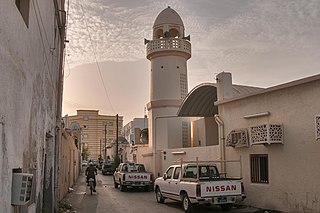
Lejbailat is a district in Qatar, located in the municipality of Doha. It has a relatively higher elevation compared to the rest of Doha and provides a vantage point of West Bay, one of Doha's main commercial districts. Imam Muhammad ibn Abd al-Wahhab Mosque, Qatar's state mosque, is situated in the district.

Zone 73 is a zone in the municipality of Al-Shahaniya in the state of Qatar. The main district recorded in the 2015 population census was Al Jemailiya.

Zone 80 is a zone in the municipality of Al-Shahaniya in the state of Qatar. The main district recorded in the 2015 population census was Al-Shahaniya City, the municipal seat.

Zone 82 is a zone in the municipality of Al-Shahaniya in the state of Qatar. The main district recorded in the 2015 population census was Rawdat Rashed.

Zone 84 is a zone in the municipality of Al-Shahaniya in the state of Qatar. The main district recorded in the 2015 population census was Umm Bab.

Zone 85 is a zone in the municipality of Al-Shahaniya in the state of Qatar. The main district recorded in the 2015 population census was Al Nasraniya.

Zone 86 is a zone in the municipality of Al-Shahaniya in the state of Qatar. The main district recorded in the 2015 population census was Dukhan.

Zone 81 is a zone of the municipality of Al Rayyan in the state of Qatar. The main district recorded in the 2015 population census was Mebaireek.

Zone 83 is a zone of the municipality of Al Rayyan in the state of Qatar. The main district recorded in the 2015 population census was Al Karaana.

Zone 96 is a zone of the municipality of Al Rayyan in the state of Qatar. The main district recorded in the 2015 population census was Abu Samra.

Zone 92 is a zone of the municipality of Al Wakrah in the state of Qatar. The main district recorded in the 2015 population census was Mesaieed.

Zone 75 is a zone of the municipality of Al Khor in the state of Qatar. The main districts recorded in the 2015 population census were Al Thakhira, Ras Laffan, and Umm Birka.

Zone 76 is a zone of the municipality of Al Khor in the state of Qatar. The main district recorded in the 2015 population census was Al Ghuwariyah.

References

  1. 1 2 "Geoportal". The Centre for Geographic Information Systems of Qatar. Retrieved 21 February 2019.
  2. 1 2 3 "2015 Population census" (PDF). Ministry of Development Planning and Statistics. April 2015. Retrieved 14 February 2019.
  3. "Housing units, by type of unit and zone (April 2010)" (PDF). Qatar Statistics Authority. Retrieved 7 August 2015.
  4. "Establishments by status of establishment and zone (April 2010)" (PDF). Qatar Statistics Authority. Retrieved 7 August 2015.
  5. 1 2 "Geo Statistics Application". Ministry of Development Planning and Statistics. Archived from the original on 2012-09-11. Retrieved 7 August 2015.
  6. "1986 population census" (PDF). Qatar Statistics Authority. Archived from the original (PDF) on 3 July 2015. Retrieved 2 July 2015.
  7. "1997 population census" (PDF). Qatar Statistics Authority. Archived from the original (PDF) on 24 September 2015. Retrieved 2 July 2015.
  8. "2004 population census". Qatar Statistics Authority. Archived from the original on 24 September 2015.
  9. "2010 population census" (PDF). Qatar Statistics Authority. Archived from the original (PDF) on 1 July 2015.
  10. "Physiography - Land use 2015". Ministry of Development Planning and Statistics. 15 January 2018. Retrieved 14 February 2019.