
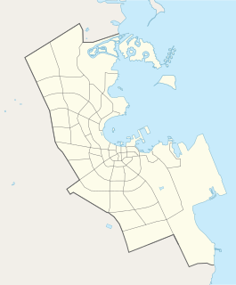
Al Daayen is a municipality in the state of Qatar. Most of the urban landscape can be found in the southern zone of the municipality, particularly in the city of Lusail, while the northern and central sections are primarily rural. It is one of the fastest growing municipalities in Qatar due to its close proximity to the capital Doha.

Rawdat Al Hamam is a village in the municipality of Al Daayen in Qatar. It is located between two major highways: Al Khor Expressway and Al Shamal Road. Government authorities have launched major developments in the village, including a housing subdivision with a target capacity of 30,000 residents.
Wadi Al Banat is a district in Qatar, geographically located in the municipality of Al Daayen but also a census-designated district of Ad-Dawhah. It is situated near the borders with Doha Municipality and Umm Salal Municipality.
Al Kharayej is a district in Qatar, geographically located in the municipality of Al Daayen but also included in the census as a district of Ad-Dawhah. After a cabinet resolution was passed in 2002, Al Kharayej became the one of three settlements in Qatar where foreigners could own real estate. It is a part of Lusail city.
Al Masrouhiya is a village in Qatar, located in the municipality of Al Daayen.
Al Egla is a district with portions in the municipality of Al Daayen and the municipality of Doha in Qatar. It adjoins the area of the planned city of Lusail.

Al Tarfa is a district in Qatar, located in the municipality of Ad Dawhah. Together with Jelaiah and Jeryan Nejaima, it makes up Zone 68 which has a total population of 5,521 as of 2015.
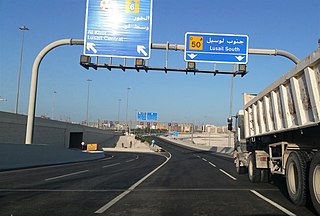
Wadi Lusail is a district in Qatar, located in the municipality of Al Daayen.
In the administrative divisions of Qatar, zones are the second-highest level of government after municipalities. As of the 2015 census, there were 98 zones. However, several of these zones are not currently in use. Over the years, numerous changes in zones have taken place. For instance, in the 2010 census, Zone 69 was transferred to Al Daayen Municipality, Zones 50 and 58 were added to Ad-Dawhah Municipality, and part of Zone 74 was merged with Zone 70 of Al Daayen Municipality.
Zone 71 is the only zone in the municipality of Umm Salal in the state of Qatar. The main districts recorded in the 2015 population census were Bu Fasseela, Izghawa, Al Kharaitiyat, Umm Salal Ali, Umm Salal Mohammed, Saina Al-Humaidi, Umm Al Amad, and Umm Ebairiya.
Zone 72 is a zone in the municipality of Al-Shahaniya in the state of Qatar. The main district recorded in the 2015 population census was Al Utouriya.
Zone 73 is a zone in the municipality of Al-Shahaniya in the state of Qatar. The main district recorded in the 2015 population census was Al Jemailiya.
Zone 82 is a zone in the municipality of Al-Shahaniya in the state of Qatar. The main district recorded in the 2015 population census was Rawdat Rashed.
Zone 56 is a zone of the municipality of Al Rayyan in the state of Qatar. The main districts recorded in the 2015 population census were Fereej Al Asiri, New Fereej Al Khulaifat, Bu Samra, Al Mamoura, Abu Hamour, Mesaimeer, and Ain Khaled.
Zone 96 is a zone of the municipality of Al Rayyan in the state of Qatar. The main district recorded in the 2015 population census was Abu Samra.
Zone 91 is a zone of the municipality of Al Wakrah in the state of Qatar. The main districts recorded in the 2015 population census were Al Thumama, Al Wukair, and Al Mashaf.
Zone 95 is a zone of the municipality of Al Wakrah in the state of Qatar. The main district recorded in the 2015 population census was Al Kharrara.
Zone 74 is a zone of the municipality of Al Khor in the state of Qatar. The main districts recorded in the 2015 population census were Simaisma, Al Jeryan, Al Khor City.
Zone 75 is a zone of the municipality of Al Khor in the state of Qatar. The main districts recorded in the 2015 population census were Al Thakhira, Ras Laffan, and Umm Birka.
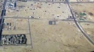
Zone 69 is a zone of the municipality of Al Daayen in the state of Qatar. The main districts recorded in the 2015 population census were Al Egla, Al Kharayej, Jabal Thuaileb, Lusail, and Wadi Al Banat.